
[ Home ]
Now for the East Cross Timbers. In the East Cross Timbers there was an equivalent range type of "sandrough" or "sandtangle" that develops in the West Cross Timbers. With exception of the defining dominant, sand post oak or margaret oak, trees of the East Cross Timbers pygmy sandyland forest were generally larger than those of the West Cross Timbers deep-sand scrub forest. Domination by blackjack oak rather than sand post or margarette oak plus major presence black or Texas hickory (Carya texana) and winged elm (Ulmus alata) along with such shrubs as hop tree (Ptelea trifoliata) and white buckeye (Aesculus arguta) distinguished this variant of "sandrough" or "sandtangle" from that of the Western Cross Timbers. Most of the other species including the dominant grass, white-haired panicgrass (Panicum acuminatum var. villosum), were the same in both East and West Cross Timbers forms. The following section was devoted to the East Cross Timbers scrub forest variant of the general Cross Timbers range cover type.


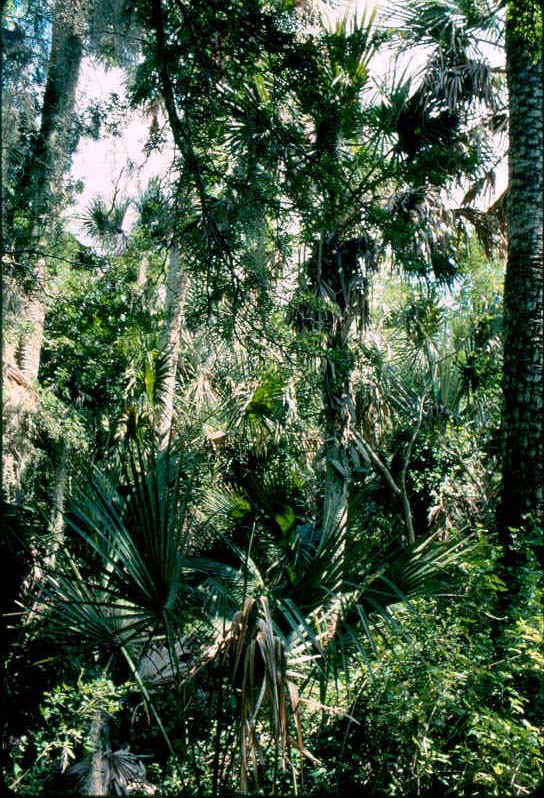
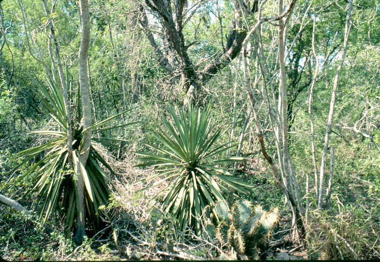
175. Exterior view- Physiogonomy and gross structure of a scrub (dwarf or pygmy) forest in the East Cross Timbers in the Red River Valley of southcentral Oklahoma. The dominant species was the tree, blackjack oak (Quercus marilandica ). Some adults of blackjack oak were more like big shrubs in the vegetation seen here. Other important tree species were post oak (Q. stellata), sand post or margarette oak (Q. margarettiae), Texas or black hickory (Carya texana), and winged elm (Ulmus alata). The dominant shrub was fiddleleaf green-brier (Smilax bona-nox) while other major shrubs included mustang grape (Vitis mustangensis), hop tree (Ptelea trifoliata), white buckeye (Aesculus arguta), Virginia creeper (Parthenocissus quinquefolia), eastern or devil's tongue pricklypear (Opuntia humifusa). The major grass species, which was sparse in cover and infrequent in density, was white-haired rosette panicgrass (Panicum acuminatum var. villosum). There were also a few plants of fall witchgrass (Leptoloma cognatum). The most common forb was the euphorb, Texas bull-nettle (Cnidoscolus texanus).
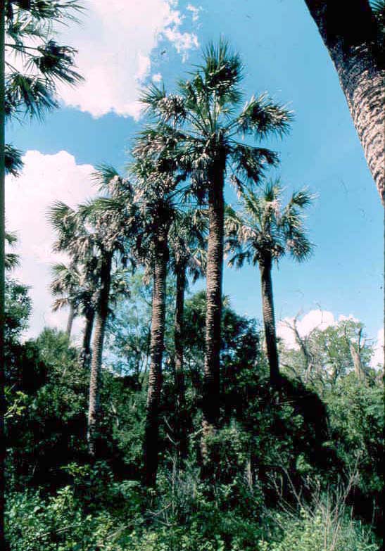
These three "photo-dendrograms" were taken on the sun-lite side (east exposure) of this stand of Cross Timbers vegetation in early morning.
Love County, Oklahoma. Late May; late vernal aspect. FRES No. 15 (Oak-Hickory Ecosystem). Scrub variant in K-75 (Cross Timbers). Edaphic variant of SRM 731 (Cross Timbers, Oklahoma). Deep Sand range site.


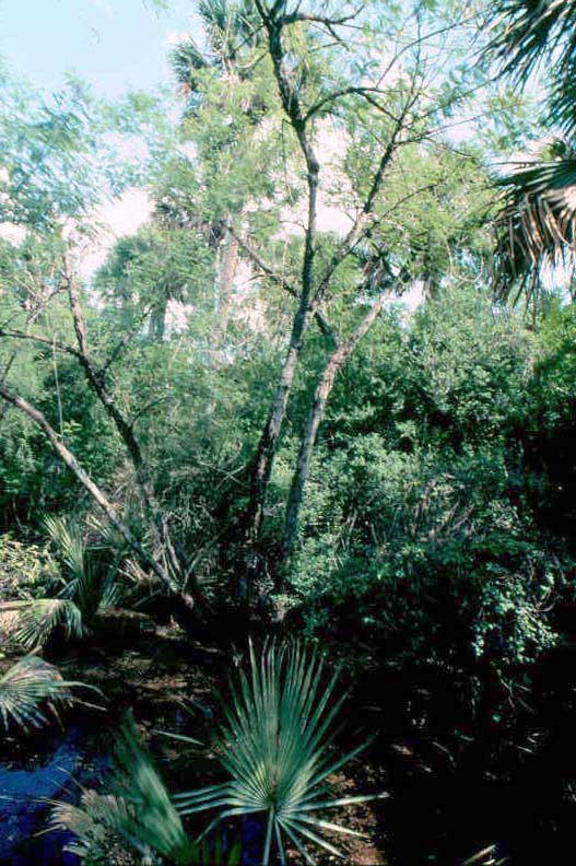
176. From the shady side- Two exterior views of morning-shaded "sandrough", a scrub forest in the East Cross Timbers in the Red River Valley of southcentral Oklahoma. Blackjack oak was the dominant plant of this dwarf forest cover type, but there were other tree species that were well-represented: post oak, sand post oak, black hickory, and winged elm. Fiddleleaf green-brier was the major shrub with mustang grape, hop tree, white buckeyek Virginia creeper and devil's tongue or eastern pricklypear. The major grass was white-haired rosette panicgrass and the major forb was the pesky Texas bull-nettle.
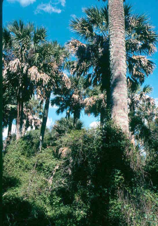
These two"photo-quadrants" were taken on the shady side (west exposure) of this stand of Cross Timbers vegetation in early morning.
Love County, Oklahoma. Late May; late vernal aspect.FRES No. 15 (Oak-Hickory Ecosystem). Scrub variant in K-75 (Cross Timbers). Edaphic variant of SRM 731 (Cross Timbers, Oklahoma). Deep Sand range site.

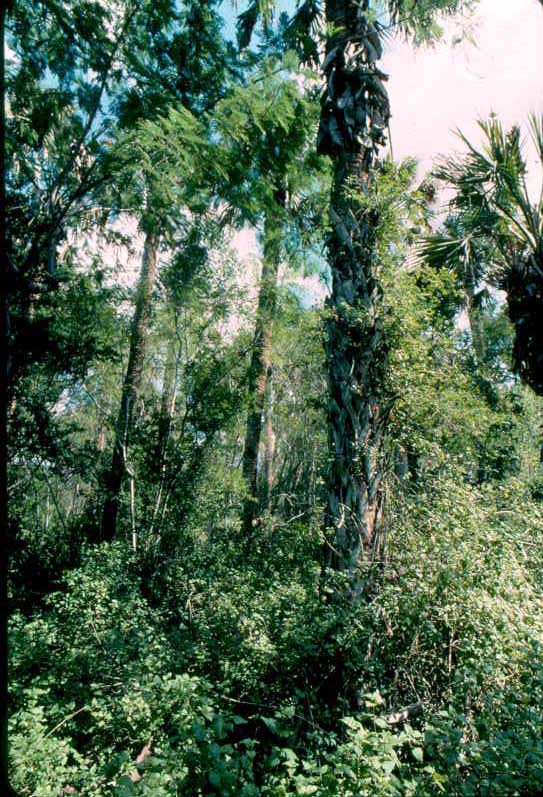
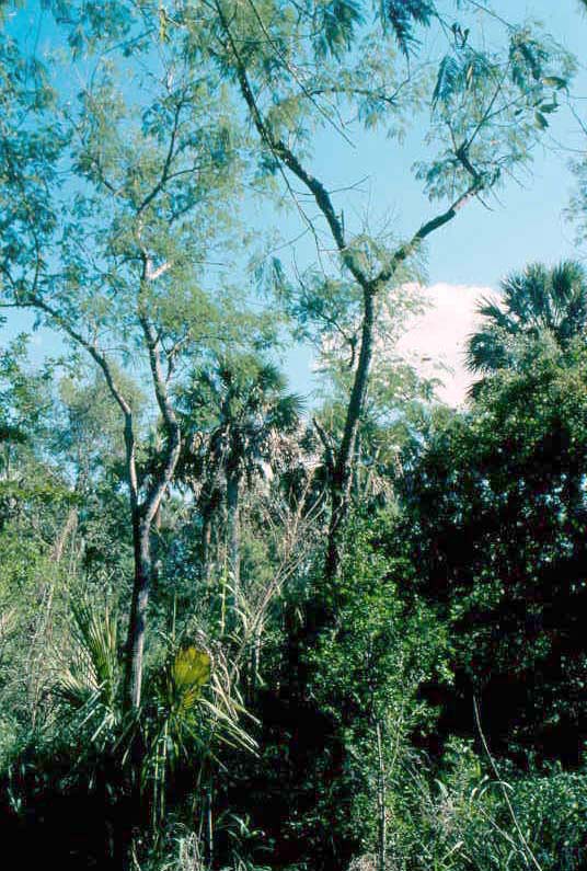
177. Those of the edge- At outermost perimeter of a scrub oak-hickory forest in the East Cross Timbers shrubs and herbaceous plants comprised the range vegetation The principal shrubs were white buckeye and eastern or devil's pricklypear. The main grass was white-haired rosette panicgrass (Panicum acuminatum var. villosum), but there were also several plants of little bluestem (Andropogon scoparius). Forbs included Texas bull-nettle, lemon beebalm (Monarda citriodora), and red or bloody milkwort (Polygala incarnata).
This was the outermost margin of the blackjack oak-dominated "sandrough" (local name for scrub forest) shown in the two preceding slide/caption sets.
Love County, Oklahoma. Late May; late vernal aspect (the vernal society).FRES No. 15 (Oak-Hickory Ecosystem). Scrub variant in K-75 (Cross Timbers). Edaphic variant of SRM 731 (Cross Timbers, Oklahoma). Deep Sand range site.

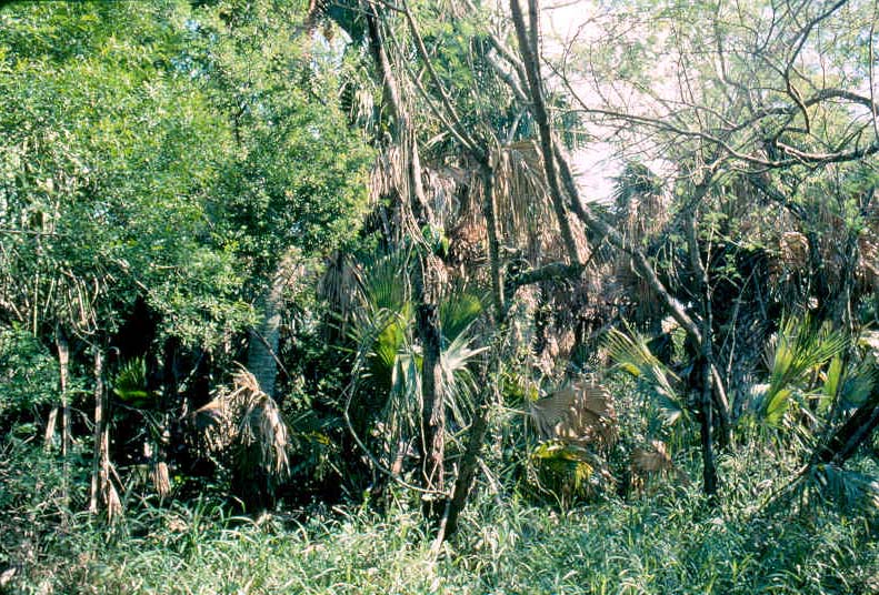
178. Chestnuts-- of a sort- Texas, white, or western horse-chestnut or buckeye (Aesculus arguta= A. glabra var. arguta) gowing at edge of a dwarf forest dominated by scrub or sand post oak in the East Cross Timbers of southcentral Oklahoma. White (Texas, western) buckeye or western (white, Texas) horse-chestnut ws one of the key woody species that distinguished the "sandrough" or "sandtangle", a sand post oak-dominated dwarf or scrub forest (or, alternatively, a scrubland of large shrubs or "runt" trees) of the East Cross Timbers from the West Cross Timbers. Texas buckeye is not found in the drier (less humid) West Cross Timbers, but this native shrub is a characteristic (and attention-grabbing) range plant in the dwarf forest that develops on deep sand of the East Cross Timbers.
This slide and the next two photographs (immediately below) were taken in early morning at the same time as the three immediately preceding sets of slides.
Not a lot of knowledge has been amased regarding this member of the Hippocastanaceae, buckeye family. White buckeye can grow into a plant of small tree-size, but it has generally been regarded as a shrub. Sargent (1933, p. 704) recognized A. glabra as a "shrubby form" of four taxonomic varieties. The species (biological) range of western horse-chestnut or white buckeye would vary depending on interpretation of the species or variety. A. arguta or A. glabra var. arguta has a species range that extends from western Missouri and eastern Nebraska across Kansas down to the Edwards Plateau of Texas (Great Plains Flora Association, 1986, p. 568; Diggs et al., 1999, p. 737-738), but biological range of the generic A. glabra, designated as Ohio buckeye, extends from Maine across to Quebec and Ontario and south to Georgia and west to Texas. Fernald (1950, ps. 988-989) recognized A. glabra var. arguta as A. glabra var. Sargentii and gave this taxonomic variety a range from Ohio to Mississippin across to Oklahoma. In Manual of the Vascular Plants of Texas (Correll and Johnson, 1979, ps. 1004-1005) distinguished A. arguta from A. glabra with the former having a much more restricted geographical distribution.
Vines (1960, ps .678-679) remained the reference of choice for notes on natural history and uses of A. arguta which, like Correll and Johnston (1979, ps. 1004-1005), he distinguished from A. glabra while noting that A. glabra var. leccodermis and A. glabra var. sargentii were quite similar (Vines, 1960, ps. 680-681).
Strictly speaking this is a poisonous range plant with both younger, more palatable leaves as well as seeds being toxic to range animals (refer to Kingsbury, 1964; Burrows and Tyrl, 2001, 2013).
Love County, Oklahoma. Late May, immature fruit-stage.


179. Bucked-on eyes- Upper shoots of Texas, white or western buckeye or horse-chestnut with leaves and young fruit growing on a sand post oak-dominated scrub or dwarf forest that developed on the deep sand of a Eufaula soil in the East Cross Timbers in southcentral Oklahoma. Diggs et al. (1999, p. 737) described the fruit of buckeye as a "leathery capsule" to which this author noted that the "leathery" substance turns woody at maturity.
Presence of this shrub was one of the main species that distinguished the sand post oak-dominated scrub forest of the East Cross timbers from that of the West Cross Timbers in which white buckeye or Texas horse-chestnut was absent.
Love County, Oklahoma. Late May, immature fruit-stage.

180. Hopping on the shady side- A shrub-size individual of common hoptree or wafer-ash (Ptelea trifoliata) growing on the west side of a local stand os dwarf forest dominated by sand post or margaretta oak on the deep sand of a Eufaula soil in the East Cross Timbers in the southcentral Oklahoma portion of the Red River Valley. Hoptree has a large species range in North America that extends from Quebec and Ontario westward across the Upper Midwest (eg. Minnesota) to California and as far southeastward as Florida.
Wafer-ash is another of those woody species for which comparatively little knowledge is available beyond its taxonomy, morphology, and fundamental biology. Browse value, successional status, regeneration following disturbance, and even utilitarian aspects were not available--at least not readily available--to students. Standard descriptions of common hoptree ranged from historic manuals like Sargent (1933, ps. 639-640) to more recent descriptive/photographic or pictoral field guides like Samuelson and Hogan (2003, 348-349), Kurz (2004, ps. 188-190), and Kirkman et al. (2007, ps. 301-303). About the best discussion of hoptree (or, as it is frequently shown in hyphenated form, hop-tree, or as two words, hop tree), including notes on propagation, was that of Vines (1960, ps. 591-592) who pointed out that there are a number of varieties of common hoptree as well as several closely related Ptelea species that have been interpreted variously by different workers. Great Plains Flora Association (1986, p. 576) recognized three subspecies for what they interpreted as the "Great Plains" (and all three subspecies were found in Oklahoma). Diggs et al. (1999, ps. 972-973) recognized two subspecies (and one variety for each subspecies) of P. trifoliata for northcentral Texas. Based on the key of Diggs et al. (1999, p. 973) the example specimen presented here would be P. trifoliata subsp. angustifolia var. persicifolia. Allred and Ivey (2012, p. 528) concluded that "[v]ariation within the species is bewildering, and numerous subspecific taxa have been proposed, but distinguishing them is unrealistic for our purposes". 'nough said.
Ptelea species are in the Rutaceae, the citrus or rue family.
The common name of hoptree was derived from occasional use of the fruit as a substitute (generally a poor one) for hops in the brewing of beer.
Love County, Oklahoma. Late May, immature fruit-stage.


181. Hops in the shade- Canopy with leaves and fruit (first slide) and cluster (second slide) of common hoptree or wafer-ash growing on the western or drier edge of a stand of scrub forest dominated by sand post oak or margaretta oak that developed on deep sand (Eufaula soil series) in the southcentral Oklahoma portion of the Red River Valley. These early morning shots were obviously taken in the shade with the forest canopy between this hoptree specimen and the sun.
The fruit type of hoptree is a samara, an indehiscent winged fruit. Samaras of this species have been used as a second-rate substitute for commercial hops, especially for home-brewing of beer. Hence, the common name of hoptree. In this context your Okie author saw fit to include--with absolutely no personal experience in such matters-- what seemed some appropriate honky tonk lyrics:
"Give me champagne I won't complain
If that's the best you can do
But when I go first class
Fill my glass with Oklahoma home brew."
----- Hank Thompson and the Brazos Valley Boys
Love County, Oklahoma. Late May, immature fruit-stage.


182. Hoppin' for a substitute- Apical part of shoot with leaves and fruit (first slide) and cluster of fruit (second slide) of common hoptree growing at the western edge of a stand of "sandrough", a sand post oak-dominated dwarf forest, on a deep sand (Eufaula soil series) in the Eastern Cross Timbers of southcentral Oklahoma in the Red River Valley.
Hoptree (or often written in hyphenated form as hop-tree or as two words, hop tree) derived its common name as a sometimes substitute for commercial hops, especially by "po'r folk" for home-brewing of beer.
Love County, Oklahoma. Late May, immature fruit-stage.
The pygmy, dwarf, or scrub forest, known by local folk as "sandrough" or "sandtangle" occurs in both the Eastern Cross Timbers and the Western Cross Timbers. While the general form of this scrub forest is similar as to physiography and structure between these two spatially separated and distinct Cross Timbers communities, there are conspicuous differences between them especially in plant species composition from standpoint of some different species as well as relative proportions among shared species.
This section treated the interior of a scrub oak forest of the East Cross Timbers. This dwarf forest type formed and covered extensive areas on the deep sand of the Eufaula soil series in the Red River Valley of southcentral Oklahoma. Major tree species in this East Cross Timbersforest community were sand post or margaretta oak, blackjack oak, post oak, Texas or black hickory, and winged elm. Some of these tree species (ie. post or margaretta oak, blackjack oak, post oak) were common to those of the scrub forest of the West Cross Timbers while other tree species were limited to the East Cross Timbers scrub forest (iel black hickory, winged elm).
Fiddleleaf green-brier was the dominant shrub of both East and West Cross Timbers forms of "sandrough". Also, devil's tongue or eastern pricklypear was common to both both general forms of Cross Timbers climax scrub forest. The cool-season, native white-haired rosette panicgrass was the dominant grass species in both East and West Cross Timbers.
Although the major species of trees growing in East Cross Timbers and West Cross Timbers forests were the same (eg. margaretta or sand post oak was generally the dominant) or similar, tree size was frequently quite different with some trees of the species common to both variants or sub-types of Cross Timbers being substantially taller and larger in diameter in some tracts of East Cross Timbers scrub forest. These bigger trees (or shoots, if some of these were clonal trees) also had more of a tree habit (= morphology) with straighter (= less twisted or crooked) boles (trunks) than almost all of the dwarf or pygmy trees that comprised the West Cross Timbers forest form.


183. Tangled with bigger plants- A sand post oak-blackjack oak-black hickory-fiddleleaf or saw green-brier scrub forest that that developed on the deep sand of the Eufaula soil series in the Red River Valley of southcentral Oklahoma. This scrub forest in the Eastern Cross Timbers consisted primarily of larger trees of margaretta or sand post oak and blackjack oak with a tangled "living net-wire fence" of fiddleleaf or saw green-brier. Trees of these species were taller-growing with larger-diameter boles (trunks) than trees of these species on some other tracts on Eufaula soil. Winged elm was another tree species and generally a species of larger trees. Winged elm was a local associate, but generally of infrequent presence or occurrence. There were some plants of devil's- tongue pricklypear and white-haired rosette panicgrass in the generally sparse understorey iof this forest range.
Thye first of these two slides presented a view of the outer edge of this climax scrub forest as seen upon entering it. Trunks (or shoots if there were several trunks of the same genetic tree, the same genotype) of these trees were comparatively tall, bigger-diametered, and of mostly unbranched habit (overall morphology). Much of the ground cover in the first slide was of Virginia creeper and Carolina snailseed (Cocculus carolianus). The second slide was a closer-in perspective that gave an example of the live barrier that developed with dense-growing, thorny shoots of fiddleleaf (saw) green-brier.
Note the leaves covering the ground which, upon rotting, comprised the O horizon of this impoverished soil.
These two slides were taken under a full-sun sky in contrast to the two images in the next slide/caption set that were taken under an overcast sky within just a few minutes of these photographs.
Love County, Oklahoma. Early August; mid-vernal aspect. FRES No. 15 (Oak-Hickory Ecosystem). Scrub variant in K-75 (Cross Timbers). Edaphic variant of SRM 731 (Cross Timbers, Oklahoma). Deep Sand range site.


184. Bigger scrubs- A scrub or pygmy forest comprised of trees of sand post oak, blackjack oak, black hickory, all of which were major tree species, with some trees of winged elm and common post oak along with saw or fiddleleaf green-brier as the dominant shrub. This dwarf forest developed on a deep-sand Eufaula soil in the Red River Valley of southcentral Oklahoma. In this forest tract, trees of sand post or margaretta oak, blackjack oak, and Texas or black hickory had sizes and a gross morphology or habit more typical of trees than of stunted shrubs that sometimes made up forest of the same species on the same Eufaula soil series.
The first slide showed this phenomenon of taller trees with larger-diameter trunks. Most of the trees in this first image were margaretta (sand post) oak, but the two foremost trees were black or Texas hickory, the presence of which was a main distinguishing feature between this East Cross timbers scrub forest and those that developed in the West Cross Timbers.
The second slide showed trees at closer camera distance revealing that trunks (or, in some cases, clonal shoots of the same tree) were more crooked or twisted than they appeared at greater distance. The second image also revealed the nearly impenetrable "curtain" formed by close-growing, short thorn-studded shoots of saw or fiddleleaf green-brier. Trees in the second slide with predominately black-toned trunks were blackjack oak, the co-dminant with sand post oak.
The completely leaf-covered soil surface of this scrub forest was obvious in both of these photographs. This did not impede emergence of such understorey species as devil's-tongue pricklypear or white-haired roseette panicgrass, the dominant herbceous species of this forest range.
These two slides were taken with an overcast sky as a dense cumulus cloud passed between the sun and the subject of the photographs.
Love County, Oklahoma. Early August; mid-vernal aspect. FRES No. 15 (Oak-Hickory Ecosystem). Scrub variant in K-75 (Cross Timbers). Edaphic variant of SRM 731 (Cross Timbers, Oklahoma). Deep Sand range site.


185. Spindley scrubs and spiny lianes- Interior of a sand post or margaretta oak-blackjack oak-saw or fiddleleaf green-brier scrub forest on deep sand (Eufaula soil) in the Red River Valley of southcentral Oklahoma. In contrast to scrub forest in the Western Cross Timbers, black jack oak was typically at great enough cover and adequately high density to be a co-dominant tree species with the more deep sand-restricted sand post oak. The three trunks (boles) in left-center midground were of blackjack oak.
Both of these slides featured saw or fiddleleaf green-brier, the dominant shrub of this scrub forest vegetation, in their foreground. The first slide was taken under a full-sun sky at greater camera distance whereas the second slide was under an overcast sky at shorter camera distance so as to present the leaves of saw green-brier. To experienced travelers, these images conveyed the fact that a combination of saw green-brier and dense scrubby trees made movement nearly impossible through this tangled "sandrough" forest.
Woody vines such as those of green-brier and mustang grape, this latter a much less common species with fewer though much larger trunks, are known by the technical terms of liana or liane. Two other (and, typically, smaller) liane species in this "sandtangle" scrub forest were Virginia creeper and Carolina snailseed, both of which were well-represented in this and several slides shown below.
Love County, Oklahoma. Early August; mid-vernal aspect. FRES No. 15 (Oak-Hickory Ecosystem). Scrub variant in K-75 (Cross Timbers). Edaphic variant of SRM 731 (Cross Timbers, Oklahoma). Deep Sand range site.


186. Principal players on deep sand- Two views in the interior of a scrub forest dominated by sand post or margaretta oak, blackjack oak, and saw or fiddleleaf green-brier on deep sand (Eufaula soil series) in the Red River Valley of southcentral Oklahoma. The first slide presented two comparatively large boles (trunks) of sand post oak and a trunk of black or Texas hickory to the right and rear of the two oak boles. Saw or fiddleleaf green-brier had climbed trunks of all trees and was "everywhere" running along the ground. Other woody vine (liana) species visible in the first slide were Virginia creeper and Carolina snailseed.
The second slide provided an example of fiddleleaf green-brier on the trunk of a black hickory. Both "photo-quadrants" included the thick leaf cover of the soil surface of this climax scrub forest. Role or influence of this leaf layer, including deeper rotting leaves, in this edaphic climax range plant community was unknown.
Love County, Oklahoma. Early August; mid-vernal aspect. FRES No. 15 (Oak-Hickory Ecosystem). Scrub variant in K-75 (Cross Timbers). Edaphic variant of SRM 731 (Cross Timbers, Oklahoma). Deep Sand range site.


187. Clonal plants make for close quarters- Several examples of multi-shooted, clonal plants (sapling-sized trees) of sand post or margaretta oak growing in deep sand (Eufaula soil) in the East Cross Timbers in the Red River Valley of southcentral Oklanoma. The classic scientific name of Quercus stellata var. margaretta form stolonifera (Sargent, 1933, p. 295) for this shrub form of sand post oak indicated the distinguishing morphological feature of horizontal rootstocks (which are almost always subterranean so as to be rhizomes not stolons). Sargent (1933, p. 295) described this taxonomic, morphological form as "... spreading into broad thickets by stoloniferous shoots; ...on the dry sand hills of central Oklahoma".
Sand post oak or margaretta oak is a clonal species with various shoots arising off of the same genotype (= same tree) being clones or modules commonly called "daughter plants" or "sister shoots". The first of these two slides included three such modular units (clonal clumps) of margretta oak (left foreground, central midground, right background). The second slide presented two shoots of margaretta oak which appeared to be united by a belowground horizontal shoot. Without careful and laborous excavation of soil at base of these two shoots it was impossible to state with 100% certainity that these were sister shoots, but the author was reasonably certain of this woody connection. Leafy branches on lowest parts of these two shoots gave a good example of the larger shade leaves of this dense-canopy adapted scrub oak.
The largest trunk in the first slide (at right foreground) was also that of margaretta or sand post oak. This tree was about as large a specimen as the author ever encountered. This big tree (by sand post oak standards) appeared to have no clonal shoots. It served as an example of some single-bole (one-trunk) sand post oaks that are found in this otherwise scrub forest of multi-shooted clumps of sand post oak. This latter shrub or scrub form is far more common on deep sand sites though, again, single-trunk specimens are found, some of which are "respectable size" trees. More examples of 1) clump-forming versus single-trunk and 2) comparatively large versus small shoots of sand post oak were shown in the two-slide/caption set immediately after the next one-slide/caption set. (One thing was certain in this deep-sand, edaphic climax forest: big and little trunks of all tree species were surrounded and climbed by wirey, thorny shoots of fiddleleaf green-brier!)
Fiddleleaf green-brier was conspicuous in both of these slides as was the essentially complete leaf cover by tree leaves on ground surface. This leaf cover commonly had depths up to four inches, but apparently this was no deterrent to emergence of the various species of forest plants ranging from green-brier shoots to devil's-tongue pricklypear, white-haired rosette panicgrass, and seedlings of various tree species. For instance, there were seedlings of winged elm visible in foreground of the first slide in addition to plants of Virginia creeper, and, in the background, of mustang grape. In the forest understorey seen in the foreground of the second slide there were several shoots of Virginia creeper joining the lower shade leaves of margaretta oak.
Love County, Oklahoma. Early August; mid-vernal aspect. FRES No. 15 (Oak-Hickory Ecosystem). Scrub variant in K-75 (Cross Timbers). Edaphic variant of SRM 731 (Cross Timbers, Oklahoma). Deep Sand range site.

188. Two independent trees or two shoots of one tree attached at their woody hips?-In the immediate foreground there numerous "baby" vegetative (asexual) shoots of sand post oak as well as Virginia creeper which had ascended the trunk of sand post oak on the left. The sand post oak trunk on the right was being climbed by Carolina snailseed and fiddleleaf green-brier. There were also many "baby" asexual (vegetative) shoots of Carolina snailseed along with Virginia creeper that were quite distinctive in the foreground. This same four-species combination or "woody mixture" was growing over the leaf-covered soil surface in the background of this view.
Love County, Oklahoma. Early August; mid-vernal aspect. FRES No. 15 (Oak-Hickory Ecosystem). Scrub variant in K-75 (Cross Timbers). Edaphic variant of SRM 731 (Cross Timbers, Oklahoma). Deep Sand range site.


189. Big trunks and little trunks- An assortment of trunks of margaretta or sand post oak in a scrub forest that developed in the East Cross Timbers on deep sand (Eufaula soil) in the Red River Valley of southcentral Oklahoma. Some of these single trunks were obviously of one genotype (a single trunk, genetic tree) whereas other trunks were growing in clumps so close together that these boles were most likely "sister shoots" of one tree (one genotype: several clonal shoots of a single tree). Smaller shoots growing immediately beside a larger shoot (bole or trunk) were apparently "sister trunks", "daughter shoots", or "offshoots". Examples of these "sister shoots" included the big trunk with a little shoot to its left in the left foreground of the first slide and, in the second slide, larger trunk with a small shoot to its right in the center foreground and a little trunk to left of bigger trunk in right midground.
Green leaves at ground level in both slides were of the three liana speacies (fiddleleaf green-brier, Virginia creeper, and Carolina snailseed) along with many, "baby", asexual shoots ("offshoots" or "sister shoots") which were clones or modules of sand post oak. The next two-slide/caption showed more examples of these sand post oak clonal "offshoots" at closer camera distance.
Love County, Oklahoma. Early August; mid-vernal aspect. FRES No. 15 (Oak-Hickory Ecosystem). Scrub variant in K-75 (Cross Timbers). Edaphic variant of SRM 731 (Cross Timbers, Oklahoma). Deep Sand range site.


190. A mess of young 'uns- Two local patches of clonal "offshoots" or "daughter shoots" of margaretta or sand post oak at ground level of a sand post oak-blackjack oak-black hickory-fiddleleaf or saw green-brier scrub forest that that developed on deep sand (Eufaula soil) in the Eastern Cross Timbers of the Red River Valley of southcentral Oklahoma. There were a few plants of Virginia creeper and saw green-brier along with these baby "offshoots" (clonal or asexual shoots) of sand post oak in both slides and there was one small plant of mustang grape in foreground of the first slide. Nonetheless, easily over 90% of the leaves or foliar cover on this woody plant ground layer was made up of modules of sand post oak. There was no cover of herbaceous plants in these patches of woody plant species.
Fiddleleaf green brier and Virginia creeper were climbing trunks of trees (most of which were sand post oak) in the backgrounds of these two images.
Love County, Oklahoma. Early August; mid-vernal aspect. FRES No. 15 (Oak-Hickory Ecosystem). Scrub variant in K-75 (Cross Timbers). Edaphic variant of SRM 731 (Cross Timbers, Oklahoma). Deep Sand range site.


191. Big examples of a distinguishing species- Winged elm (Ulmus alata) grows in the deep-sand habitat of "sandrough" scrub forest in the East Cross Timbers whereas winged elm is absent from scrub forest of the West Cross Timbers (not found in West Cross Timbers generally for that matter). Instead, cedar elm (U. crassifolia) is rarely encountered at edges of "sandrough" in the Western Cross Timbers.
One comparatively large winged elm was present in the first slide image with rest of smaller tree trunks being those of margretta oak or sand post oak. Two relatively big (real big relative to typical specimens in deep sandy soil) winged elm were presented in the second slide (foremost trunk in left foreground; tree behind and to right of first tree, this one in center midground leaning to right) with sand post oaks behind the two winged elms.
There was complete coverage of the soil surface by shed leaves of trees. Low-growing, live (green) leaves on land surface in foreground of first slide were Virginia creeper whereas those in the second slide were of fiddleleaf green-brier. Shoots of fiddleleaf green-brier were quite dense in both of these slides.
Love County, Oklahoma. Early August; mid-vernal aspect. FRES No. 15 (Oak-Hickory Ecosystem). Scrub variant in K-75 (Cross Timbers). Edaphic variant of SRM 731 (Cross Timbers, Oklahoma). Deep Sand range site.
Understorey coverage- The following two slide/caption sets presented the undrstorey of a sand post or margaretta oak-blackjack oak- saw or fiddleleaf green-brier scrub forest that developed on deep sand (Eufaula soil series) within part of the Eastern Cross Timbers portion of the Red River Valley in southcentral Oklahoma. The combination of woody and herbaceous species of this lower zone of range vegetation varied in degree of development and species composition depending primarily of completeness of tree canopy cover.

192. Commonplace yet distinguishing- Two trunks of winged elm (Ulmus alata) which was one of the defining tree species of the sand post oak-dominated dwarf or pygmy forest in the East Cross Timbers. This community and trees shown in this slide(and the two immediately preceding slides) grew in deep sand (Eufaula soil series) in the Red River Valley of southcentral Oklahma. It was explained previously that certain woody species--especially winged elm, Texas or black hickory, and Texas, white, or western horse-chestnut or white buckeye--distinguished this form of "sandrough" from that of the West Cross Timbers which lacked these species. The species range of winged elm extends over a vast region bounded by Maryland and Virginia across to Illinois and Kansas and southward to the Guld of Mexico and along the the southern Atlantic Seaboard. Species ranges of these three key distinguishing woody species do not extend into the more western reaches of the subhumid zone.
Winged elm does not grow to such massive size and proportions as American elm (U. americana), slippery or red elm (U. rubra), or cedar elm (U. crassifolia) which are also indigenous to this area of the Red River Valley. Notwithstanding, in this area winged elm does sometimes grow to "respectable size" such the larger trunk seen here which was roughly 14 inches at trunk base and over 11 inches at diameter breast height which is about as large as this species attains in Oklahoma (Little, 1985, p. 97). Other examples of winged elm at their maximum size were shown in two slides in the immediately preceding slide/caption unit.
It was interesting (and perplexing) that winged elm grew to such comparatively large size (about maximum for its species) on the generally harsh edaphic environment of deep sand. This was the same soil on which the scrub species sand post oak or margaretta oak thrived (as a scrub, dwarf tree or large shrub) along with "runt"-sized blackjack oaks.
Sources for identification, morphology, and general descriptions of winged elm included Sargent (1933, ps.312-313), Vines (1960, ps. 210-211), Kurz (2003, ps. 356-357), Samuelson and Hogan (2003, ps. 398-399), and Kirkman et al. (2007, p. 339).
It is a common observation that winged elm is not as vulnerable to Dutch Elm Disease or Elm Phloem Necrosis as is American elm or slippery elm.
Love County, Oklahoma. Early August; mid-vernal aspect.


193. Wings on sticks- Three views of leaders (woody shoots or branches) of winged elm showing the corky extensions of thin bark ("wings") on both sides of twigs for which winged elm is named. These examples were on small saplings in the Ozark (Springfield) Plateau of northeastern Oklahoma. These specimens provided better textbook examples than any the photographer could find in the sand post oak-dominated dwarf or scrub forest that developed on deep sand in the Red River Valley. These specimens were growing on shallow, rocky soil such that the limited or harsh edaphic aspect of this species ecological niche was still demonstrated.
Winged bark is generally better developed (ie. wings are larger and more prominent) on younger shoot, especially twigs (Kurz, 2003, p. 356; Samuelson and Hogan, 2003, p. 398).
Ottawa County, Oklahoma.


194. Woody and herbaceous plants- Ground cover or the ground layer of edaphic climax vegetation growing on deep sand (Eufaula soil) in the Eastern Cross Timbers of the Red River Valley of southcentral Oklahoma. This infertile, low-water capacity soil sustained a sand post oak-blackjack oak-black hickory-fiddleleaf or saw green-brier scrub or dwarf forest. In less shaded microsites and in openings of the forest canopy cover inside this scrub forest there developed a diverse lower layer of vegetation that consisted of both woody and herbaceous plant species.
Woody species included young plants of saw or fiddleleaf green-brier, seedlings of winged elm, Virginia creeper, and, with much less cover, Carolina snailseed. Herbaceous cover was primarily that of white-haired rosette panicgrass, the herbaceous dominant of this climax scrub forest. species. The trunk of a sand post oak was present in extreme upper left-hand corner of the first slide.
The complete cover of the land surface by shed leaves (mostly of sand post and blackjack oak) was conspicuous in both of these slides.
The first slide was taken with overcast sky whereas the second (lower) slide was taken a few minutes later under full-sun conditions. Often, a combination of overcast and sunny views provides a better perspective of range vegetation. More depth of field and more details for certain plant features exist with more light as one can use a higher aperture (at the same shutter speed). On the other hand, light overcast conditions eliminate shaded or dark areas and, in the perception of some viewers, yield photographs that are less "harsh" or "forceful", and that suggest a "cooler", more "hospitable" condition.
Love County, Oklahoma. Early August; mid-vernal aspect. FRES No. 15 (Oak-Hickory Ecosystem). Scrub variant in K-75 (Cross Timbers). Edaphic variant of SRM 731 (Cross Timbers, Oklahoma). Deep Sand range site.


195. Ground layer players- Major plant species in the understorey of a scrub forest of sand post oak, blackjack oak, black hickory, and fiddleleaf or saw green-brier. This scrub forest was an edaphic climax with the infertile, low water-holding capacity of this deep-sand soil (Eufaula series) being the determinative habitat factor most responsible for this climax forest range vegetation (ie. an edaphic climax) which had developed in the Eastern Cross Timbers in parts of the Red River Valley of southcentral Oklahoma.
The first slide featured white-haired rosette pnicgrass, the herbaceous dominant of this climax sandyland range plant community; along with fidleleaf green-brier, the dominant shrub of this range vegetation; seedlings of sand post oak, the overall dominant species; and Carolina snailseed, a less common shrub (a liana or woody vine). The second slide featured devil's-tongue pricklypear, an important and defining lower shrub, growing with fiddleleaf green-brier, Virginia creeper, seedlings and/or vegetative offshoots (asexual shoots from rhizomes) of sand post oak, and Carolina snailseed, in that approximate order of foliar cover.
Both of these slides were taken under a sunny sky beneath the crown canopy of this scrub forest. This resulted in small patches of shade (alternating spots of sun light and shade).
Love County, Oklahoma. Early August; mid-vernal aspect. FRES No. 15 (Oak-Hickory Ecosystem). Scrub variant in K-75 (Cross Timbers). Edaphic variant of SRM 731 (Cross Timbers, Oklahoma). Deep Sand range site.

196. Outer edge- Exterior or outer contact of a stand of "sandrough" or "sandtangle", a sand post oak-fiddleleaf green-brier dwarf forest (or, perhaps, scrubland depending on interpretation/perception) in the Red River Valley portion of the East Cross Timbers of southcentral Oklahoma. Blackjack oak was the associate tree species while poison ivy (Rhus radicans= Rhus toxicodendron= Toxicodendron radicans) was the associate to local dominant liana (in isolated patches at outer edge). There were some plants of netleaf hackberry (Celtis laevigata var. reticulata= C. reticulata); Virginia creeper (Parthenocissus quinquefolia); white, western, or Texas, buckeye or horse-chestnut; winged elm; Texas or black hickory; and common hoptree. It was only in local, restricted areas that these latter listed species were abundant or, more frequently, only present at trace proportions.
Herbaceous species at exterior of this edaphic climax range plant community were listed in the immediately following caption. (Detailed views of some of these species were presented variously herein.)
This soil-determined potential natural vegetation had developed on a Eufaula soil (siliceous, thermic Psammentic Paleustalfs) that develomed on stabilized dunes on stream terraces (largely formed by water-action). Parent material of Eufaula soil was sand of the Pleistocene Epoch.
Love County, Oklahoma. Early August; mid-vernal aspect. FRES No. 15 (Oak-Hickory Ecosystem). Scrub variant in K-75 (Cross Timbers). Edaphic variant of SRM 731 (Cross Timbers, Oklahoma). Deep Sand range site.


197. Going into (and barely able to get inside) a stand of "sandtangle"- Outermost edge of a tract of "sandrough", a stand of sand post or margaretta oak-fiddleleaf gren-brier pygmy forest (or scrubland, depending on interpretation). Major plant species in these two "photo-plots" were blackjack oak, fiddleleaf green-brier, poison ivy, and netleaf hackberry. The interior was a consociation of sand post oak from a tree-species standpoint with, of course, fiddleleaf green-brier as co-dominant and the major liana (woody vine) species. On the "botanical outskirts" of this "sandrough" blackjack oak was locally do-dominant with sand post oak along with occasional plants of netleaf hackberry; winged elm; white, Texas, or western buckeye; and common hoptree.
There were also some herbaceous species at this outer edge. The herbaceous species with the most plants (most cover, greatest density) was a rosette panicgrass known variously as white-haired panicgrass, white-haired rosettegrass, white-haired rosette panicgrass (also variously (Panicum villosum= P. acuminatum var. villosum= Dichenthium acuminatum subsp. villosissimum= D. villosissimum). This cool-season (C3), rosette Panicum species was the dominant herbaceous species of this dwarf forest vegetation (both here in the Eastern Cross Timbers as well as in the Western Cross Timbers). The second most abundant grass species was fall witchgrass (Leptoloma cognatum). The major forb at exterior of this dwarf forest--and in centers of natural openings or "natural clearings" inside the pygmy forest--was tall or smooth four-o'clock (Mirabilis glabra).
The dead, drooping limb or lower branches (best seen in the first or vertical of these two slides and in various slides shown below) were what are known as pins. Pin is a lumbermen's term for a dead, but persistent (staying attached to the trunk) lower limb on tree and larger shrub. These dead, low-hanging, persistent limbs are a major obstacle to movement through such vegetation by larger animals (man and beast). Some pins actually reach the ground and, in combination with green-brier (sometimes also poison ivy), form a nearly impenetrable barrier to vertebrates larger than snakes, lizards, mice, and half-grown rabbits. This nearly impasssable, woody barrier even slows rate of through-passage for the nine-banded armadillo (Dasypus novemcinctus). This impedance is a minor problem for the armoured mammal, however, because even when attempting to flee enemies the woody barrier slows (even more) the movement of most pursers as, for example, a rangeman delusional enough to think he could photograph an armadillo in "sandtangle".
There were far more species (= greater species diversity) at the outer edge than in the interior of "sandrough" which, as shown immediately below, was largely restricted to sand post or margaretta oak, fiddleleaf green-brier, and blackjack oak.
Love County, Oklahoma. Early August; mid-vernal aspect. FRES No. 15 (Oak-Hickory Ecosystem). Scrub variant in K-75 (Cross Timbers). Edaphic variant of SRM 731 (Cross Timbers, Oklahoma). Deep Sand range site.


198. Tangled with smaller plants- Another tract of the edaphic climax scrub or dwarf forest dominated by sand post oak and fiddleleaf green-brier and with blackjack oak the associate tree species. Plants of sand post oak in this tract where much smaller than those presented in another tract that was treated immediately above. Both tracts were on the Eufaula soil series in the Eastern Cross Timbers portion of the Red River Valley of southcentral Oklahoma. Actually, the oak plants--both sand post oak and blackjack oak, this latter being the associate tree species--on the tract now being described had shoots that were more the size and shape of shrubs and often with two to several shoots. This resulted in more of a shrub than a tree morphology. Sand post oak is a clonal species with subterranean woody shoots usually known as "rootstocks" or, more accurately, rhizomes. Numerous shoots seen in these two slides and the two slides following them are almost certainly shoots of the same genotype (same plant).
The two larger boles in the center midground and one trunk left of center midground were blackjack oak. The rest of these woody shoots were sand post or margarette oak, the dominant of this "sandtangle" (long-standing local name for this form of scrub forest). While it is not evident from these two slides, the thorny, wirey shoots of fiddldleaf or saw green-brier grew so thick as to intertwine with the clonal shoots of sand post oak making movement by larger animals (including humans) extremely difficult and, in some places, virtually impossible. (One does a lot of backtracking when threading his way through this dwarf or pygmy forest.) In addition to fiddleleaf green-brier, there were woody vines of mustang grape resulting in the liana growth form being well-represented (and, again, making movement through this climax forest community very difficult and uncomfortable).
It was repeated that this range plant community was the potential natural vegetation and not a brush invasion. It was the infertile, low water-holding capacity, deep-sand soil (Eufaula series) that was responsible for this scrub forest known locally as "sandrough" or "sandtangle".
In his classic reference, Manual of the Trees of North America (Sargent, 1933, p. 295) designated sand post oak as Quercus stellata var. margaretta f. stolonifera (or as Q. margaretta) " and he described this plant as "... spreading into broad thickets by stononiferous shoots" as in the "... dry sand hills of central Oklahoma". Small (1933, p. 424) recognized "small post oak" as Q. margaretta, a shrub or occasionally a tree up to 30 feet in height and having its habitat as "sandhills". Muller (1951) applied the common name of runner oak to Q. margaretta. Gleason and Cronquist (1991:85) described sand post oak as "spreading underground and becoming colonial (forming colonies)".
Love County, Oklahoma. Early August; mid-vernal aspect. FRES No. 15 (Oak-Hickory Ecosystem). Scrub variant in K-75 (Cross Timbers). Edaphic variant of SRM 731 (Cross Timbers, Oklahoma). Deep Sand range site.


199. Barely traversably (by rabbits)- Deep interior of a scrub forest dominated by margaretta or sand ost oak (blackjack oak was the associate tree species) and fiddleleaf or saw green-brier. Shoots of both oak species found in the forest tract shown here and in the immediately preceding two slides were much smaller than those shoots found in another tract (described above). Shoots in the forest tract now being treated were distinctly of the shrub form. This contrasted with some oak shoots (as well as those of black hickory and winged elm) growing in the other scrub forest covered just before treatment of the current tract of forest vegetation. Vegetation in both of these tracts were on Eufaula soil in the Eastern Cross Timbers in part of the Red River Valley of southcentral Oklahoma.
In addition to sand post oak, blackjack oak, and fiddleleaf green-brier about the only other plant species in the scrub thicket of this tract were a few specimens of winged elm along with the woody vines of poison ivy (Rhus radicans= Rhus toxicodendron= Toxicodendron radicans). Leaves of winged elm were visible in left foreground of the first slide and in the lower right corner of the second slide seen here.
These two tracts were approximately three miles apart. The scrub forest on both tracts was the potential natural vegetation for its Deep Sand range site. This natural range plant community was an edaphic climax for which the low water-holding capacity, poor fertility, deep-sand soil was the ultimate determining factor responsible for sand hills vegetation known since earliest days of travel by the whiteman as "roughs".
The first white travelers described movement through "roughs" as "nearly impossible" if not "impossible" due to the "impenetrable" thick, thorny growth of "roughs". Uncle Remus' Br'er Rabbit would certainly be at home herein, but nothing else the size of Br'er Fox or bigger would. Feral hogs can negotiate through the "sandrough" scrub forest, but even they get foiled frequently in their intended movements through the Cross Timbers "roughs". "Pins" (dead, partly detached, lower limbs) of blackjack oak combined with thickly clumped trunks of the clonal sand post oak, all of which were interlaced with thorn-fitted saw green-brier made for a vegetational structure that is a natural, formitable barrier to movement by most animals. Even white-tailed deer browse mostly along well-established game trails and leave the inter-trail interior to smaller animals (and plant ecologists contrary enough to study it). Ya'll need to appreciate the determination it takes to bring you these images, but the author is not holding his breath waiting for a tin medal of recognition.
Love County, Oklahoma. Early August; mid-vernal aspect. FRES No. 15 (Oak-Hickory Ecosystem). Scrub variant in K-75 (Cross Timbers). Edaphic variant of SRM 731 (Cross Timbers, Oklahoma). Deep Sand range site.
The complete covering of the ground (soil surface) by tree leaves was an "always there" feature of the edaphic climax scrub forest of sand post oak-fiddleleaf green-brier in both its East and West Cross Timbers forms. For instance, all of the slides of the Eastern Cross Timbers "sandrough" scrub or dwarf forest showed, very distinctly, this feature of heavy leaf litter that covered the land surface.


200. Another view of "For Rabbits Only"- Three more views (not that they were needed) of the deep interior of a dwarf or pygmy forest of sand post oak-fiddleleaf green-brier that developed on deep sand (Eufaula soil series) in the Red River Valley portion of the East Cross Timbers in southcentral Oklahoma. Sand post or margaretta oak was the dominant arboreus species such that this climax range vegetation was a consociation of sand post oak, but blackjack oak was the associate arboreus species. Other species in the interior of this dwarf forest as presented in these three images were poison ivy, Virginia creeper, and winged elm.
Fiddleleaf green-brier was co-dominant with sand post oak. Hence, sand post oak could be interpreted as the dominant tree (even though adult trees were dwarf-size) and fiddleleaf green-brier the dominant shrub thereby forming a sand post oak-fiddleleaf green-brier (Quercus margaretta-Smilax bona-nox) habitat type in the Daubenmire (1952, 1984) vegetational scheme.
Although most of the woody shoots seen in these three slides were those of sand post or margaretta oak there were also shoots of blackjack oak, the associte tree species, present. The darker trunk in left-center midground of the first slide and the dark trunk in right-center foreground (to right and slightly behind the foremost and largest trunk which was sand post oak) of the third slide were blackjack oak.
Note the numerous pins (dead, persistent, low-hanging, lower limbs) hanging from blackjack oaks (mostly) and sand post oaks (less consistently). It was explained earlier than these pins slow the movement of larger animals (anything bigger than a half-grown rabbit) through this "sandtangle". Pins, in combination with many thorny shoots of fiddleleaf green-brier, form the proverbial impenetrable--literally in some spots, nearly so in other local areas--barrier.
These three additional slides--in fact, the comparatively high number of slides--of the edaphic climax sand post oak-fiddleleaf green-brier dwarf forest were included to emphasize the fact that this range plant community was the climax, the potnetial natural, vegetation and not a brush invasion due to overgrazing, cessation of fire, past tillage, road construction, and so forth. No, this was a virgin forest. Scrubby, depauperate, dwarf trees? Yes. Worthless from a wood production standpoint? Yes, even for firewood. Of limited value for most economically valuable wildlife species? Yes, largely inaccesable to all but the smallest vertebrates. Yet, this scrubby oak forest (or scrub oak shrubland if one prefers) was the climax plant community.
Yes, such scrub oak vegetation drapped in green-brier is misleading. This author passed by this vegetation over a span of more than a quarter century (and had analyzed similar climax sand post oak-fiddleleaf green-brier in the West Cross Timbers) before he "made the connection" and realized that this was the East Cross Timbers equivalent community and the potential natural vegetation for this environment (range site). This range plant community did resemble--physiogonomy, compositionally, structurally--just another woody plant encroachment on grassland brought about by the whiteman's misuse of the land. Closer evaluation, review of early frontier accounts, (and perhaps a little introspection into this grasslander's background and previous experiences) brought out the true nature of this range cover type.
Love County, Oklahoma. Early August; mid-vernal aspect. FRES No. 15 (Oak-Hickory Ecosystem). Scrub variant in K-75 (Cross Timbers). Edaphic variant of SRM 731 (Cross Timbers, Oklahoma). Deep Sand range site.
The complete covering of the ground (soil surface) by tree leaves was an "always there" feature of the edaphic climax scrub forest of sand post oak-fiddleleaf green-brier in both its East and West Cross Timbers forms. For instance, all of the slides of the Eastern Cross Timbers "sandrough" scrub or dwarf forest showed, very distinctly, this feature of heavy leaf litter that covered the land surface.

201. Herbaceous dominant accompaned by one of the edge- At the outermost edge of the sand post oak-blackjack oak-fiddleleaf green-brier scrub forest that was presented in the immediately preceding two two-slide/caption sets there were some plants of fall witchgrass (Leptoloma cognatum), a native, perennial, panicoid grass. In the "photo-quadrant" seen here a specimen of fall witchgrass was at left foreground extending diagonally back to right foreground with a smaller plant of white-haired rosette panicgrass to it's right. A plant or two of toothed spurge (Euphorbia dentata) slipped in for good measure. Toothed spurge was not encountered inside the "sandtangle" scrub forest, but its fellow Euphorbiaceae family member, Texas bull-nettle, was right at home there (see above).
Love county, Oklahoma. Early August.

202. A major herbaceous species (such as it was)- Top-down view of white-haired panicgrass, white-haired rosettegrass, white-haired rosette panicgrass (Panicum villosum= P. acuminatum var. villosum= Dichenthium acuminatum subsp. villosissimum= D. villosissimum) on the floor of a sand post oak-dominated dwarf or pygmy forest that developed on deep sand (Eufaula soil series) in the Red River Valley in southcentral Oklahoma.
The following detailed explaiation was presented previously, but was shown here also as an aid to readers. White-haired panic, the native grass and the herbaceous species with greatest cover in these dwarf forest tracts, apparently has a pattern or condition of genetic, morphological, and taxonomic variation that is similar to that of sand post oak and dwarf conifer species found on harsh, infertile soils. Taxonomic interpretation of white-haired panic has varied among agrostological authorities (Silveus, 1933; Correll and Johnston, 1979, Gould, 1975; Hignight et al., 1988; Diggs et al., 1999; Feckman and Lelong, 2003, Shaw, 2012) at levels of genus, species, subspecies, and variety. White-haired panic was designated by numerous scientific names including Panicum acuminatum var. villosum, P. villosissimum, P. lanuginosum in part, P. ovale var. villosissimum, Dichanthelium villosum, D. acuminatum var. villosum, and D. lanuginosum var. villosissimum. Intergradation and hybridization among subspecies and varieties is widespread within the Panicum or Dichanthelium taxon resulting in morphological diversity and taxonomic difficulty (Gould and Clark, 1978; Feckman and Lelong, 2003; Shaw, 2012). Lelong (1984) described eight taxonomic varieties within the polymorphic Panicum acuminatum complex which he described as the "most troublesome" species in the Panicum genus. Even with such varietal diversity in P. acuminatum, Lelong (1984) departed from the treatment by Gould and Clark (1978) and interpreted P. acuminatum var. villosum as a variety of the morphologically similar P. ovale (= P. ovale var. villosum) which had been recognized by Hitchcock and Chase (1950) at the species level as P. villosissimum as was P. ovale which Gould and Clark (1978) recognized as Dichanthelium ovale. For this taxon in the Cross Timbers of Texas (Diggs et al., 1999) used P. acuminatum var.villosissimum while Shaw (2012) gave D. ovale var. villosissimum.
Shaw (2012, p. 394) cited work stating that Dichenthium acuminatum was the most problematic species in the Dichenthium genus due to extreme polymorphic variability. Smaller plants of Lindheimer's rosettegrass often produce only one shoot whereas larger individuals have been found to produce from three to seven shoots arising from the basal rosette (R.E. Rosiere, personal observation).
In this dwarf or scrub forest at mid-summer this specimen still had its vernal fascicles (with ripening fruit) which were presented at closer camera distance and greater detail in the next slide/caption unit ...
Love County, Oklahoma. Early-August, ripening of spring grain (fruit of vernal fascicles).


203. Cute clusters on deep sand- Two large apical or terminal fascicles and one smaller sub-apical fascicle (first slide) and details of the apical fascicle at terminus of a shoot (second slide) of white-haired rosette panicgrass that grew in the understorey of a sand post oak-dominated scrub forest on deep sand (Eufaula soil) in the Red River Valley of southcentral Oklahoma. These organs were part of the plant featured in the immediately preceding slide.
This grass species (variety of a species) was the dominant (major might be a more descriptive term) herbaceous species in the understorey of this dwarf or pygmy forest. It was also the dominant herbaceous species in a sand post oak (= margaretta oak)-dominated scrub forest or oak scrubland in the West Cross Timbers of northcentral Texas.
Love County, Oklahoma. Early-August, ripening of spring grain (fruit of vernal fascicles).


204. Tall forb on the edge- Two specimens of tall or smooth four-o'clock (Mirabilis glabra) growing on the outer edge of "sandtangle" or "sandrough", a dwarf forest dominated by sand post oak, on deep sand in the Red River Valley of southcentral Oklahoma. Edge habitats and their "combination" communities are a "unique blend" of two or more adjoining communities (in this case, the "sandtangle" and degraded tallgrass prairie. Thyere were also some plants of tall four-o'clock growing in natural openings--along with white-haired panicgrass and saw or fiddleleaf greenbrier--in this sandrough fores.
Height of these forbs varied from a little over two and a half to almost four feet. Four o'clock species are in the four o'clock family (Nyctaginaceae).
Love County, Oklahoma. Early-August, peak-bloom stage of phenology.

205. Tall o'clocks- Upper shoot with flower clusters of tall four-o'clock growing on deep sand (Eufaula soil series) at the outer edge of a dwarf or scrub forest dominated by sand post oak or margaretta oak of the Red River Valley in southcentral Oklahoma.
Love County, Oklahoma. Early-August, peak-bloom stage of phenology.


206. An afternoon oening- Flowers of tall or smooth four-o'clock growing at the outer edge of a scrub forest dominated by sand post oak on deep sand (Eufaula soil) in the Red River Valley of southcentral Oklahoma.
The common name of four-o'clock was derived from the characteristic feature of flowers of most Mirabilis species to open in late afternoon or early evening. In this instance, these flowers were open at about 1430 hours (2:30PM for you "damned civilians" as this author's Army drill sargent taught him).
Love County, Oklahoma. Early-August, peak-bloom stage of phenology.


207. At sandrough's edge- At the perimeter of sandrough or sandtangle dominatead by margaretta oak in the East Cross Timbers plants of field or plains snake-cotton (Froelichia floridana), an annual forb of the pigweed family (Amaranthaceae), were thriving in the heat and typcal dryness of mid-summer.
There was no particular ecological significance of this native forb except it was one that thrived at the edge--rather than in the interior--of sandrough in the greater Red River Valley of the South.
Love County, Oklahoma. Early-August, peak-bloom stage of phenology
One of the most unique and restricted types of native vegetation in southeastern North America and in the important range state of Texas is the jungle-like forest dominated by the native palm that grows to tree size and habit and is known variously as sabal palm, Texas or Rio Grande palmetto, palma de micharos (Sebal texana= S. mexicana). This native woodland is a flatwoods or floodplain forest (more commonly than it is a riparian or gallery forest which is a narrower zone of wetland vegetation) that develops over the greater or general floodplain or the Rio Grande (= Rio Bravo) in the states of Texas and Tamaulipas. The other major woody plant species that defines this woodland community is Texas ebony or ebano (Pithcellobium flexicaule= P. ebano). Thus this natural plant community has been described as the sabal palm-Texas ebony jungle forest. A common associate (when interpreting sabal palm and ebony as co-dominants) is anacua or knock-away (Ehretia anacua), a small tree (and often with multiple trunks like a large shrub) in the Boraginaceae (borage family). The successional relation of Texas ebony and anaqua was described later in this introduction.)
Other frequent large shrubs or small trees in this forest community include tpeguaje (Leucaena palverulenta) and tenaza (Pithecellobium pallens). The most common-- and, in fact, often dominant --understorey shrub is David milkberry or cahinca (Chinococca alba). Milkberry or cahinca frequently forms the entire understorey in groves of mature palms (shown below). Other common understorey shrubs include chile piquin, chillipiquin, or bird pepper (Capsicum annuum var. minus) and Drummond's turk's cap or Drummond wax-mallow or Texas mallow (Malvaviscus drummondii= M. arboreus). Bloodberry, rouge plant, pigeonberry or coralito (Rivina humilis= R. laevis= R. portulaccoides) is one of the most common forbs in the understorey of this floodplain forest vegetation.
There is typically little or no understorey beneath larger adult palms as the older mature fronds (leaves) are shed complete with their immense petioles that can be as much as four or more inches wide at the abscission zone. These shed fronds form a mulch of multi-layers in various stages of decomposition so that the forest floor is devoid (or nearly so) of understorey plants. The hard woody petioles sometimes extend as much as two feet above the blade parts of fronds making travel through fallen palm leaves very difficult. These shed fronds are ready fuel and many of the trunks of older palms are blackened from past fires. Sabal palm appears to regenerate beneath adult palms, sometimes even in the dim-lite, frond-mulched interior of the palm forest (see photographs below).
There has been comparatively little material written describing this extremely restricted vegetation. The most readily available discriptions may be Texas Natural History, the original Biological Survey of Texas by Vernon Bailey with introduction and updates by Schmidly (2002, ps. 65, 75, 145, 319, 320, 326, 390, and 426) and the mostly faunal description in Saving the Best of Texas (Bartlett, 1995, ps. 132, 134-136). Vines (1962, p. 46) listed trees and shrubs in the sabal palm forest based on his previous visit to the Frank Rabb Ranch in Cameron County, Texas (this became the Sabal Palm Audubon Center and Sanctuary). Woody species included on Vines' list (and using his names) were Texas ebony or ebony apes-earring (Pithecellobium flexicaule= P. ebano), apes-earring (P. pallens), granjeno (Celtis pallida), Rio Grande or Mexican or Berlandier ash (Fraxinus berlandieri), Berlandier mimosa (Mimosa berlandieri), tepeguaje or great lead-tree or tpeguaje (Leucaena pulverulenta), white popinac lead-tree (L. glauca), Barbados-cherry (Malpighia glabra), lime pricky-ash (Zanthoxylum fagara), lotebush (Condalia obtusifolia= Ziziphus obtusifolia), saffron-plum bumelia (Bumelia angustifolia), Texas persimmon (Diospyros texana), and autumn salvia or autumn sage (Salvia greggii). Strangely, Vines (1962, p. 46) did not list anacua, one of the major trees, nor drummond's turk's cap and chile piquin, which are some of the major shrubs, for the sabal palm forest.
The sabal palm forest was apparently not a large community even in pre-European North America. Officials associated with various organizations like the Sabal Palm Audubon Center and Sancttuary and World Wildlife Fund have reported in worldwide web publications (eg. www.tx.audubon.org/centers/ sabal) that in North America sabal palm-dominated forest was limited primarily to the floodplains of such rivers as the Rio Grande and San Bernard and, except for isolated relict vegetation, extending northward primarily through the Lower Rio Grande Valley and up the Rio Grande for about 80 miles (Bartlet, 1995. p. 135). According to reports from the LaSalle Expedition sabal palm grew much farther west including along the Guadalupe River. There is no evidence, however, that the sabal palm-Texas ebony (ebano) jungle forest developed north or west of the Lower Rio Grande Valley.
Bartlett (1995, p. 135) reported that the pre-white man sabal palm forest totaled about 40,000 acres in the Lower Rio Grande Valley. It was not clear if this included acreage in both the United States and Mexico. Almost all of the sabal palm forest on the USA side of the Rio Grande (= Rio Bravo) was cleared for irrigated agriculture and, later, for urban sprawl, beginning in the early Twentieth Century. Prior to clearing, or simultaneously with clearing, sabal palms were felled so that logs from the limb-less, easily bucked boles could be used for warf-pilings. According to Landon Lockett (www.audubon.org/ local/sanctuary/sabal/nativepalms.html) the wood of sabal palm is resistant to consumption by shipworms. Demand for shipworm-resistant wood in ports along the Gulf Coast was great enough that sabal palm populations were devastated by the "cut-and-run" logging practices of the time.
Interesting sidebar note: There are several species of bivalve marine mollusks that are known as shipworms because they are capable of destroying submerged wood by eating burrows or tunnels throughout the wood, a dire condition that can ultimately destroy submerged (or partly submerged) wood that is then said to be "wormshot". Burrowing begins with the larval stagae. The most common of these marine bivalves is the tropical species, Teredo navalis, an elongated two-shelled clam that reaches lengths up to two feet. This species is especially active in the warm waters of the Gulf of Mexico.
As of this writing the only remaining sabal palm-ebano forest remaining in anything resembling natural vegetation is that preserved on the Sabal Palm Audubon Center and Sanctuary in Cameron County, Texas. Of the 527 acres in this sanctuary (www.audubon.org/local/sanctuary/sabal) only 32 acres is virgin palm-Texas ebony jungle forest (Bartlett, 1995. p. 135). Most of the vegetation remaining on the Audubon Sanctuary is second-growth, recovering (= secondary successional) forest.
Diamond (1998, p.1) described southwestern subtropical forest types in the Lower Rio Grande Valley. These included: 1) southwestern subtropical upland forest composed of broad-leaved, mostly evergreen species and that developed on moist uplands and resaca terraces (an evergreen low forest type), 2) floodplain hardwood forest composed mostly of (ie. dominated by) sugarberry (Celtis laevigata), cedar elm (Ulmus crassifolia) and Berlandier as (Fraxinus berlandieri), and 3) the Texas palmetto or sabal palm-dominated floodplain forest. Diamond (1998, ps.4-5) divided the upland subtropical evergreen forest type into two series: 1) Texas ebony-anaqua series that was described as a "well-developed forest and 2) Texas ebony-snake eyes (Phaulothamnus spinescens) series described as a "low forest grading into shrubland" but these series formed a continuum of vegetation on the uplands of the Lower Rio Grande Valley. Texas ebony was the defining dominant species on the more favorable sites of both of these upland forest series. Stands of old-growth upland subtropical evergreen forest also contain large trees of anaqua as well as Texas ebony. Shrub species in (and indicative of ) understorey of these old-growth forest include brasil, snake-eyes, and Texas persimmon. Sugarberry, cedar elm, soapberry (Sapindus drummondii), and tepeguaje are generally successional woody species. Neither mesquite nor huisache are dominants of these forest types. In fact, mesquite was usually found to be almost absent in interior of old-growth stands while Texas ebony or Texas ebony and anaqua comprise almost all of the canopy of climax forests. There is little or no understorey in such forests resulting in a see-through feature below the canopy.
Apparently this Texas ebony or Texas ebony-anaqua upland forest type intergrades with the sabal palm-dominated floodplain forest. Furthermore the description that the Texas ebony or Texas ebony-anaqua forest type occupied ox-bow (resaca) terraces (Diamond, 1998, p. 1) seemed to the present author to argue for it also being a bottomland forest type under such conditions (ie. when it occurs on ox-bows of floodplains). In such locations ebano- or ebano-anaqua-dominated forests would likely "blend" into sabal palm-dominated forests.
It was the sabal palm-dominated and, often, sabal palm-ebano- or, even, sabal palm-ebano-anaqua-dominated floodplain or gallery forests that the following section was devoted to. On some local habitats there were palm groves whereas on others there was a mix of palm, ebano, and anaqua. Mostly sabal palm and ebano were co-dominant. All photographs were of forest vegetation from Sabal Palm Audubon Center and Sanctuary, (written in abbreviated form as "Audubon Sanctuary").
This natural community was not designated specifically by any of the standard authorities like Kuchler (1964), Garrison et al., 1977), Brown et al. (1998), Society of American Foresters (Eyre, 1980), or Society for Range Management (Shiflet, 1994). Diamond (1998, p. 4) also emphasized that there was no Society of American Foresters cover type. Vegetation was probably too small a unit to merit inclusion in treatments devoted to general units of vegetation or in hierarchial vegetation classification systems. Anyway, there were not published vegetation units for this range vegetation so none were shown. While this forest range vegetation was not named or described as a cover type or specific biotic community or series it was in Western Gulf Coastal Plains- Lower Rio Grande Alluvial Floodplain 34f (Griffith et al., 2004).
207. Exterior view of sabal palm-ebano or Texas ebony forest- Physiogonomy of a virgin palm-ebano Rio Grande Valley forest. Local small palm grove (= stand) with Texas ebony in background. Understorey consisted of David milkberry or cahinca (Chinococca alba), bloodberry or rogue plant (Rivina humilis), chilipiquin or bush pepper (Capsicum annuum var. glabriusculum), and Drummond wax-mallow or Texas mallow (Malvaviscus arboreus). Bloodberry was the only major forb.
Audubon Sanctuary, Cameron County, Texas. October.

208. Stand of sabal palm forest- Species composition and structure of a virgin grove of Sabal mexicana (= S. texana) with understorey dominated-- almost exclusively --by David milkberry or cahinca. Mature and immature individuals of Texas ebony or ebano (Pithecellobium flexicaule= P. ebano) were visible in midground of both photographs.
The smooth bark on trunks of palms indicated mature trees. Abscission scars and residue of frond petioles were "long-gone" in contrast to younger trees (see photographs below).
Audubon Sanctuary. Cameron County, Texas. October.
209. Species diversity of a sabal palm-ebano jungle forest- Co-dominants of this floodplain forest were in close association on this "photo- sample" of one of the most rare of North American range types. Ebano or Texas ebony was growing alongside sabla palm with David milkberry or cahinca dominated the shrubby understorey. Rouge plant or bloodberry was most abundant forb.
Note abscission scars and "trash" (residue) of shed fronds on trunk of the young palm. These leaf bases are commonly known as "boots".
Audubon Sanctuary, Cameron County, Texas. October.
210. "Outskirts" of a sabal palm-Texas ebony floodplain jungle forest- On the edge of this Lower Rio Grande Valley floodplain palm-ebano forest both of these dominant tree species were accompanied by lime prickly ash and young plants of anaqua and tpeguaje (Leucaena pulverulenta). In the lower understorey the most common species were bloodberry and chilipiquin.
Dead fronds of sabal palm are shed and fall to the forest floor to form a relatively deep litter layer. "Boots", the bases of shed fronds, typically remain for a period of time (perhaps several years) following shedding of the leaves.This relative early shedding of dead leaves is in contrast to some other palm species in which dead fronds remain on trees to form a "skirt".
Audubon Sanctuary, Cameron County, Texas. October.
211. Jungle on the Rio Grande- Vegetation layers of sabal palm-ebano jungle forest were conspicuous in this photograph of the interior of the virgin vergetation that got sunlight for only a relatively short period (at least long enough for this composed shot).
Regeneration of sabal palm beneath its own shade was obvious in this and the next three succceeding slides as well as others below. Sabal mexicana (= S. texana) was not included in the Forest Service Silvics of North America (Burns and Honkala, 1990), but the similar S. palmetto was classed as shade- tolerant and probably both climatic climax and fire climax (Burns and Honkala, 1990, p. 765).
Audubon Sanctuary, Cameron County, Texas. October.
212. Palm and ebony along a resaca- The sabal palm-Texas ebony virgin forest shown in this series of photographs developed around a resaca (Spanish for ox-bow or ox-bow lake) that formed on the previous bed of the meandering Rio Grande. In 1895 the Rio Grande flooded to such extent that it changed course-- formed a new meander as such rivers are wont to do --and formed a new river bed. After being cut off from the main channel of the Rio Grande the old riverbed developed into a lake (or several small lakes) along the old meander. Ox-bow takes its name from the bows of an ox yoke. A bow is one of the two curved, slender wooden pieces that fits around the ox's neck. Later a saddle stirrup in which the boot is less likely to hang up was patterned after this piece so as to become known as ox-bow stirrup. Pioneer geologist adopted the name of the then-common piece of teamster (bull-wacker) equipment and applied it to stream meanders, especially when backwater lakes formed behind river meanders that became cut off from the main stream channel as when floods changed the river or its major tributaries.
Sabal palm-ebano jungle forests developed along the floodplain of the Rio Grande in the Lower Rio Grande Valley, especially around an ox-bow (or, again the Spanish, resaca). That phenomenon was "caught on Kodachrome" in the scene shown here and in the next photograph. Both ebano or Texas ebony and sabal palms were growing in standing surface water and with tree crowns of both species outlined against the humid Gulf Coast sky. Furthermore, the tolerant palm had regenerated such that young palms were growing in open water of the resaca.
Audubon Sanctuary, Cameron County, Texas. October.
213. Crowns along the El Rio de las Palmas- One of the numerous names of the river now know as Rio Grande and Rio Bravo alluded to the palm-lined terminus of the river that has its source in the Rocky Mountains of Colorado. Spanish explorers were forced to skirt the dense palm jungle forest that grew in the floodplain of the Rio de Palmas. Deep mud and perhaps quicksand may have "teamed-up" with the multi-storied floodplain forest in causing diversion of horseback Spanish exploration parties.
That combination of treacherous river and formitable forest vegetation was presented in this photograph. Crowns of sabal palm and ebano, co-dominants of this range type, clearly showed botanical composition of this riparian corridor or what could be viewed as a gallery forest at this location. In addition to reproduction of sabal palm, other plant species growing along the resaca included anaqua, tpeguaje, tenaza, David milkberry, bloodberry, chilipiquin, lime prickly ash, Texas mallow or Drummond wax-mallow, and, the large native wetland grass, common reed or carrizo (Phragimites communis= P. australis).
Audubon Sanctuary, Cameron County, Texas. October.
314. The "drier end" of sabal palm-ebano jungle forest- The series of three photographs presented immediately below showed range vegetation that developed on parts of the floodplain palm forest above (higher in elevation) and farther from the resaca (ox-bow lake) and its vegetation that were shown in the two immediately precdeding photographs. On these "higher and drier" localized habitats plant species composition shifted from that of palm groves with less dense understories to dense, impenterable thickets of thornscrub that lived up to the billing of a "jungle".
214A. Regeneration of palm and ebano in the "jungle"- Young sabal palm and Texas ebony or ebano were growing along with lime prickly ash, anaqua, and common reed on a location within 25-30 steps of the backwater of the Rio Grande in a resaca. Audubon Sanctuary, Cameron County, Texas. October.

214B. No wonder the explorers detoured- Lime prickly ash, night-blooming cereus (Acanthocereus pentagonus), ebano, tpeguaje, and anaqua along with a few sabal palm presented this formitable fortress of vegetation "uphill" (maybe a yard increase in elevation) from an ox-bow along the former channel of the Rio Grande.This would seem to be the "jungle"-like expression of sabal palm-ebano floodplain forest that forced Spanish explorers to divert from the Rio Grande then known as El Rio de las Palmas. Cameron County, Texas. October.
214D."There's gotta be a better way than this" (or "Ah, but what interesting vegetation")- Spanish dagger (Yucca treculeana) and some species of pricklypear (Opuntia sp.) joined ebano, tpeguaje, lime prickly ash , chilipiquin, and Berlandier fiddlewood to form this vegetational arrangement often described as a "jungle". It was readily apparent why such a barrier of thornscrub forest caused mounted explorers to find another route. Audubon Sanctuary, Cameron County, Texas. October.
215. Past fire and present undergrowth- Boles (trunks) of sabal palm and ebano or Texas ebony along with tenaza, tpeguaje, Berlandier fiddlewood, lime prickly ash, chilipiquin, and bloodberry or rouge plant produced this "jungle"-like sample of floodplain palm-ebano virgin forest. This range vegetation was close to the edge of a resaca (ox-bow lake) that formed when a flood 110 years ago changed the course of the Rio Grande. The resaca formed along the former channel meander that was cut off from the new riverbed.
Viewers atttention was drawn to the fire-burnished trunks of sabal palm. Readers were reminded of the dense, often multi-layered litter or debris composed largely of shed fronds that covered the forest floor. This constitutes a readily available fuel for fire which, as evidenced by fire-charred palm trunks, has occurred in this vegetation. It was cited above that in Silvics of North America Burns and Honkala (1990, p.765) regarded the cabbage palm (Sabal palmetto) of Florida as a fire-climax species. S. mexicana (= S. texana) was not treated in Silvics but it seemed likely that sabal palm was similar to S. palmetto in response to fire (and shade).
Ages of trees and shrubs was not determined. Indeed, the monocotyledonous palm does not produce annual growth rings so ages of individuals of this species could not be accurately determined. It seemed obvious, however, that Texas ebony or ebano trees (pole-size trunks) were younger than the larger palms because there was no evidence of fire on bark of ebano poles. It followed from this that ebano had grown after the fire that charred palm trunks. From this self-evident fact it was obvious that ebano had grown under shade of the pre-existing sabla palms. Ergo, ebano or Texas ebony is also relative shade-tolerant, which is consistent with its ecological niche and role in this forest range type as a climax (and co-dominant) species.
Audubon Sanctuary, Cameron County, Texas. October.
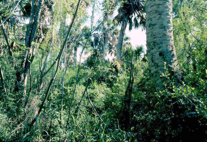
216. Intriguing view of virgin forest- A composite scene of old-growth sabal palm-ebano Rio Grande floodplain forest revealing regeneration of both co-dominant climax tree species. Other woody species in this forest tract were lime prickly ash, anaqua, tenaza, tpeguaje, Spanish dagger, and David milkberry or cahinca (the overall dominant understorey shrub). Other low-growing shrubs that were common in the understorey included chilipiquin and Texas mallow or Drummond wax-mallow. Bloodberry or rogue plant was the major forb. Common reed or carrizon, the large arundinoid grass, was locally dominant and frequently present as a major herbaceous species (in latter case, as in foreground of this photograph).
Abscission scars from shed fronds were distinctive on trunk of palm (right foreground).
Audubon Sanctuary, Cameron County, Texas. October.
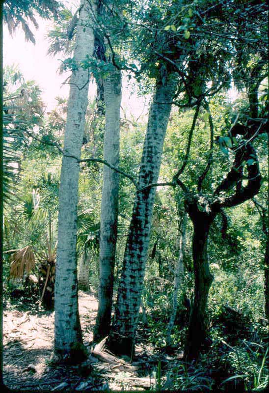
217. Not an island paradise but Texas' Lower Rio Grande Valley- No, this was not a tropical island in the Caribbean Sea, but sabal palms, an anaqua, Texas persimmon, and common reed welcomed guests to a floodplain forest near the mouth of the Rio Grande emptying into the Gulf of Mexico. Young palms and ebano saplings attested to regeneration of these climax co-dominants of this forest range type.
(And, yes for some folks this always warm-- and, usually, hot -- and humid, mesquite-infested, closed-in, backwater "jungle" is paradise. "To each his own".)
Audubon Sanctuary, Cameron County, Texas. October.
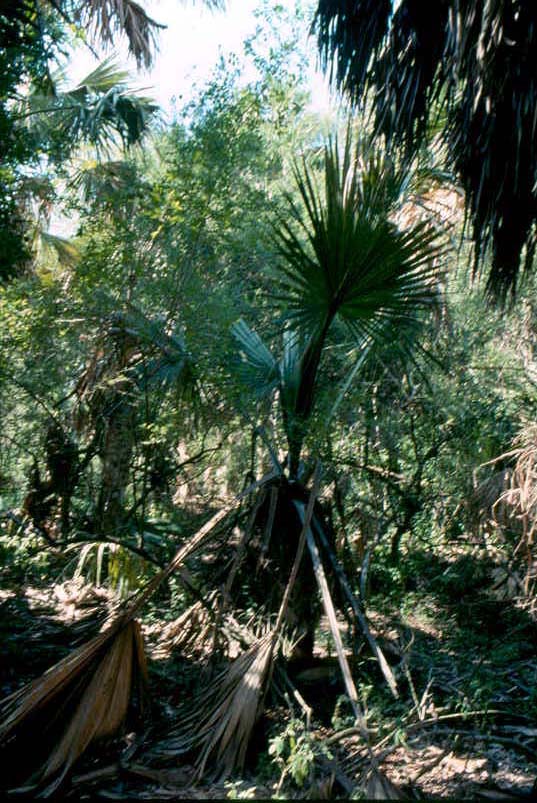
218. Next crop of co-dominants- Regeneration of sabal palm (foreground) and ebano or Texas ebony (background) was shown distinctly in this view of the understorey of a palm-ebano floodplain forest.
Litter from shed palm fronds covered much of the forest floor, but some plant species grew through this debris (and perhaps benefitted from it). It was remarked previously that based on tolerance of cabbage palm it was logical to assume that sabal palm is probably a shade- tolerant species. .
Audubon Sanctuary, Cameron County, Texas. October.
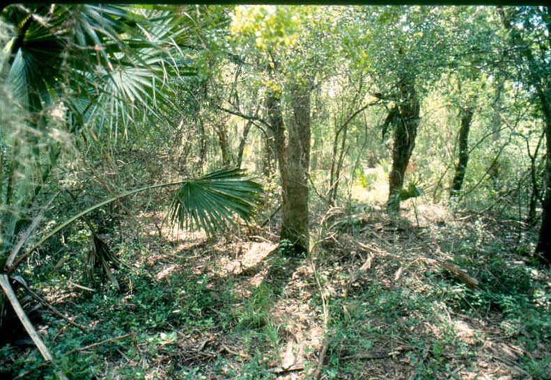
219. Inside a sabal palm-ebano forest- Deep interior of a Rio Grande floodplain forest with young sabal palms and older and larger ebano (largest tree trunk but with uncharcteristic lower bark) and anaqua (two trees with dark trunks in right background and one tree at extreme right margin). It was mentioned above that Sabal mexicana is likely shade-tolerant so that palm regeneration occurs in climax forests.
Low-growing plants on forest floor included David milkberrry or cahinca, chilipiquin, bloodberry, and common reed. Almost all individuals of these species were stunted and were not flowering or bearing fruit in sharp contrast to individual plants of these same species. (Sexually reproductive specimens of these species that were photographed at this same time and in this forest were presented below.)
Climax forest vegetation seen here was a representative sample of the Texas ebony-anacua series of upland subtropical evergreen forest described by Diamond (1998, p.4). The author of the present publication explained in the introduction to this section on Palm Forest the likelihood that floodplain sabal palm groves (the Texas palmetto [S. mexicana]-dominated forest of Diamond [1998. p.1]) intergraded (ie. "blended") into the ebano-anaqua series. Diamonde (1998, p. 4) described a vegetational continuum of similar and floristically related plant communities in the Lower Rio Grande Valley.
The absence of a well-developed understorey that was described by Diamond (1998, p. 4) as "... essentially no middle story or ground cover" was evident in this photo-quadrant.
Audubon Sanctuary, Cameron County, Texas. October.
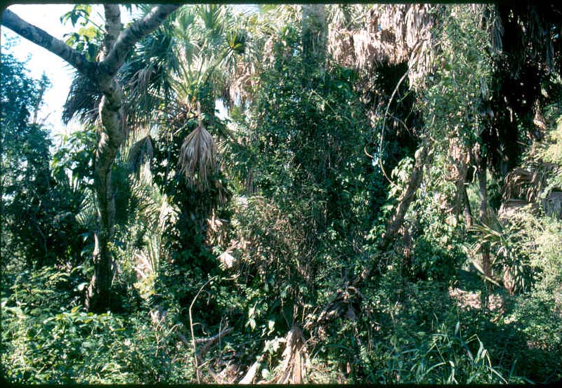
220. Forest smorgasbord- Within this dense sabal palm-ebano forest community several strata (layers) of vegetation were visible illustrating the structure of this floodplain range type. David milkberry was the conspicuous twining, leafy shrub ascending trunks and into the more open canopy. Bloodberry or rouge plant (also pigeonberry), the most common forb, and Texas wax-mallow or shrubby turk's cap and Berlandier fiddlewood were other common shrubs. Also present (and very conspicuous in right foreground) was common reed or carrizo. The forked-limb tree with the "dead giveaway" mottled bark was Texas persimmon. Recall from the introduction of this section that Texas persimmon was interpreted by Diamond (1998, p. 4) was a member of the climax Texas ebony-anaqua forest type. Dead fronds and "boots" (remaining bases of dead leaves) were visible on almost the entire trunks of sabal palms in foreground indicating that these were relatively young trees and that regeneration of sabal palm was on-going..
Audubon Sanctuary, Cameron County, Texas. October.
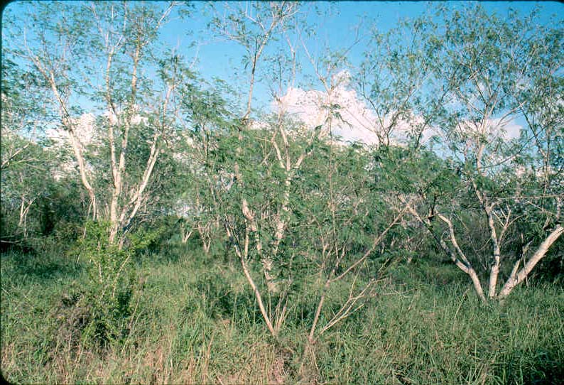
221. New forest on an old-field- Old-field is an "old" term in American ecological circles where it is still used in reference to abandoned farm land, most of which consisted of fields (referring to land that had been devoted to field crops). Historically before involvement of the Federal (United States) government, abandoned farm ground was left without much, if any, attempt at revegetation. What natural revegetation took place on such abandoned land did so by secondary succession. Land so abandoned was left to "go back on its own" and hence also became known as "go-back land" (a synonym for old-field and used in more more western-- subhumid to arid --regions). With advent and wide acceptance of government cost-sharing (ie, subsidized) programs for soil conservation and revegetation like the Soil Bank and, later (and more successful), Conservation Reserve Program most abandoned fields (and mined lands) in the United States are now artificially revegetated by seeding or tree planting.
The range presented in this slide was an old-field or go-back land undergoing secondary succession. Forest range vegetation was in an advanced seral stage that was approaching plant species composition of climax sabal palm-ebano forest. The complete chronology of agricultural use (livestock grazing, field crop farming, horticultural cropping) on this land was, of course, not known. Likewise, the record of human inputs-- direct and/or indirect --on this stand of Texas ebony or ebano was incompletely known. Diamond (1998, p. 5) pointed out that while there had been considerable effort directed toward reforestation of abandoned cropland in the Lower Rio Grande Valley (more than 5000 acres) "only dubious records" had been kept on materials and methods or successes and failures of this restoration effort. Even on property of proverbial "crack-conservation outfits" like The Nature Conservancy details of restoration projects are far from complete.
On the Audubon Society forestland shown here it was not known how much or what proportion--if any-- of Texas ebony forest regeneration was due to artificial revegetation (including tree planting) and what was atrtributable to the natural processes of secondary plant succession. Furthermore, "little is known about processes in old-growth Texas ebony forests, nor about presettlement disturbances". "Gap-phase succession is not clearly apparent in old-growth upland forests of the Rio Grande Valley" (Diamond, 1998, p. 5). Consistent with the latter statement, it appeared that on go-back land adjacent to sabal palm-ebano forest (such as the old-field shown here) climax plant species reestablished rapidly on the forest sere via old-field (= secondary) succession.
A possible important factor in reforestation-- natural and/or artificial revegetation --of subtropical evergreen forests, including the various cover types and series of both floodplain and upland forests, was role played by invasive and naturalized plant species. The introduced guinea grass (Panicum maximum) recently and with unbelieveable rapidity naturalized throughout much of southern portions of the Rio Grande Plains vegetational area (and extending north of the Lower Rio Grande Valley). Naturalization (Clementsian invasion) of (by) guinea grass was complete within the time frame of approximately 30 or 40 years. This phenomenonal rate of spread rivaled that of annual grasses in California and King Ranch bluestem throughout much of Texas. Guinea grass comprised almost all of the herbaceous cover in the vegetation seen in this and the next succeding slide. Role, if any, of guinea grass in re-establishment of Texas ebony, anaqua, sabal palm, Texas prsimmon, etc. has apparently not been established or, perhaps, not even investigated. Would presence of dense cover by perennial grass have any impact on invasion by native species-- climax and/or seral -- on the forest sere? Would any such impact be different with an exotic like guinea grass than with native species?
Audubon Sanctuary, Cameron County, Texas. October.
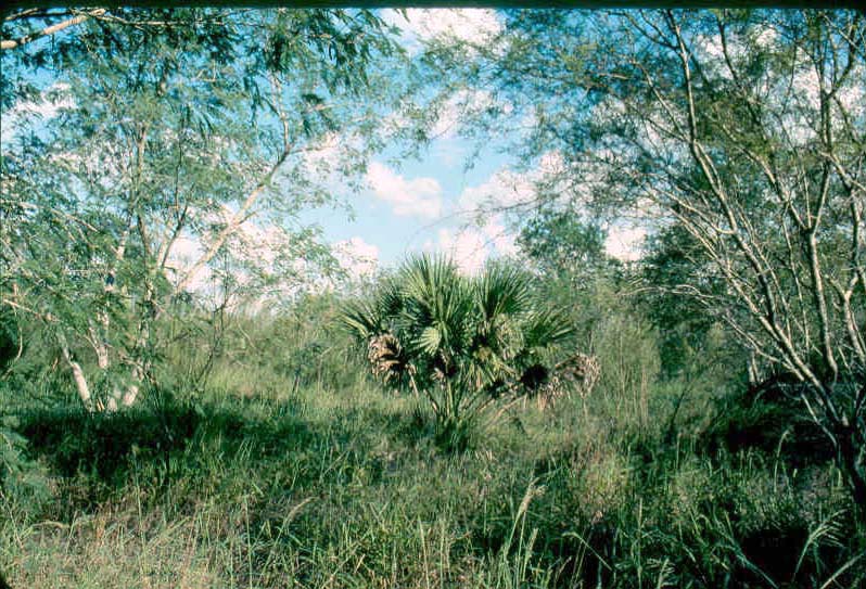
222A. Forest come-back on go-back land- Young Texas ebony or ebano and sabal palm re-established on an old-field adjacent to old-growth floodplain forest co-dominated by these climax tree species. This was another view of the same land and range vegetation introduced in the preceding photograph. The forest community was obviously dominated by Texas ebony and sabal palm which are climax dominants of this forest cover type, subtropical evergreen upland forest. Anaqua was also established but at much less cover and density than the other two tree species. The herbaceous layer of this range plant community was composed almost exclusively of the introduced and naturalized guinea grass. There were trace amounts of bufflegrass (Pennisetum ciliare), another introduced (exotic or alien) and widely naturalized grass, present in the otherwise single-species herbaceous layer. Other woody species present as widely scattered individual plants included mesquite, huisache, lime prickly ash, and the subshrub ivy treebine (Cissus incisa). These species did not comprise a shrub layer.
Audubon Sanctuary, Cameron County, Texas. October.
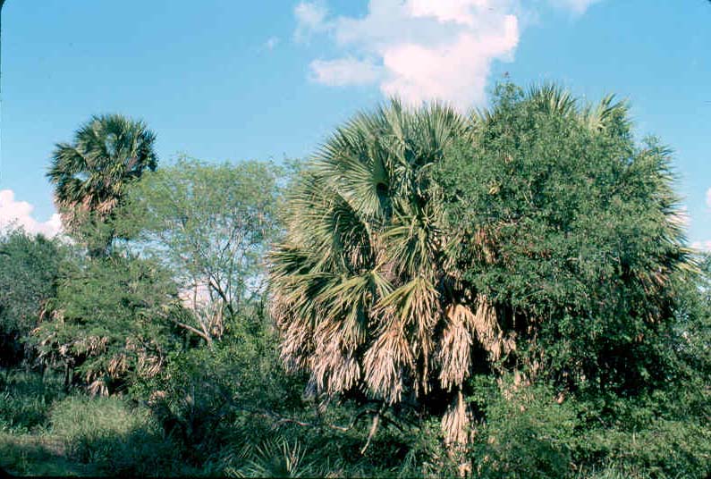
222B. Species line-up of come-back forest- Botanical make-up of the young forest that was developing on the go-back land introduced in the two immediately preceding photographs was shown here in greater detail. Re-establishment of climax tree species of Texas ebony, sabal palm, and anaqua along with shrubs like Texas persimmon and lime pricklyash resulted in on-going reforestation of a subtropical, evergreen upland palm-ebano-anaqua forest, the climax vegetation for this forest range site.
Attention was drawn to the smaller (younger) individual plants of the climax tree species that had regenerated in close proximity to larger (more mature) and, apparently, parent plants. A closed-canopy, climax palm-ebano forest was developing on this old-field. Secondary plant succession had advanced on this forest sere to advanced stage(s) such that botanical composition of this forest community was very similar to species make-up of what is interpreted as climax (= potential natural) vegetation.
Almost all of the herbaceous layer was the introduced and naturalized guinea grass.
Other local aggregations of vegetation on this go-back land had not advanced to this successional stage and instead were in various brush stages composed largely of mesquite and huisace (along with guinea grass, lime prickly ash, tpeguaje, tenaza, Texas fiddlewood, etc.).
Audubon Sanctuary, Cameron County, Texas. October.
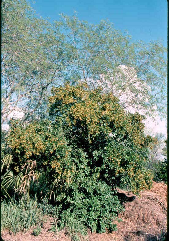
222C. Botanical sampler- Detailed sample of second-growth sabal palm-ebano forest. This photo-plot showed the plant species composition of a young but climax forest. It may not have all the outer trappings of an old-growth sabal palm-Texas ebony forest like scenes from the virgin tract shown above but this "little bit" of vegetation had the species composition of climax palm jungle forest.
Tallest, sparsely foliated trees were ebano or Texas ebony. Foremost tree (shorter than ebano and with dense foliage and ripening fruit) was anaqua or knock-a-away. A young sabal palm was at extreme left foreground (margin of photograph). Grass in front of young palm was common reed or carrizo. All of these speceis were present in an adjacent old-growth floodplain forest that had developed along a resaca (ox-bow) of the Rio Grande. Thus species composition of this local aggregation of vegetation consisted of the same climax tree species as the virgin forest vegetation. However, species make-up was not as rich or diverse as that of the relict old-growth in that there was an absence of many of the understorey shrub and forb species (eg. chilipiquin, shrubby turk's cap or Drummond wax-mallow, Texas fiddlewood, and bloodberry or rouge plant) and twining or liana-like shrubs (eg. typical understorey dominant, David milkberry or cahinca).As such, structure and function of the smaller, botanically incomplete stands of vegetation was not the same as in larger and pristine palm-ebano forest communities.
Audubon Sanctuary, Cameron County, Texas. October.
Shown below were examples of major plant species of climax subtropical evergreen sabal palm-Texas ebony forest. Photographs of twigs, inflorescences, and legumes of Texas ebony or ebano or ape's earring were presented above with the other species of woody legumes.
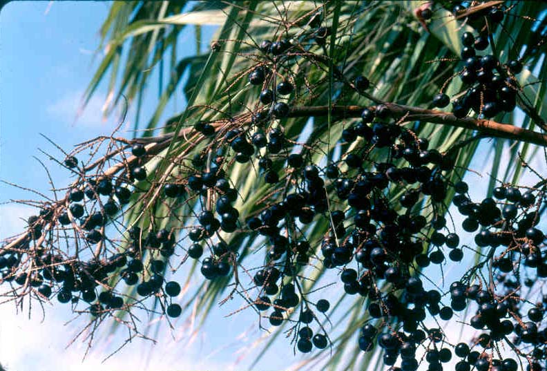

223. Fruit of sabal palm (Sabal mexicana= S. texana)- Fruit cluster (panicle inflorescence type) in sabal palm. Fruit type in the Palmae (palm family) is a drupe or berry. Fruit of sabal palm has been described as "berrylike" or "fruitlike" (Correll and Johnston, 1979).
The common name for sabal palm in Spanish is palma de micheros. Micheros is Spanish for the palm fruits which are resemble grapes but are have more of a datelike flavor and are relished by numerous species of animals including humans (at least under the right conditions).
Cameron County, Texas. October (both ripe and unripe fruits).
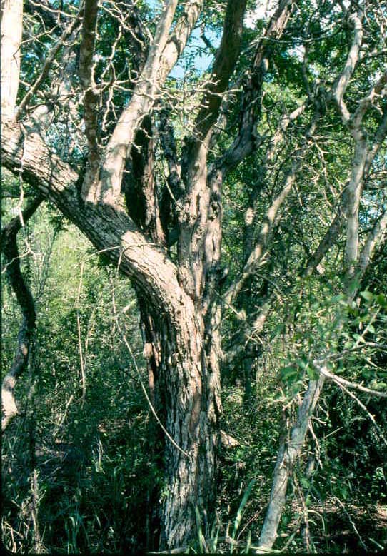
224. Texas ebony or ebano- Trunk and major limbs of a mature tree with characteristic bark. Smaller tree or shrub to immediate right of ebano with its "can't miss this one" bark was Texas persimmon. It was explained previously in this section that Texas persimmon is a climax (and indicator) species associated with ebano-anaqua forest (see again Diamond, 1998, p. 4).
Audubon Sanctuary, Cameron County, Texas. October.
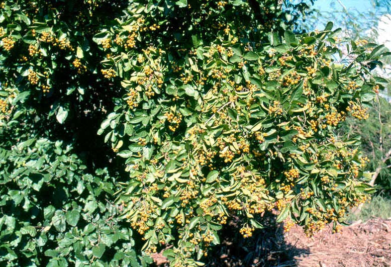
225. Anaqua (Ehretia anacua)- This medium-sized tree of the Boraginaceae (borage family) is a climax co-dominant with Texas ebony on forest sites of the Texas ebony-anacua series of subtropical evergreen upland forest in the Lower Rio Grande Valley (Diamond, 1998, p. 4). In the present publication anaqua was interpreted as the major associate of co-dominant species, sabal palm and Texas ebony, on climax floodplain forests near mouth of the Rio Grande. This was based on empherical observations by this author in the relict vegetation of Sabal Palm Audubon Center and Sactuary, Cameron County, Texas.
The example of leaves and fruit shown here was of the large anaqua specimen in the last photograph of forest range vegetation on the old-field of the Audubon Sanctuary. October.
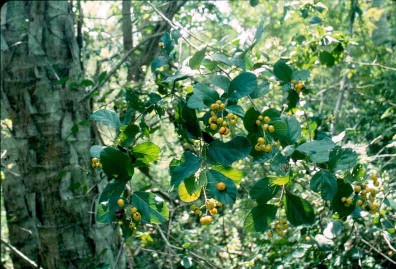
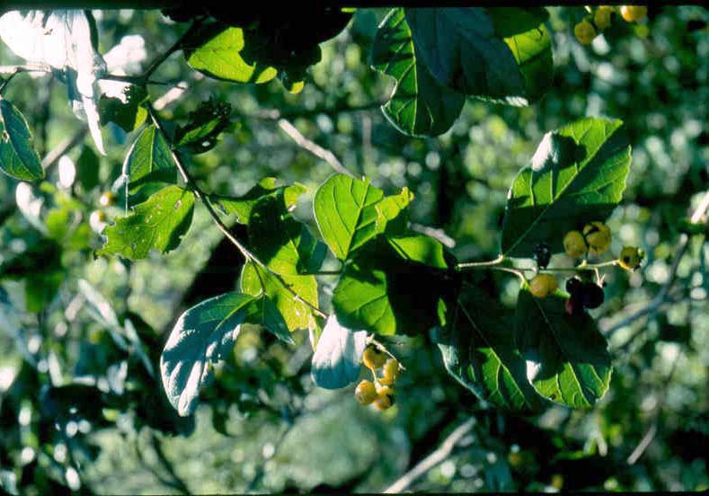
226. Leaves and fruit of anaqua or knock-away- Fruit type in anacua (anaqua is spelled with either a "c" or a "q") is a drupe. Each drupe has two stones or pits each of which has two seeds. The fruit is juicy and eaten by numerous wildlife species. Viewers should scroll back to the preceding slide and observe again the heavy fruit crop. Multiply that by four and get an idea of the number of seeds dispersed from a single tree. Anacua trees deep inside sabal palm-ebano forest do not produce high fruit yields like the specimen in the go-back land above. More realistic examples of fruit yield in forest interiors were presented in the present two photographs. Still, a "heap of seeds" are produced by one tree.
Trunk of sabal palm in background of first of these photographs depicted close association of these two climax tree species.
Audubon Sanctuary, Cameron County, Texas. October.
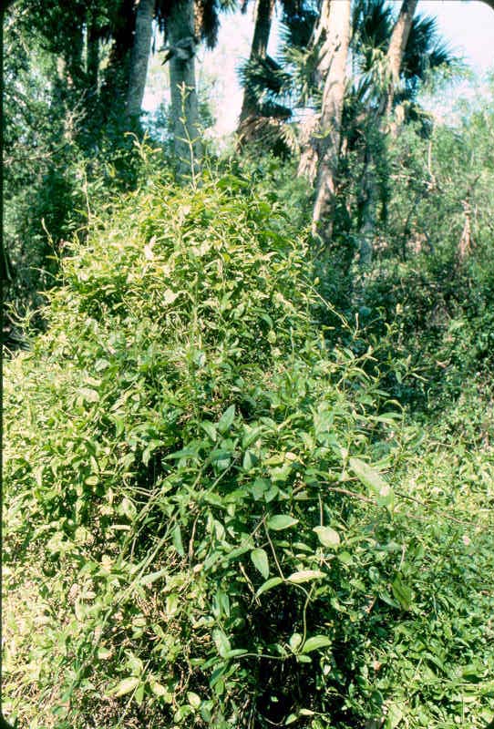
227. David milkberry or cahinca (Chinococca alba)- This woody vine has been interpreted as the most common dominant species of the understorey of climax sabal palm-Texas ebony floodplain forest. Cahinca is expecially common-- sometimes the exclusive or nearly sole --dominant shrub of palm groves.
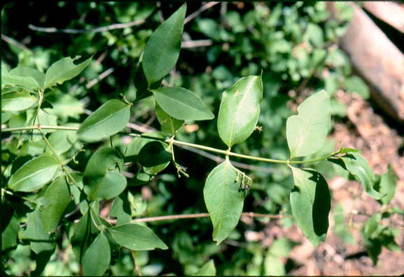
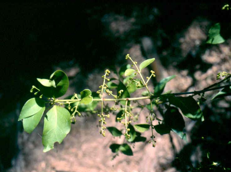
228. David milkberry or cahinca- Leader and shoot apex with some fruit of the dominant shrub (woody vine) of sabal palm groves. Audubon sanctuary, Cameron County, Texas. October.
229. Shrubby or woody turk's cap, Drummond wax-mallow or Texas mallow (Malvaviscus drummondii= M. arboreus var. drummondii)- One of the more common and, certainly, conspicuous understorey shrubs in climax sabal palm-Texas ebony forests is this member of the mallow family (Malvaceae). Audubon Sanctuary, Cameron County, Texas. October.
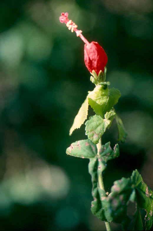
230. Drummond wax-mallow- Shoot apex with inflorescence. The telltale staminal column of the mallow family was displayed prominently by this proud member of the lower woody layer of the climax sabal palm-ebano floodplain forest. Audubon Sanctuary, Cameron County, Texas. October.
231. Chilepiquin or chilitepin (Capsicum annuum var. glabriusculum)-The official native pepper of the Lone Star State. Yep, that's right. Passed the Texas House of Representatives in 1997 as some sort of House Resolution. Ain't it fine to have statesmen with such leadership, vision, and botanical insights! Would you believe a sense of political savy and a taste of subtle seasonings?. Anyway this little annual chili is widespread in various habitats and range regions in the Southwest. The individual shown here was growing in the understorey of a stand of sugarberry (Celtis laevigata) in the Western Cross Timbers, but it is also common in the Rio Grande Plains including the sabal palm forest. This individual (including the details of its leaves and inflorescences shown in the succeeding slides) seemed to be an unusually intact and unbattered specimen so it was included here.
Erath County, Texas. September; full-bloom and immature fruit stages.
232. Details of a seasoned native- Leaves and inflorescence chilepiquin. This individual (introduced in the preceding photograph) was growing in the West Cross Timbers of northcentral Texas, but the species is so widespread that the same taxonomic variety is even more common in south Texas and Mexico.
Erath County, Texas. September.
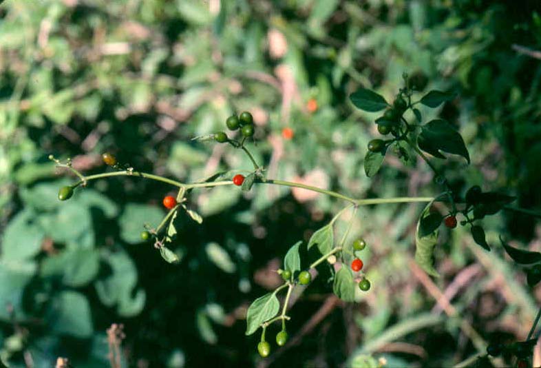
233. Chilipiquin, bird-pepper, or bush pepper (Capiscum annuum var glabriusculum= C. annuum var. minus)- This member of the nightshade family (Solonaceae) is regarded as subshrub or undershrub (suffrutescent or suffrticose). Whichever term is most appropriate this is one of the more widely distributed species along the Rio Grande(= Rio Bravo) growing from the Gulf of Mexico through the Chihuhuan Desert portions of the Trans-Pecos Region.
Chilipiquin was a common associate of David milkberry, Drummond wax-mallow, and bloodberry as a member of the understorey of sabal palm-Texas ebony forests. This one was happy in the Audubon Sanctuary, Cameron County, Texas. October.
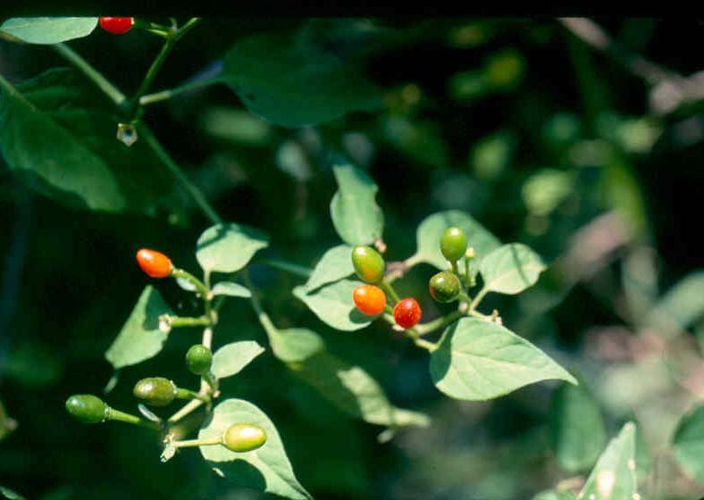
234. Leaves and fruit of chilipiquin- Close-up photograph showing detail of shoot apex with unripe (immature) and ripening fruit. Fruit type is a berry. Capsicum is the genus of various chilis and peppers. C. annuum is the species commonly known as cayenne pepper. Fruit of chilipiquin is commonly used as a sesoning, in various "hot sauces", and as an all-around good tonic. This little fruit is adored as a wild spice by rangemen and foresters, cowhands and loggers, and other outdoorsmen who take life's litle pleasures where we find them. Have some on the woods.
Audubon Sanctuary, Cameron County, Texas. October.
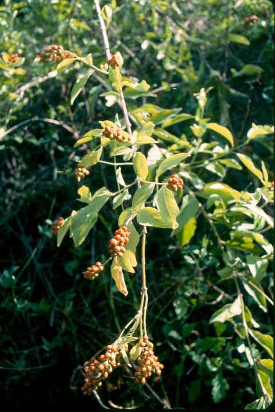
235. Berlandier fiddlewood or negrito (Citharexylum berlandieri)- This member of the verbena or vervain family (Verbenaceae) is a not-so-common species in climax sabal palm-ebano forest. Negrito is most commonly found growing in well-lite forest microsites (eg. outer edges of floodplain forests). Fiddlewood can grow to size of a small tree. It bears considerable fruit which is undoubtedly feed for animals, especially birds.
Audubon Sanctuary, Cameron County, Texas. October (fruit-ripe stage).

236. Barbed-wire cactus or triangle cactus, or (Acanthocereus pentagonus= Cereus pentagonus)- This sprawling specimen was growing in the most dense, most jungle-like thicket of a sabal palm-Texas ebony floodplain forest just upslope from a resaca (ox-bow) along an old riverbed of the Rio Grande. This species blooms at night and ever so briefly such that it is sometimes referred to as night-blooming cereus, but most authorities reserve that title as a preferred common name for another species (one which does call palm jungles home).
This specimen's dancing pardner was a a lime prickly ash (single-stemmed shrub with gray-colored trunk immediately to right of the cactus). Both were safe at home in Audubon Sanctuary, Cameron County, Texas. October.
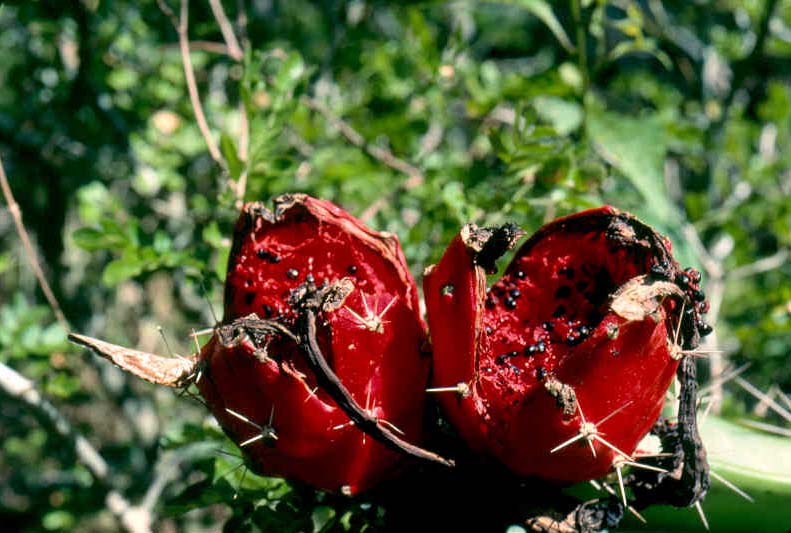
237. Shoot apex and fruit of triangle cactus- The cactus plant shown in the preceding photograph was at fruit-ripe phenological stage and the happy occasion was a "Kodak moment" for the reader's fortunate author/photographer. Fruit of triangle or barbed-wire (the origin of second common name was obvious in first photograph) is extremely sweet and a bon apetite bonanza for animals including the hymenopteran (ous) guests shown here. All were happy on the Audubon Sanctuary, Cameron County, Texas. October.
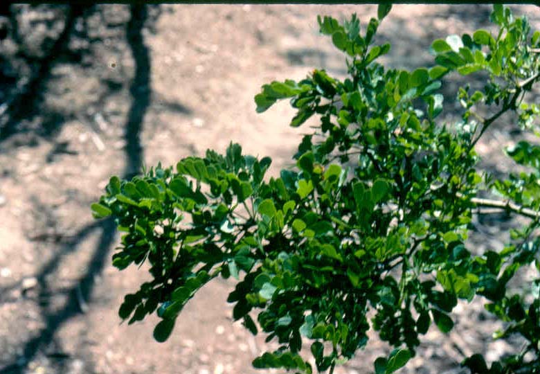
238. Leaves of lime prickly ash or colima (Zanthoxylum fagara)- In recent times the Lower Rio Grande Valley became famous for its production of fine citrus fruit. This species is not one of those horticultural fruit crops, but it is in the citrus family (Rutaceae). Z. fagara is widely distributed in the Rio Grande Plains and Coastal Prairies and Marshes vegetational areas of Texas across the Gulf Coastal Plain to Florida and south into Central America. Lime prickly ash is a common member of climax sabal palm-texas ebony forest as well as of the "brush country" in general. Colima superficially resenbles legumes including possessing catclaw-like prickles.
The example shown here was growing at the edge of a resaca in association with (and within wind-blown touching distance of) sabal palm, anaqua, and ebano on the Audubon Sanctuary, Cameron County, Texas. October.

239. Bloodberry, pigeonberry, coralito, or rouge plant (Rivina humilis)- This is one of the few forb species that grows in the usually deeply shaded interiors of climax sabal palm-Texas ebony forest, but it is a common herbaceous plant in that range plant community. Bloodberry is in the small family Phytolaccaceae although some taxonomists have included teh genus in the Petiveriaceae. Audubon Sanctuary, Cameron County,Texas. October.

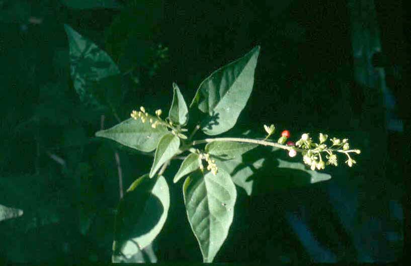
240. Shoots of bloodberry or coralito- Leaves, flowers, and fruit of one of the most common (and one of the few) forbs in climax palm-ebano floodplain forest. Audubon Sanctuary, Cameron County, Texas. October.
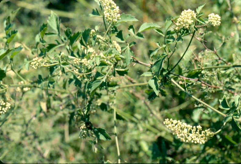
241. Cow-itch, ivy treeebine, or hierba del buey (Cissus incisa)- This woody vine or liana was growing on the old-field land featured in photographs above that was undergoing natural reforestation back to a sabal palm-Texas ebony forest. Cow-itch was not common in an adjoining old-growth palm-ebano forest where it was observed (in very scrawny form) on more open local sites (microsites). Audubon Sanctuary, Cameron County, Texas. October.
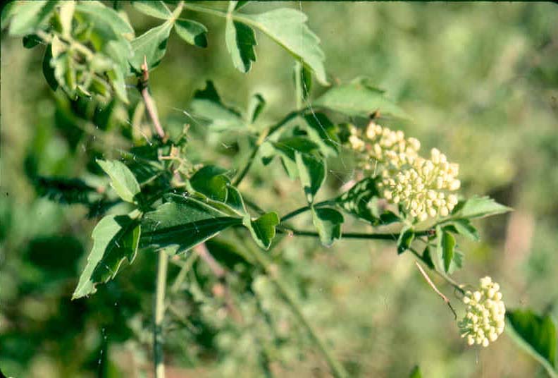
242. Shoot tip of ivy treebine- Details of leaves and flower cluster of cow-itch growing on go-back land on floodplain of Rio Grande where it was growing in association with sabal palm, Texas ebony, anaqua, and common reed. Audubon Sanctuary, Cameron County, Texas. October, full-bloom stage.

243. Source of water for a gallery forest-.A natural limestone sinkhole. Approximately 1,400,000 US gallons of arsenic-water flow out of this sinkhole every day. Two underground springs or seeps are sources of this water. Indians of the 1) Hohokam group and, later, those of the 2) Northern Sinagua culture built and used an irragation system to grow corn, beans, and squash (see below). This geologic phenomenon was in the Arizona Transition Zone or Central Highlands situated between the Basin and Range physiographic province to the south and the Colorado Plateau physiographic province to the north. Chronic (1983, ps. 137-142) provided a good summary of the geology of the Transition Zone.
This is a textbook example of a sinkhole being formed in karst topogoraphy. The following description of the formation of this phenomenon was provided by DesertUSA: "Montezuma Castle overlooks Beaver Creek, a tributary of the Verde River, which flows through the Verde Valley. The Verde Valley runs between the mountainous highlands -- the Black Hills -- of central Arizona to the south and the southern edge of the Colorado Plateau to the north.
"The valley was created by the Verde Fault, which eventually caused the Black Hills to be uplifted more than 4,000 feet while impounding the Verde River into series of lakes. Tributary streams drained the limestone surface of the Coconino Plateau from the north into these lakes, creating 3,000-feet-thick deposits called the Verde Formation.
"Slightly acidic groundwater in limestone regions gradually dissolves passages and caverns in the underground rock. Geologists call this karst topography of which the Verde Valley is a classic example. With changes in ground water levels, underground caverns sometimes collapse, creating sinkholes filled with water. Such is the case with Montezuma Well, which is still a primary source of water for the Verde River. Near Beaver Creek, the generous amount of water gushing from rock crevices was used by prehistoric peoples of the Verde Valley to provide irrigation water their crops."
The tree crown in lower left corner was that of an Arizona black walnut (Juglans major) that was featured in in the after-the-next slide-caption set (ie. two slide-caption sets "from now".
Montezuma Well unit, Montezuma Castle National Monument, Yavapai County, Arizona. Mid-July.


244. Government explanation- Montezima' s Well with two plaques placed by the National Park Service explaining the geologic creation of this karst limestone sinkhole (first slide) and a description of the sink hole (second slide).
The plaque in the first slide read as follows: "The Forming of Montezuma Well. Scientists speculate that about twelve million years ago, this part of Verde Valley was covered by a large, shallow lake full of small floatig plants. The plants caused dissolved limestone to form minute crystals which slowly sank to the bottom eventually, produced thick layers of soft limestone.
"About two million years the lake began drying. Underground streams started dissolving some of the softer limestone under the ground and a cavern began to take shape.
"The constantly moving water carved the underground cave even larger until, probably about 11,000 years ago, the roof gradually crumbled--forming Montezuma Well. Continued erosion formed the outlet in a side cave.
"When the water enters the well through the bottom vents, limestone falls out of solution and carbon dioxide (CO2) is relaeased as a dissolved gas into the water."
The plaque in the second slide read as follows: "Montezuma Well. A funnel-shaped, limestone sink containing a pool of water 55 feet deep and 368 feet across, Montezuma Well is all that remains of an ancient cavern.
"Subterranean springs of warm water replinish the well with over a million and a half gallons of water a day: an amount unvarying, apparently, since prehistoric times. The water maintains an even temperature of 76 F (25C) year around.
"Water from the well flows out through a side cave in the limestone cliffs to your right.
"We do not know what the first settlers called this, but early soldiers attributed the deep pool of water in the desert to the Aztec emperor who lived 2000 miles south and several hundred years earlier." National Park Service.
The diagram in the second plaque: showed two streams of water eminating from the outlet of Montezuma's Well-- 1) irrigation cannel built by Hohokam and, later, Northern Sinagua Indians and 2) natural mountain stream, Beaver Creek, a tributary of the Verde River. Along these precious flows of water the native vegetation had formed a gallery forest composed of various species of native hardwood trees and shrubs along with an herbaceous layer of native grasses, both warm- and cool-season perennials. That hardwood forest range was the subject of this section. he gallery forest would have been present at time of arrival of southwestern North American Indians. This forest--actually more like a woodland--community developed in both the riparian zone and the floodplain or creek bottomland of Beaver Creek.
Hohokam Indians arrived about 600AD and grew corn, squash, beans, etc. on the alluvial bottomland of Beaver Creek with water from the creek and the karst sinkhole knonw later as Montezumas' Well. The Hohokam people abandoned this area about 1000AD and the Northern Sinagua moved in and adopted the Hohokam irragation system. Sometime shortly after 1400AD the Sinagua also abandoned Montezuma's Well /Beaver Creek site.
Following human abandonment the "land reclaimed its own" with redevelopment through plant succession of the climax gallery forest.
Montezuma Well unit, Montezuma Castle National Monument, Yavapai County, Arizona. Mid-July.

245. Walnut by water- Crown of an Arizona walnut on bank of the karst sinkhole known as Montezuma's Well. This is the same tree crown shown in the first slide that introduced this coverage of gallery forest in the Arizona Transition Zone. Arizona walnut was a locally important food source for the Hohokam and Northern Sinagua Indians that lived at this location for hundreds of years using primitive irrigation methods.
Montezuma Well unit, Montezuma Castle National Monument, Yavapai County, Arizona. Mid-July.
A brief introduction to the mixed hardwood bottomland forest known variously as riparian and/or gallery forest. Descriptions of this natural plant community--which the current author treated as a forest range cover type--have been quite limited. Ffolliott and Gottfried (2008, p.115) specified that there were three major riparian plant associations in Arizona. Among these three it was the Arizona sycamore-willow-cottonwood-Velvet ash-Arizona walnut community that had greatest canopy cover. This riparian association was "commonly found in intermingling combinations as narrow stringers along the mainly intermittent or ephemeral streams" (Ffolliott and Gottfried, 2008, p.115). This gallery forest is of the Cottonwood-Willow (235) forest cover type described by the Society of American Foresters (Eyre, 1980, p. 113). For purposes of the following description/discussion, this natural forest community was labeled a Sonoran gallery forest because it has been interpreted as being in the Sonoran floristic province (Thorne, Phytogeography of North America North of Mexico. Flora of North America, Vol. 1, Ch. 6.)
This forest range vegetation could also be termed a "corridor forest" from the perspective of Landscape Ecology because it 1) developed along a stream corridor and 2) has structure (long, narrow) and function of a corridor (transporrts and connects other landscape units such as between or among matrices (matrix being the largest landscape element). More discussion along these lines was included below in description and discussion of the non-riparian zone portion of this Sonoran gallery forest.
Campbell and Green (1968) studied stream channel vegetation along Sycamore Creek in the southern Transition Zone of central Arizona and concluded tht this probably never reaches a climax hierarchy due to periodic flood dusturbances..." Along " a relatively stable stream channel" at elevations of about 3300 feet the forest community was a Platanus wrightii-Populus fremontii-Fraxinus pennsylvanica [var. velutina]-Cupressus arizonica and similar communities including those with Juglans major, Salix gooddingii and Quercus epp. with Prosopis juliflora forming a rather dense understory beneath the canopies". They further concluded that tree species including Arizona sycamore, Fremont's cottonwood, Arizona walnut, and green ash were riparian versus pseudoriparian species while mesquite was a psuedoriparian species (Campbell and Green, 1968). These authors listed only three Gramineae species of which two were exotic grasses.
Based on a few studies such as that of Campbell and Green (1968) and a classification systm developed by Szaro (1989), DeBano and Schmidt (in Baker et al., 2004, ps. 17-18) lumped riparian vegetation in the southwestern United States into three general groups. Two of these groups were relevant to the present description: 1) riparain ecosystems at elevations below 3280 feet associated with various kinds of streams that supported deep-rooted trees including Arizona sycamore and Fremont's cottonwood along with the naturalized, alien saltcedar (Tamarix spp.) with an herbaceous understorey of grasslike plants (Juncaedae and Cyperaceae species) and 2) riparian ecosystems at elevations between 3280 feet and 6560 feet which had the greatest number of species including cottonwood, willow, sycamore, velvet ash, and Arizona walnut with herbaceous layer(s). DeBano and Schmidt (in Baker et al., 2004, p. 18) explained that these mid-elevational riparian forests (the latter group that was just described) occurred "... as narrow stringers of vegetation along intermittent and ephemeral streams, although some perennial streams remain at these intermediate elevations". Tree species having large adults and that are obligate riparian plants such as sycamore and cottonwood "are often perceived by the public and by environmental professionals as being the more typical riparian vegetation" along Arizona streams even though several "less conspicuous and less glamorous species" are also members of riparian forests (Danzer et al., 2001). In a comprehensive treatment Snyder et al. (2002. p. 106).noted a" riparian community dominated by Platanus wrightii".
At an elevation of 3,681 feet for Montezuma's Well itself (and downhill from there") and with the few qualitative descriptions cited above, especially that in Baker et al. (2004), it was axiomatic that the gallery forest which developed along Beaver Creek and its floodplain--and that is featured below--corresponded to the more species-rich hardwood riparian forest association, SAF forest cover type 235.
Apparently, gallery or riparian forests (in particular those comprised of large tree species like sycamore, walnut, and ash among angiosperms and/or gymnosperms like pines) are not found (or are nearly nonexistant) among Great Basinn riparian communities (Chambers and Miller, 2004, esp. p. 280). Cottonwood-dominated riparian forests are present in the Great Basin (Chambers and Miller, 2004, ps. 269-292 passim.). McLaughlin (in Baker et al., 2004, ps. 127-168 passim.) showed that Fremont's cottonwood, Arizona sycamore, velvet ash, and Arizona walnut are core riparian (central component) species of both the Mandrean and Sonoran Floristic Provinces.
Given the precious nature of water and watersheds and the inestimatable value of stream corridor vegetation, especially in arid and semiarid zones, rational responses would include baseline studies of these natural resources and the ecosystems providing them. It is remarkable indeed that so little research and demonstration has been done with regard to stream-derived (= riparian or gallery) forests in desert regions.
And he shall be like a tree planted by the rivers of water, that bringeth forth his fruit in his season; his leaf also shall not wither; and whatsoever he doeth shall prosper--.Psalms 1:3. KJV.
Trees planted by "rivers of water"- Presented below are dominant tree species of the gallery--or, if one prefers, though less correctly perhaps--riparian or floodplain forest that developed along Beaver Creek, a tributary of the Verde River, and an irrigation canel constructed millenia ago by Hohokam and, later, Northern Sinagua Indians to carry arsenic-laden water from a karst sinkhole known as Montezoma's Well in the southern Arizona Transition Zone. It could be argued that these trees are or, alternatively are not phreatophytes ("well plants"), plants with their roots in the capillary fringe of an aquifer. Certainly tree roots are bathed in arsenic-loaded surface water both directly and indirectly through lateral flow that is carried in the irrigation aqueduct. None of the plant species in the riparian zone of this man-made stream of water could survive without the water though, of course, there was overflow water from the outlet of the sinkhole long before ingenious and industrious Indians built the irrigation cannel.
Obviously, a gallery forest of these same dominant tree species was here for millions of years before the Indians--the first wave of the nonnative, exotic, and highly invasive species Homo sapiens--began manipulating this forest ecosystem.
Riparian zone of Beaver Creek and ancient irrigtion canel, Montezuma Well unit, Montezuma Castle National Monument, Yavapai County, Arizona. Mid-July.


246. Water, including that from floods, is the key factor- Riparian or gallery forest of Arizona sycamore (Platanus wrightii= P. racemosa var. wrightii), Fremont's cottonwood (Populus fremontii), and velvet ash (Fraxinus velutina, specifically F. velutina var. glabra) that developed along the riparian zones of Beaver Creek, a tributary of Verde River, and an abandoned Indian irrigation canel, the source of which was the outlet from the karst sinkhole known as Montezuma's Well. In these two "photoplots" Fremont cottonwood was just an assoicate species (locally it was largely absent) with the other two general dominants clearly "in control" along this streatch of the natural and man-made water courses. Western poison ivy (Toxicodendron rydbergii= T. radicans= T. r. var. rydbergi= Rhus radicans) and Arizona grape (Vitis arizonica) were well represented in these two "photoquadrants". Other woody plant species included desert false-indigo or indigo-bush (Amorpha fruticosa var. occidentalis= A. occidentalis) and New Mexico or Arizona alder (Alnus oblongifolia) as well as many young shoots of velvet ash. It could not be determined what proportion of these young ash shoots were seedlings versus asexual (secondary) shoots off of roots and trunk-rootcrown sections. Shoots were either of sexual and asexual origin.
A number of Arizona alder were present on the bank of the stream. These alder were especially obvious in the first photograph where one alder was to left and front of the velvet ash in left-center foreground. Another (and quite large shrub by standards of this species) was behind this velvet ash. There was also an alder specimen in the second photograph: three shoots from same point of origin in center midground and flanked to its left and right by velvet ash.
Most of the herbaceous layer of the forest range vegetation seen in the foreground of these two photographs was the invasive, exotic tall fescue (Festuca arundinacea) , an introduced and now important tame pasture grass and turfgrass species. For whatever reason, the list of plant species for Montezuma's Well National Monument (Schmidt et al., 2006, Appendix A) did not include tall fescue, but the numerous, grain-filled panicles visible (upon projection) in this and the next succeeding slide unequivocally proved presence of--and local dominance by-- this non-native, agronomic, perennial bunchgrass. Most of the large, cespitose, herbaceous wetland plants in Beaver Creek were softstem or great bulrush (Scirpus validus= S. tabernaemontani).
Debris transported by flood water from preceding winter and spring rains had been deposited and accumulated in the water and on the floodplain of the first terrace of the creek and irrigation canel. Had Montezuma's Well and its outlet been in a typical city (or even and all too often) a standard state park such "trash" would have been removed by Dudley DoGooders and/or "grounds keepers" kept busy "cleaning up the place" by their busy body, bean-counting bureaucratic supervisors. By contrast, enlightened, ecologically educated, science-based management of the National Park Sevice purposely and correctly left the important, life-restoring debris where it had been deposited by natural processes of flooding. Leaving the debris was wise (proper) use management. This is not to say that federal agencies get it right every time, but they did in this case, and they knew why they needed to leave the debris where it washed up. Such natural debris is important because it: 1) recycles nutrients, 2) adds organic matter to the alluvial soil, 3) serves as barriers to succeeding flood water thus slowing down time of cresting and providing protection against erosion of the stream channel and banks, and 4) provides microhabitats for some--certainly not all--plant and animal species. The importance of woody debris in desert streams was reviewed by Minckley and Rinne (1985).
Seedlings of pioneer (colonizing) riverine and riparian species like Fremont's cottonwood and willows (Salix spp.) establish on mineral soil scoured by action of flood water (Stromberg et al., 1991; Stronberg, 1997). Such Intolerant tree species do not benefit from litter such as debris and instead require areas from which the debris was displaced and redeposited as seen in these photographs.
In arid and semiarid zones of hot, southwestern North America tree species like Arizona sycamore, Fremont's cottonwood, and velvet ash are obligate riparian species (Campbell and Green, 1968; Danzer et al., 2001). Beaver Creek is a textbook example of that phenomenon.
Riparian zone of Beaver Creek and ancient irrigtion canel, Montezuma Well unit, Montezuma Castle National Monument, Yavapai County, Arizona. Mid-July. FRES No. 17 (Elm-Ash-Cottonwood Forest Ecosystem). A variant of K-92 (Elm-Ash Forest). SAF 235 (Cottonwood-Willow). Mixed Broadleaf Series 223,22 of Southwestern Riparian Deciduous Forest and Woodland 223.2 of Brown et al. (1998). Arizona/New Mexico Mountains Ecoregion, 23.

247. Principal players in the gallery- Trunks of Arizona sycamore, the quientessential obligate riparian tree of the "desert southwest". Sycamore was one of three dominant tree species of a Sonoran gallery forest that developed along Beaver Creek immediately downslope from Montezuma's Well, a classic water-filled karst sinkhole. Other woody plant (tree, shrub, liana) species in this "photoquadrant" included velvet ash, western poison oak, Arizona grape, desert false-indigo or indigo-bush, and Arizona or New Mexico alder.
Riparian zone of Beaver Creek and ancient irrigtion canel, Montezuma Well unit, Montezuma Castle National Monument, Yavapai County, Arizona. Mid-July. FRES No. 17 (Elm-Ash-Cottonwood Forest Ecosystem). A variant of K-92 (Elm-Ash Forest). SAF 235 (Cottonwood-Willow). Mixed Broadleaf Series 223,22 of Southwestern Riparian Deciduous Forest and Woodland 223.2 of Brown et al. (1998). Arizona/New Mexico Mountains Ecoregion, 23.

248. Stars of the gallery show- Dominant riparian trees and shrubs of a mixed hardwood bottomland forest in low mountains of southwestern North America (effectively, semiarid precipittion zone). Wildlifers, eco-tourists, birders, and Bambi-hugging surburbanites have their "chriasmatic megafauna". Foresters, horticulturalists, and run-of-the mill tree huggers (don't miss that twist of a pun) have their "chriasmatic megaflora", and this is it. The massive and striking trunk of an Arizona sycamore flanked by smaller, though also eye-catching, trunks of velvet ash. These were the two local dominants of a Sonoran gallery (riparian) forest that developed in the Arizona Transition Zone along Beaver Creek downhill from Montezuma's Well, a karst sinkhole. Beaver Creek is a tributary of the Verde River. Prominent leafy shoots in lower right corner were those of velvet ash that were either seedlings or offshoots (suckers, root/stump sprouts), it being indeterminable which without exposure of lower parts of thee shoots.
Shrubs included western poison oak, Arizona grape, and desert indigo-bush or false-indigo. The dominant herbaceous species was, unfortunately, the exotic perennial grass, tall fescue, which at this point in the growing season had produced a heavy grain crop. The other identifiable herbaceous species in this "photoplot" was softstem or great bulrush (Scirpus tabernaemontani= S. validus).
Cliffs or bluffs of late Miocene to Cenozoic (Tertiary Era) limestone served as a geologic backdrop for this equally spectacular floristic array. This geologic strata was the Verde Formation that formed from a freshwater lake and was a combination of silts, sands, clays, and lime muds.
Riparian zone of Beaver Creek and ancient irrigtion canel, Montezuma Well unit, Montezuma Castle National Monument, Yavapai County, Arizona. Mid-July. FRES No. 17 (Elm-Ash-Cottonwood Forest Ecosystem). A variant of K-92 (Elm-Ash Forest). SAF 235 (Cottonwood-Willow). Mixed Broadleaf Series 223,22 of Southwestern Riparian Deciduous Forest and Woodland 223.2 of Brown et al. (1998). Arizona/New Mexico Mountains Ecoregion, 23.

249. Water makes for velvet- Velvet ash was another member of the "chriasmatic megaflora", of a Sonoran gallery forest, and a hardwood species that also had handsome adult trees. Velvet ash had produced many young shoots, some that were seedlings and others that were offshoots, secondary shoots, or clonal units (modules) of mature individuals. Other woody plant species included Arizona grape, western poison oak, desert false-indigo, and New Mexico or Arizona alder. The trunk of one Arizona alder was behind the two velvet ash trunks at left.
Most of the herbaceous foliage in this "photoplot" was that of the introduced pasture grass, tall fescue. This cool-season C3 bunchgrass had produced a bountiful grain crop on rank-growing shoots that exceeded two feet in height. Tall fescue is a dreadfully invasive weed, even in the semiarid zone when it is growing in cool, moist habitats.
Riparian zone of Beaver Creek and ancient irrigtion canel, Montezuma Well unit, Montezuma Castle National Monument, Yavapai County, Arizona. Mid-July. FRES No. 17 (Elm-Ash-Cottonwood Forest Ecosystem). A variant of K-92 (Elm-Ash Forest). SAF 235 (Cottonwood-Willow). Mixed Broadleaf Series 223,22 of Southwestern Riparian Deciduous Forest and Woodland 223.2 of Brown et al. (1998). Arizona/New Mexico Mountains Ecoregion, 23.


250. Defining star of the riparian stage- Upper trunks and crowns of the breath-takingly beautiful Arizona sycamore as seen from the top of a limestone cliff or bluff of the Verde Formation that formed in late Miocene-Cenozoic (Tertiary Era) and looking down into the floodplain of Beaver Creek, a tributary of the Verde River. The first of these two slides featured upper boles and crowns of two Arizona sycamore. The low-growing bush in center foreground of this slide (at point of a large, flat slab of limestone) was golden current (Ribes aureum).
The second of these two slides featured another (a third) sycamore crown. There was also part of the crown of a velvet ash in the right margin of this slide with a plant of golden current to left of the ash (center foreground). Also in this second slide (center midground and to immediate right of the sycamore and much below it) was the crown of an Arizona alder, the dominant shrub in this forest community. Arizona grape was another shrub species in this second photograph (lower left quarter of frame). The old sycamore in this second photograph was "sporting" an old but only partly healed wound where it had lost a large limb years ago. The orientation of this wound (upward facing) was such that it collected what limited precipitation fell in this semiarid area. The result was rotting wood and, almost assuredly, the extension of rot down into the trunk so that this tree was more than likely hollow to a large degree. All individuals of Arizona sycamore along this stretch of gallery forest were at (or past) their prime so as to be in or approaching the life cycle stage of senescence.
Riparian zone of Beaver Creek and ancient irrigtion canel, Montezuma Well unit, Montezuma Castle National Monument, Yavapai County, Arizona. Mid-July. FRES No. 17 (Elm-Ash-Cottonwood Forest Ecosystem). A variant of K-92 (Elm-Ash Forest). SAF 235 (Cottonwood-Willow). Mixed Broadleaf Series 223,22 of Southwestern Riparian Deciduous Forest and Woodland 223.2 of Brown et al. (1998). Arizona/New Mexico Mountains Ecoregion, 23.
Farther downstream and out from the stream chanel- Down on the floodplain of Beaver Creek yet away from its riparian zone a Fremont's cottonwood-Arizona sycamore-velvet ash Sonoran gallery forest had trees of these dominant species much more widely spaced so that there was a well-developed herbaceous understorey of native grasses, both cool-season and warm-season species. Among shrub species, Arizona alder, the dominant shrub in the riparian zone, and Arizona grape, desert false-indigo along with western poison oak, associate shrubs of the riparian zone, disappeared from the intermediate woody layer of this forest and were replaced by shrub-sized velvet mesquite (Prosopis velutina= P. juliflora var. velutina).
That portion of the gallery forest--the farther or more distant floodplain versus the riparian zone--was treated below. It should be stressed that much of this distant mixed hardwood bottomland forest, a gallery forest in a semiarid zone, was subirrigated (at least during wetter times of the year). This permitted survival of trees, including Arizona sycamore which has been shown to be an obligate riparian species in this semidesert environment (Campbell and Green, 1968; Danzer et al., 2001).
The outermost portion (part of farthest away from the riparian zone) of this forest had a structure and herbaceous composition so different from the riparain zone forest that it had to be treated separately.

251. Outward from the riparain zone- Composition and structure at the perimeter or outermost portion of a Fremont's cottonwood-Arizona sycamore-velvet ash gallery forest that developed along Beaver Creek in the Arizona Transition Zone or Central Highlands (Chronic, 1983, ps. 137-142). This was the least mesic or driest part of this forest range community. This relict vegetation was on the outskirts of this bottomland forest in a semidesert environment. This environment was a long, linear mesosite or mesohabitat (habitat of intermediate spatial scale) so that the tree-dominated vegetation which developed on it was a textbook example of a gallery or "corridor" forest. Corridor in this usage refers to the long, connecting landscape element, corridor (versus matrix and patch, the other two elements), of Landscape Ecology based on structure, shape, and function. The corridor aspect of this Sonoran gallery forest was also discussed above in introduction of this forest range plant communiity.
In this "photoquadrant" a large Fremont's cottonwood towered above an shrub layer of velvet mesquite and an herbaceous layer of grasses that was drastically different from the understorey layers of the riparian zone forest dealt with above. The herbaceous portion of this less mesic zone of the gallery forest was dominated by native grasses in a mosaic (patchwork pattern) with first one species and then another species of grass being dominant in a local patch. Each of these local patches that was dominated--and sometimes populated exclusively--by a single grass species (ie. a single-species stand) was a miniature consociation, a plant community with only one dominant plant species (a term coined by American plant ecologist, Frederick E. Clements). The dominant (and almost exlusive) herbaceous species in foreground of this "photoplot" was common squirreltail or bottlebrush squirreltail (Sitanion hystrix). This local consociation was presented in the next slide-caption set.
Numerous young seedlings of velvet mesquite hade invaded this bottomland forest range to comprise a mid-level woody (shrub) layer in this range plant community. This population (it was a cohort, a group of organisms of the same age) of velvet mesquite seedlings was visible in the midground of this photograph. There were at least three critical questions regarding these mesquite plants. First, would these mesquites mature as shrubs or, alternatively, grown into mid-size trees? Second, would crowns of these mesquites form enough of a canopy cover so as to "shade out" or outcompete--for light, water, space, etc.--native grasses, perhaps to point that there would no longer be an herbaceous layer in this gallery forest? Third, was mesquite invasion (and possible exclusion of grasses and loss of the herbaceous component) a natural part of plant community succession or, just the opposite, was successful establishment of velvet mesquite due to exclusion of fire (or possibly other factors including flooding) and thus be an unnatural brush invasion and consequent range deterioration (degradation due to retrogression, an approximate reverse of plant succession)? A fourth question followed from some or all of the above questions or, said another way, the first three questions were follow-up to this fourth question. Was invasion of velvet mesquite the culmination of the first step in secondary plant succession leading to a climax mesquite bosque? The second part of this fourth question--or, perhaps, of the only necessary question--would then be, will velvet mesquite develop into the climax plant community known as a mesquite bosque of which the Fremont's cottonwood-Arizona sycamore-velvet ash gallery forest was but a higher seral stage (perhaps subclimax)?
Perhaps only time will tell. Yet even this may not present or constitute "successional truth" because presence or absence of fire or flood could (probably would) "sway" the path of plant succession away from or toward, respectively, the possible mesquite bosque. The real question comes down to whether or not the possible mesquite bosque is the potential natural (climax) range vegetation so that the Fremont's cottonwood-Arizona sycamore-velvet ash Sonoran gallery forest (with or without a shrub layer of velvet mesquite) is a subclimax or, perhaps, a natural climax due to natural disturbances including fire, drought, flooding, or even grazing.
To the distant left-rear of the large Fremont's cottonwood was the crown of an Arizona sycamore growing along Beaver creek (in the riparian zone of this stream). This crown was on one of the sycamores presented above. Also to the rear--but the near rear (left and right)--of the cottonwood were crowns of smaller one-seed juniper (Juniperus monosperma). These juniper or, in local lingo, "cedars" had invaded from juniper-bunchgrass woodland and/or savanna beyond the floodplain of Beeaver Creek.
Was such invasion natural (ie. on-going plant succession) or was this a brush invasion due to fire suppression or, even, absence of recent flooding of enough duration to "drown out" the one-seed juniper? Same question as regarding invasion by/or velvet mesquite. At this stage (of plant succession and time) this remains an open question. This rangeman will go out on a sycamore limb (hopefully not a rottten one) and say that tentative evidence suggest the recent absence of fire has been largely responsible for spread of both one-seed juniper and velvet mesquite into this otherwise relict (tract of climax) forest vegetation, and that such invasion is of brush (woody noxious plants) and comprises retrogression not on-going forest succession. As evidence of this conclusion by the author, he saw it as sufficient to cite the classic work of Arizona range sicentist, Humphrey (1962, ps. 148-167). Given that return of the Northern Sinagua and Indian burning is not possible, have ready the drip tourches!
Greater floodplain of Beaver Creek, Montezuma Well unit, Montezuma Castle National Monument, Yavapai County, Arizona. Mid-July; estival aspect. FRES No. 17 (Elm-Ash-Cottonwood Forest Ecosystem). A variant of K-92 (Elm-Ash Forest). SAF 235 (Cottonwood-Willow). Mixed Broadleaf Series 223,22 of Southwestern Riparian Deciduous Forest and Woodland 223.2 of Brown et al. (1998). Arizona/New Mexico Mountains Ecoregion, 23.

252. Tails on the bottom- Local stand of common squirreltail or bottlebrush squirreltail (Sitanion hystrix) as dominant of the herbaceous layer of a Fremont's cottonwood-Arizona sycamore-velvet ash gallery forest that developed along Beaver Creek, a tributary of Verde River, in the Arizona Transition Zone or Central Highlands (Chronic, 1983, ps.137-142). This constituted a mesoscale consociation, a term invented and popularized by F. E. Clements (1916, 1936) for a plant community with only one dominant plant species. Common squirreltail was not abundant in the understorey of the gallery forest range, but it was locally dominant as seen here. Squirreltail is most likely an increaser on this bottomland forest range site. The climax dominants were presented later in this section.
Greater floodplain of Beaver Creek, Montezuma Well unit, Montezuma Castle National Monument, Yavapai County, Arizona. Mid-July; estival aspect. FRES No. 17 (Elm-Ash-Cottonwood Forest Ecosystem). A variant of K-92 (Elm-Ash Forest). SAF 235 (Cottonwood-Willow). Mixed Broadleaf Series 223,22 of Southwestern Riparian Deciduous Forest and Woodland 223.2 of Brown et al. (1998). Arizona/New Mexico Mountains Ecoregion, 23.


253. Beautiful in form and function- Structure and composition of Fremont's cottonwood-Arizona sycamore-velvet ash Sonoran gallery forest. Adult trees of these three dominant hardwood (angiosperm) species plus velvet mesquite (still in seedling to shrub size/stage) were presented in these two slides. These two photographs were taken from the same (more or less) camera location other than vertical versus horizontal orientation. There were three prominent layers of vegetation in this gallery forest community: 1) tree (three "tri-dominants" just listed), 2) shrub (seedlings to multi-stemed shrubs reaching roughly half the height of adult dominant trees), and 3) grass, the herbaceous layer comprised of native midgrass (intermediate height at maturity) species.
The emphasis in these two "photoplots" was on the herbaceous layer that was composed of three grass species, two of which were dominants (co-dominant grasses) and one that was an associate species. Co-dominant grasses were cane bluestem (Androogon barbinodis= Bothyriochloa barbinodis), a panicoid and warm-season species, and blue wildrye (Elymus glaucus), a festucoid and cool-season species. The associate grass was common squirreltail or bottlebrush squirreltail (covered in the immediately preceding slide-caption set). More consideration of these native perennial grasses followed in slide-caption sets presented below, including those devoted to the individual species as range plants.
In addition to these three, major, native grass species there were scattered individuals of three species of perennial, introduced, agronomic (pasture and hay) grasses: smooth brome (Bromus inermis), tall fescue (Festuca arundinacea), and Johnsongrass (Sorghum halapense). Another Eurasian grass introduced--unintentionally--by white man was the annual, ripgut brome (Bromus rigidus= B. diandrus). In this forest understorey red brome (B. rubens), the most abundant and widespread naturalized Eurasian grass throughout the "desert southwest", had less cover than ripgut brome. The larger growing, more moisture-requiring ripgut brome would be expected to thrive better than the smaller, more xeric red brome on this mesic bottomland forest range.
"Only time will tell" if the three, introduced, forage grasses have so thoroughly naturalized as to be able to co-exist with or, even eventually, displace the native perennial grasses. Johnsongrass, an introduced (from Africa) warm-season--a panicoid--grass has long been recognized as a weed (noxious plant) more than a valuable forage crop though it can be either one. Smooth brome and tall fescue are currently more accepted as major hay and pasture grasses than as weeds, but their weediness has become a problem, though a more recent weed problem than that of Johnsongrass. All three introduced grasses were undeniably weeds in this relict tract of gallery forest. Obviously annual Bromus species are weeds, but on the mesic environment of this forest range type they were not as much of an invasive plant problem as were the weedy perennial grasses.
The "big unknown" was whether or not any or all of these weedy grasses were naturalized--completely adapted to a new (non-native for them) habitat--so as to pose a threat to the native perennial grasses. In fact, it was not clear as to whether these grass weeds were naturalized to the natural habitat of this Sonoran gallery forest or adapted only to a human-perturbed forest. It was possible that presence of the exotic grasses--both agronomic perennials and annual, opportunistic species--in this forest understorey was the result of past human-induced disturbance (farming for certain and, likely, after abandonment of tillage, by livestock grazing that almost assuredly would have been at excessive atocking rates). An even more important anthropogenic (= man-made) disturbance might have been absence of the natural factor of fire. Human tillage (Indians) and anthropogenic suppression of fire (wihte man) might (could) have permitted establishment of introduced grass weeds. Elimination or, more realistically, reduction of such unnatural disturbances in this national monument might result in eventual loss of these weeds and, subsequently, their replacement by the native grass species. This reduction of human disturbance would have to include reintroduction of fire which, in contemporary times of higher human density, would amount to prescribed burning. Prescriptive use of fire will be central to restoration of this gallery forest.
Greater floodplain of Beaver Creek, Montezuma Well unit, Montezuma Castle National Monument, Yavapai County, Arizona. Mid-July; estival aspect. FRES No. 17 (Elm-Ash-Cottonwood Forest Ecosystem). A variant of K-92 (Elm-Ash Forest). SAF 235 (Cottonwood-Willow). Mixed Broadleaf Series 223,22 of Southwestern Riparian Deciduous Forest and Woodland 223.2 of Brown et al. (1998). Arizona/New Mexico Mountains Ecoregion, 23.


254. Forest members up close- Vegetational architecture and major plant species of a Sonoral gallery forest that developed on the outer floodplain of Beaver Creek, a tributary of the Verde River, in Arizona Transition Zone or Central Highlands (Chronic, 1983, ps.137-142) below the elevational zone of pine-juniper woodland. The first of tthese two "photoquadrants" featured trunk of a young adult of Fremont's cottonwood (right foreground) with a well-developed herbaceous understorey co-dominated by two native perennial grasses: 1) blue wildrye, a cool-seson festucoid species, and 2) cane bluestem, a panicoid, warm-season species Blue wildrye was represented by the cespitose plants with wider leaves. Much, but certainly not all, of the straw (dead grass shoots) in the understorey was that of 1) common squirreltail, (a native, festucoid, perennial grass) and 2) ripgut brome (an invasive, Eurasian, annual grass). Some of the straw was last year's (now dead) shoots of the co-dominant grasses. Several larger individuals of Fremont's cottonwood were in background and a young adult of Arizona sycamore was at far right margin. Also in background of this first photograph were several multi-trunked, shrub-height specimens of velvet mesquite that made up the middle woody (shrub) layer of this forest range.
The second "photoquadrant" also featured blue wildrye (immediate foreground) and cane bluestem (directly behind the wildrye)--both last year's dead shoots and current growing season living shoots--plus some straw of common squirreltail along with the straw (current year's dead shoots at end of annual life cycle) of ripgut and red brome. Growing within the herbaceous layer were seedlings and small (young) saplings of velvet mesquite that had recently invaded the Sonoran gallery forest. In background of this second slide were several recently invaded (established) plants of one-seed junipers. These were at outermost edge or perimeter of this bottomland floodplain forest.
Accumulations straw from last year's shoots of native perennial grasses along with high numbers of invading velvet mesquite and one-seed juniper were warning signs to eyes of experienced rangemen and foresters that this relict tract of gallery forest was in need of prescribed fire if the structure, composition and forage-providing function of this bottomland forest ecosystem were to be preserved. Based on historic accounts by the earliest white men to visit this region (see Humphrey [1962, ps. 148-167])non-sprouting conifers and prolific hardwood species like velvet mesquite had been kept at very minimal cover by fires, sources (Indian or lightening) of which were not known. Where human habitations are in close proximity to relict vegetation, such as the beautiful example presented herein, lightening-ignited wildfire must usually be supressed to protect human life, livestock, and man-made structurs. Thus, prescribed fire carefully conducted by the appropriate officials--National Park Service personnel in this instance--, must be applied if the relict forest is to be preserved. Burn, baby, burn!
Greater floodplain of Beaver Creek, Montezuma Well unit, Montezuma Castle National Monument, Yavapai County, Arizona. Mid-July; estival aspect. FRES No. 17 (Elm-Ash-Cottonwood Forest Ecosystem). A variant of K-92 (Elm-Ash Forest). SAF 235 (Cottonwood-Willow). Mixed Broadleaf Series 223,22 of Southwestern Riparian Deciduous Forest and Woodland 223.2 of Brown et al. (1998). Arizona/New Mexico Mountains Ecoregion, 23.


255. Beautiful form and function closer in- Two views of a Sonoran gallery forest showing major range plant species and structure of this forest range vegetation. The first slide featured: 1) young (seedling to small shrub stage) velvet mesquite beneath a Fremont's cottonwood to show the lower woody (shrub) layer of this three-layer forest and 2) large, recently senesced (death at end of annual life cycle) plants of ripgut brome (straw-colored bundhbrasses in foreground) to illustrate invasion of the forest community by exotic species. Trunks and/or crowns of other cottonwoods as well as Arizona sycamore and velvet ash were in the background of this first photograph.
The second slide of this set put a young adult of Arizona sycamore in center stage with co-stars blue wildrye and cane bluestem, the two dominant herbaceous species, and common squirreltail, the associate herbaceous species, of this gallery forest. All of these native plants had to share the spotlight with ripgut brome and red brome, two Eurasian annaual grasses that had invaded this understorey. This second photograph also had multi-trunked, shrub-sized velvet mesquite that comprised a lower woody (shrub) layer in this three-layer bottomland forest range.
Arizona sycamore is generally regarded as an obligate riparian species (Campbell and Green, 1968; Danzer et al., 2001) so it was probable that this forest land beyond the riparian zone was subirrigated. Subirrigation in this gallery forest would be natural delivery of water to plant roots from underneath (Wilson and Moore, 19898). Arizona sycamore would probably be an indicator species of this phenomenon of subsurface lateral water movement from the stream (outward from the stream channel).
Greater floodplain of Beaver Creek, Montezuma Well unit, Montezuma Castle National Monument, Yavapai County, Arizona. Mid-July; estival aspect. FRES No. 17 (Elm-Ash-Cottonwood Forest Ecosystem). A variant of K-92 (Elm-Ash Forest). SAF 235 (Cottonwood-Willow). Mixed Broadleaf Series 223,22 of Southwestern Riparian Deciduous Forest and Woodland 223.2 of Brown et al. (1998). Arizona/New Mexico Mountains Ecoregion, 23.


256. Rangeman's focus- Pair of "nested photoplots" featuring the herbaceous understorey (layer) of the non-riparian zone (less mesic outer reaches of the floodplain) of a three-layer, Fremont's cottonwood-Arizona sycamore-velvet ash Sonoran gallery forest that developed along a tributary of Verde River in the Arizona Transition Zone or Central Highlands (Chronic, 1983, ps.137-142). Although this range plant community had developed on bottomland beyond the stream's riparian zone it was likely that this land was subirrigated for at least part of the tree-growing season(s). This phenomenon was described in the immediately preceding caption.
Included in the first slide of this set was the Fremont cottonwood with mesquite seedlings and small saplings (center midground) that were featured in the first slide of the immediately preceding slide-caption set. The presence of a well-developed shrub (lower woody) layer was clearly shown in this first photograph of the current slide-caption set. Also visible (in immediate foreground) were seedlings of velvet mesquite showing invasion of this bottomland forest range by this native woody species.There was no evidence of recent fire in this gallery forest.
Grasses in this first "photoquadrant" included cane bluestem and blue wildrye, herbaceous co-dominants, common squirrreltail, the herbaceous associate, and the two Eurasian annuals, ripgut and red bromes.The straw in the herbaceous layer was composed of dead (senesced) shoots of the annuals (mostly ripgut brome) and the native, perennial squirreltail, all of which had completed their life cycle for this year, as well as last year's dead shoots of the two dominant, native, perennial grasses. Green herbage was that of the natural co-dominant grasses. Blue wildrye was at peak standing crop in early bloom stage; cane bluestem was at (or, at least, near) peak standing crop in pre-bloom (mostly, boot) stage.
The second "photoquadrant" featured several robust plants of cane bluestem at the boot stage. The light-brown to tan area behind cane bluestem was dominated by common squirreltail and ripgut brome. A more detailed view of this native, warm-season, perennial grass "accompanied by" exotic (Eurasian), invasive, cool-season grasses was presented in the photograph of the next slide-caption set.
Greater floodplain of Beaver Creek, Montezuma Well unit, Montezuma Castle National Monument, Yavapai County, Arizona. Mid-July; estival aspect. FRES No. 17 (Elm-Ash-Cottonwood Forest Ecosystem). A variant of K-92 (Elm-Ash Forest). SAF 235 (Cottonwood-Willow). Mixed Broadleaf Series 223,22 of Southwestern Riparian Deciduous Forest and Woodland 223.2 of Brown et al. (1998). Arizona/New Mexico Mountains Ecoregion, 23.

257. Still focused on grass- Grasses dominated the herbacous layer of a Sonoran gallery forest on the farther floodplain (away from the riparian zone) of a tributary of Verde River in the Arizona Transition Zone or Central Highlands (Chronic, 1983, ps.137-142). The large, cespitose grass in center foreground was cane bluestem, the dominant warm-season, native herbaceous species of this range vegetation. (Blue wildrye was the dominant, cool-season, native, herbaceous dominant, but plants of wildrye were not present in this close-in photographic field of view.) Some of the green herbage behind and to right of cane bluestem was that of smooth brome which is an invasive, Eurasian, perennial grass. Most of the straw in this "photoplot" was of red brome, an annual Eurasian grass. Red brome is the overall most common non-native grass throughout the "desert southwest", but on this floodplain forest the larger-growing, more mesic, more-restricted-in-distribution ripgut brome was more abundant (greater cover, more biomass) than the smaller, more xeric red brome.
The potential threat posed by introduced grasses--both agronomic perennials and naturalized Eurasian annuals--to native species (natural vegetation) was discussed above. At this juncture it will be reiterated that only the unfolding of ecological time (successional and, perhaps, evolutionary temporal scale) will show whether or not these introduced species--that are, unquestionably, weeds in natural plant communities--have naturalized and perhaps pose continuing threats to productivity or, even, suvival of native range and forest plant species. The exotic grass species on this gallery forest range may have been adventitive (capable of surviving only temporarily--and without reproduction--under unusually favorable conditions) or, at most, be naturalized only to on-going human-induced disturbances much like many species of garden weeds require continued soil tillage to persist. It was plausible that these alien grass species were present only in the understorey of a previously disturbed or drastically altered forest and, that as the forest community re-developed to a more natural state, the invasive exotics would be displaced by native species of advanced seral or climax successional status. Alternatively, these introduced grasses--being large, rank-growing, and competitive to considerable degree--might retard recovery of native grasses so as to extend time required for or, in some instances, prevent re-establishment of the native species.
Greater floodplain of Beaver Creek, Montezuma Well unit, Montezuma Castle National Monument, Yavapai County, Arizona. Mid-July; estival aspect. FRES No. 17 (Elm-Ash-Cottonwood Forest Ecosystem). A variant of K-92 (Elm-Ash Forest). SAF 235 (Cottonwood-Willow). Mixed Broadleaf Series 223,22 of Southwestern Riparian Deciduous Forest and Woodland 223.2 of Brown et al. (1998). Arizona/New Mexico Mountains Ecoregion, 23.

258. Threat to forest range?- Seedlings (in foreground) and small saplings to shrub-sized trees (background) of velvet mesquite had invaded the herbaceous understorey of a mixed hardwood gallery forest that developed on bottomland along a tributary to Verde River in the Arizona Transition Zone.The herbaceous layer of this three-layer forest was comprised of primarily of cane bluestem, blue wildrye, and common squirreltail (three native, perennial grasses) and secondarily of smooth brome, tall fescue, and Johnsongrass (exotic [introduced] perennial grasses) joined by ripgut brome and red brome (Eurasian annual grasses). Potential threats of the alien grasses to recovery and persistence of native grasses was discussed in the immediately preceding caption and several captions above that.
Velvet mesquite is a native woody species that exists mostly as a mid-sized to large shrub. In some floodplains, mostly of rivers, in extreme southwestern North America bosques (wet shrubland) of velvet mesquite are the climax vegetation. Velvet mesquite is, undeniably, a component plant species of riparian and floodplain forests of the semiarid and arid zones. As is always the situation, the ecological, especially successional, value or desirability of any plant species (velvet mesqiute in this instance) depends not only on it successional status but also on its proportions (cover, density, biomass, abundance) of the range plant community. Rangemen who have lived for any period of time in "mesquite country" know only all to well that all land is always vulnerable to invasion and, ultimately, dominance by this opportunistic native legume.
Yes, some presence of velvet mesquite is, by very description of such Sonoran gallery forests, required in order to have the natural forest community. Velvet mesquite comprises most to all of the lower woody or shrub layer of these riparian and floodplain forests. In absence of natural (historic) fire and flooding regimes mesquite tends to overwhelm the herbaceous layer of these forests. In some some cases, velvet mesquite can interfere with regeneration of dominant hardwood tree species like Fremont's cottonwood, Arizona sycamore, and velvet ash all of which are 1) obligate riparian (or subirrigated) species (Campbell and Green, 1968; Danzer et al., 2001) and, as a general rule, 2) Intolerant tree species that require periodic (episodial) natural disturbances such as flooding for seedling establishment (ie. sexual regeneration). Again, only Father Time would tell if the obviously recent invasion of velvet mesquite in this gallery forest was part of plant succession (forest development) and comprised only one essential, definng layer of vegetation or, conversely if the population of young mesquites was becoming excessive in successional terms so as to constitute a brush invasion that could reduce the herbaceous layer. An excessive population of velvet mesquite (ie. cover, density, biomass, etc. beyond limits of the natural vegetation) would be brush invasion and constitute retrogression not forest succession.
Greater floodplain of Beaver Creek, Montezuma Well unit, Montezuma Castle National Monument, Yavapai County, Arizona. Mid-July; estival aspect.. FRES No. 17 (Elm-Ash-Cottonwood Forest Ecosystem). A variant of K-92 (Elm-Ash Forest). SAF 235 (Cottonwood-Willow). Mixed Broadleaf Series 223,22 of Southwestern Riparian Deciduous Forest and Woodland 223.2 of Brown et al. (1998). Arizona/New Mexico Mountains Ecoregion, 23.


259. Beauty unexcelled- Interior of crown (first slide) and trunk (second slide) of Arizona sycamore (Platanus wrightii= P. racemosa var. wrightii) growing along an ancient Indian (Northern Sinagua Indians) irrigation cannel beginning at the outlet of a sinkhole known as Montezuma's Well in the Arizona Transition Zone or Central Highlands (Chronic, 1983, ps.137-142) situated between Colorado Plateau and Basin and Range physiographic provinces to the north and south, respectively.
With its large size, unique bark on shapely trunks, dark forest-green and deeply incised leaves, and pedant spherical fruit clusters, Arizona sycamore unquestionably has some of the most lavishly beautiful trees in western North Amreica. Arizona sycamore also includes some of the largest trees of any hardwood species west of the Great Plains. It is a tree species of magnificance in corridor forests of the arid and semiarid zones.
Montezuma Well unit, Montezuma Castle National Monument, Yavapai County, Arizona. Mid-July.

260. From the gallery- Outer portion of a leader (branch) off of a lower limb of Arizona sycamore growing in a gallery forest along an ancient Northern Sinagua Indian irrigation cannel built just downstream from the outled of Montezoma's Well, a karst sinkhole. Note dense and almost shingled-like arrangement of leaves accompanied by the pedant clusters of fruit (see below).
Montezuma Well unit, Montezuma Castle National Monument, Yavapai County, Arizona. Mid-July.


261. Blessed with water- Dew-touched leaves of Arizona sycamore growing along an irrigation cannel built by Northern Sinagua Indians from the outlet of Montezoma's Well, a karst sinkhole in the Arizona Transition zone. A cool (temperatures dipped to or slightly below the dew point) and foggy atmosphere left it aqueous kiss on leaves of a water-blessed individual of one of the most beautiful hardwood tree species in the Southwestern Desert Region of North America.
In addition to descriptions of Arizona sycamore in standard works like Kearney and Peebles (1960, p. 371), Shreve and Wiggins (1964, p. 580), Vines (1960, ps. 327-328), Barry et al. (1964, ps. 155-156), and Benson and Darrow (1981, ps. 280-281), Peattie (1953, ps.491-496) provided a nice natural history account. (By the way, the latter author admired Arizona sycamore as much--if not more--than this author.)
Montezuma Well unit, Montezuma Castle National Monument, Yavapai County, Arizona. Mid-July.


262. Details of arboreous beatuy- Leaves and clusters of fruit of Arizona sycamore or Arizona plane-tree. These were on a huge tree that grew along the ancient Indian-irrigation cannelconstructed immediately downstream from the outlet of Montezum's Well, a karst sinkhole in the Arizona Transition Zone or Central Highlands (Chronic, 1983, ps.137-142). Note dew drops from a foggy, dew-point atmosphere on leaves. The fruit and fruit type of Platanus has been described vriously. Smith (1977, p. 88) recognized th fruit as a collective one, "an aggregate of achenes" Diggs et al. (1999, p. 888) interpreted the fruit of sycamore is a small single-seeded indehiscent one [an achene, perhaps] with short hairs at base. These units (achenes?) occur together and all attached around a woody sphere in a "ball" or globular (spherical) cluster.
The small, light-weight achenes are wind-borne and carried to bare soil of disturbed microsites where they germinate as a pioneer or colonizing species. Adult trees are long-lived and persist into the climax forest community. Perhaps as commonly, the entire fruit cluster of achenes falls to ground with individual achenes later separating and being dispersed from the soil surface.
Montezuma Well unit, Montezuma Castle National Monument, Yavapai County, Arizona. Mid-July.


263. Mesophytic foliage in the arid zone- Large group of pedant branches (first slide), detail of a single leader (second slide), and compound leaves (third slide) of Arizona or velvet ash (Fraxinus velutina). There is notable morphological variation in Arizona ash (Kearney and Peebles, 1960, p. 642; Powell, 1999, p. 339) with distinctions made as to taxonomic varieties (Sargent, 1933, p. 849; Kearney and Peebles, 1960, p. 642; Vines, 1960, p. 863; Powell, 1999, p. 339). Kearney and Peebles (1960, p. 642) recognized three such varieties in Arizona. The glabrous leaf surfaces (almost to appearing glossy) and obvious stalks of leaflets readily showed this example to be F. velutina var. glabra, smooth-leaf velvet ash (Vines, 1960, p. 863) and the more typical Arizona ash type (Kearney and Peebles, 1960, p. 642).
The adjectives "stately" and "graceful" may be overworked words, but they aptly describe Arizona ash, especially larger trees that developed along watercourses like the ones seen here. Powell (1988, p. 338) explained that in Trans Pecos Texas, where velvet ash is the more common ash species, this tree is "usually found in protected canyons whre there is almost constatt water", the exact environment in which specimens growing at Montezoma's Well were thriving..
Montezuma Well unit, Montezuma Castle National Monument, Yavapai County, Arizona. Mid-July.


264. Long velvet- Leaders of velvet or Arizona ash bearing much fruit (fruit type in ash is smara).Brewster County, Texas. Early September; matuiring fruit stage of phenology.


265. "Velvet" of foliage and fruit- Leaves and samaras of velvet ash. "Velvet" in lingo of cow people means surplus or, at least, bountious. The compound leaves and high yield of smaras were evident on this tree. Ash species are dioecious so the tree that produced these organs was obviously a female.
Brewster County, Texas. Early September; matuiring fruit stage of phenology.


266. Aquatic pteridophyte- Common maidenhair fern or culantrillo (Adiantum capillus-veneris) growing in an ancient Indian-built irrigation channel at the outlet of Montezuma's Well, a karst sinkhole in the Arizona Transition Zone. The Northern Sinagua people constructed this aqueduct along and through limestone millenia ago (they then mysteriously disappeared from the area), but there was already a stream present in which maidenhair fern assurredly grew. Correll and Correll (1975, ps. 63-64) specified that this aquatic range forb grew around limestone rocks and ledges, in particular along streams and pools in canyons and ravines, with a species (biological) range from Trans Pecos Texas to Arizona eastward to Tennessee and Florida and south through Meso America to northern South America, a far-flung interupted range.
Ferns are vascular plants that bear spores for sexual reproduction. Such spore-bearing vascular plants are pteriodphytes.
Montezuma Well unit, Montezuma Castle National Monument, Yavapai County, Arizona. Mid-July.


267. Dominant grass of a stream bottom range- Cane bluestem or cane beardgrass (Andropogon barbinodis= A. saccharoides var. barbinodis= Bothriochloa barbinodis= B. barbinodis var. barbinodis) was the dominant herbaceous species on the floodplain (and subirrigated soil) of a bottomland riparian or gallery forest of Arizona sycamore, black ash, Fremont cottonwood, and velvet mesquite that developed along the outflow of (from) Montezauma's Well, a limestone sinkhole. This forest range was in the Arizona Transition Zone occurring between the Colorado Plateau and the Basin and Range physiographic provinces.
Cane bluestem has traditionally been regarded as similar to silver bluestem (A. saccharoides= B. saccharoides) (Hitchcock and Chase, 1950; Gould, 1951, ps. 305-307) . More recently authors like Gould (1975, ps. 591-601; Barker et al., 2003, ps. 642-645) recognized taxonomic varieties of these two species plus newly recognized related species including Springfield bluestem or Springfield beardgrass (B. springfieldii). Kearney and Peebles (1960, p. 142) recognized silver and cane bluestem, but did separate Springfield bluestem from cane bluestem for which major differences are less robust-sized plants with fewer panicle branches in Springfield bluestem. Anyway, plants presented here were cane bluestem.
Cane bluestem is one of the most valuable native grasses throughout its biological range, especially on specific range sites in the semiarid and arid zones. By definition this is on range habitats where cane bluestem is a dominant decreaser species. Although cane bluestem is a midgrass (in contrast to numerous tallgrass species in the bluestem group) it is often the largest-growing, most nutritious, and most palatable of all grass--if not all herbaceous--species in range plant communities of which cane bluestem is a member. As is the case with all panicoid grasses, the nutritive value (nutrient content, palatability, forage availability, etc.) of cane bluestem declines rather drastically with advancing matuirity and weathering (leaching of nutrients and decomposition of plant tissue with time since senescence). Such decline is characteristic of grass species in tribes, Paniceae and Andropogoneae due to (reflective of) shoot, particularly leaf, anatomy. Plant tissues having Kranz anatomy of the C4 (Hatch and Slack) photosynthetic pathway are less digestible than those of the festucoid (pooid) grass species that have C3 photosynthesis. This difference is primarily due to lower digestibility--and, thus ultimately, lower voluntary forage intake due to lower rates of digesta passage--of C4 (Kranz anatomy) grasses. Such difference among grass species and relative deterioration of nutritive value (loss of nutrients, lower digestibility, less feed intake) is considerably less in arid environments where microbial decay and physical removal of compounds by water is obviously lower. Net result is that forage value of cane bluestem is generally Good to Fair depending on these factors as well as varying preference for cane bluestem among species of range animal.
Humphrey (1960, p.9) concluded that the coarse herbage of cane bluestem was less palatable than that of grass species with finner (smaller, narrower) leaves and culms. He gave the visual guideline of one-third of sexual shoots ungrazed under proper use of cane bluestem (Humphrey, 1960, p. 9).
The large and vigerously growing plants of cane bluestem seen in these two photographs had reached maximum shoot size (growth) up to the boot stage of development (phenology). These plants were subject to grazing by resident mule deer (Odocoileus hemionus), but in effect this cane bluestem was lightly grazed to ungrazed. Dead (pale-colored) bluestem material (necromass) was that of last year's shoots.
Cane bluestem grows on a fairly wide spectrum of habitats ranging from scrubland on rocky hillsides to more level and rolling grasslands to floodplain and other bottomland forest range communities like the one described here. Overall, however, cane bluestem grows on more mesic (moisture-favorable) sites and/or, at smaller scale, microsites. Cane bluestem was the sole dominant of the understorey of this gallery hardwood forest..
Yavapai County, Arizona. Mid-July; pre-anthesis stage.


268. Preparing to bear- Cane bluestem in the Arizona Transition Zone between Colorado Plateau and Basin and Range physiographic provinces at immediate pre-anthesis phenological stage. Several such plants were in the first slide while details of a neighboring cane bluestem plant appeared in the second slide. Pale or light tan shoots were those of last year that were largely ungrazed. Three panicles of cane bluestem were visible in the second photograph.
Yavapai County, Arizona. Mid-July; pre-anthesis stage.


269. A specialized panicle emerging from its boot- Panicle of cane bluestem emerging or being exerted by grass growth from the shoot terminus and still partly surrounded by enveloping shoot organs. The subtending (immediately below or just beneath) leaf, which at this stage of growth and development still extended somewhat aabove the top of panicle, was the flag leaf. The highly derived (evolved) and specialized inflorescence (flower cluster) type of cane bluestem was described as a paniculate inflorescence with racemose branches (Highnight et al, 198; pan
Yavapai County, Arizona. Mid-July; pre-anthesis stage.
 and
and 

270. Views of a flower cluster- Young panicles of cane bluestem in the Arizona Transition Zone. These are paniculate inflorescences with racemose branches or, even more specificly stated, panicles of subdigitate racemose branches or, worded differently, terminal panicles consisting of clustered racemes (Highnight et al., 1988, ps. 4-8; Shaw, 2008, ps. 25, 222). In the inflorescence of cane bluestem there are only primary (not secondary) branches off of the central axis. Spikelets are arranged on subdigitate racemose, primary branches of a terminal panicle. Inflorescences of grass species vary from simple to--as in case of cane bluestem--fairly complex.
None of these three flower clusters or inflorescences (first two slides obviously of the same two panicles) were fully mature as they were still at pre-anthesis phenological stage. At full maturity of the panicleof cane bluestem the primary branches spread (at least, slightly) away from the floral axisis so as to apear to be less contracted than these sub-mature panicles.
Yavapai County, Arizona. Mid-July; pre-anthesis stage.


271. Big blue on the bottom- Lower shoots of an immense individual of blue wildrye (Elymus glaucus) growing on the subirrigated bottomland of an Arizona sycamore-black ash-Fremont cottonwood-velvet mesquite riparian or gallery forest that developed along the stream flowing from Montezauma's Well, a limestone sinkhole.
Several millenia ago the Northern Sinagua Indians built an irrigation ditch immediately downstream from the outlet of this sinkhole. For several thousand years the Sinagua Indians raised corn, beans, and squash on fields tilled on what undoubtedly had been a gallery forest that developed along the natural drainage from the limestone sinkhole known today as Montezuma's Well. For unknown reasons (most likely a combination of drought and wars, especially with the more recently arrived Yavapai Indians) the Sinagua people abandoned their irrigated cropland. Following this abandonment the gallery or floodplain forest redeveloped through secondary succession on the fertile subirrigated bottomland of Montezuma's Well. The National Park Service was facilitating this redevelopment as a restoration project back to the climax plant community (which in this case would have to pre-Indian not pre-Columbian vegetation).
The understorey of this subirrigated forest vegetation was predominately an herbaceous layer dominated by cane bluestem with blue wildrye as the associate species. In local areas blue wildrye was the dominant herbaceous species. (Velvet mesquite was in process of developing as a lower woody layer that was mostly of shrub-stature.)
This blue wildrye plant (genetic individual) was huge in comparison to plants of blue wildrye that grew and were local dominants in the understorey of a ponderosa pine-Gambel's oak montane forest frather to the north in the Mountains of the Colorado Plateau. Blue wildrye is an extremely variable species (Barkworth et al., 2007ps. 306-308)--both genotypically and phenotypically--that, due to diversity in gene structure and gene flow (Knapp and Rice, 1996), readily forms hybrids within comparatively short distances (Snyder, 1950).
Blue wildrye is a widespread and valuable forage species across the Western Range Region (and, as far as that goes, across much of North America). For all of its importance as a range plant, however, blue wildrye has received relatively little attention. For example, blue wildrye was not included in the University of Arizona publication, Arizona Range Grasses (Humphrey, 1960; Ruyle and and Young, 2003). Gould (1951, ps. 118-119) did provide taxonomic coverage of blue wildrye. Good general references for blue widlrye as a range plant and forage species included the old standby, Range Plant Handbook (Forest Service, 1940, G53), and Dyer et al. (2005).
Montezuma Well unit, Montezuma Castle National Monument, Yavapai County, Arizona. Mid-July; peak biomass, early anthesis.


272. Big blue spikes- Examples of spikes (spike type inflorescence) of blue wildrye growing in the herbaceous understorey of an Arizona sycamore-black ash-Fremont cottonwood-velvet mesquite riparian or gallery forest that developed on subirrigated bottomland fed by water draining from Montezuma's Well (a limestone sinkhole). These spikes were unusually large (like the plants on which they were produced). Not only were the spikes larger than spikes produced in the understorey of ponerosa pine-Gambel's oak montane forest in the Arizona Transition Zone (see Location Note below), but there were two spikelets at most rachis nodes in contrast to the usual condition of only one spikelet per node of the rachis in blue wildrye Gould (1951, ps. 118-119) and Barkworth et al. (2007, p. 308). Gould (1951, p. 118) further noted that "number of spikelets at each node is influenced or contolled both by genetical factors and by habitat" and he speculated that light intensity might be the most important of the habitat factors.
In the big spikes seen here it was likely that a combination of high soil water content and soil fertility constituted the critical habitat variables most responsible for the large size and grain-rich feature of these spikes, given that blue wildrye was under moderately heavy shade of this mesic hardwood forest. Typically there are two to four florets per spikelet in blue wildrye (Barkworth et al., 2007, p. 308).
Montezuma Well unit, Montezuma Castle National Monument, Yavapai County, Arizona. Mid-July; peak biomass, early anthesis.
Location Note: other examples of blue wildrye presented in Range Types of North America were included in chapters, Pacific Northwest Forests (Douglas Fir Forest Range) and Riparian Zone Forests- Arizona Uplands [Transition Zone} and Southern and Central Rocky Mountain Forests.
[ Home ]