
[ Home ]
The Chihuhuan Desert is the largest hot desert in North America. In fact, according to Medellin-Leal in the reference edited by Bender (1982, p. 321, 323), the Chihuhuanm Desert is "the largest division of the Great North American Desert" and "the largest of the North American deserts". Laity in Omre (2002, p. 389) described the Chihuhuan as "the largest desert in southwestern North America". The Chihuhuan Desert is a "high desert" with an average elevation of 1400 meters (Medellin-Leal in Bender, 1982, p. 323; Brown, 1994, p. 173) and ranging from 600 to greater than 2000 meters (Mares, 2002, p.112). Vankat (1979, 192) described the Chihuhuan Desert as a subtropical desert but with a climate that is more moderate than that of the adjacent Sonoran Desert. Like the Sonoran Desert, the Chihuhuan Desert was named after the Mexican in which most of the desertscrub community occurs. Though the Chihuhun Deert as a general (and vast) vegetational region (ie. Chihuhuan Desert vegetation or Chihuhuan Desertscrub) has been described on par with other vegetational units of equivalent hierarchial rank as, for example, in North American Terrestrial Vegetation (Barbour and Billings, 1988, 2000), there is not a detailed, descriptive ecological study of the Chihuhuan Desert as there is for the sister Sonoran Desert in the life-long work of Forrest Shreve (Shreve and Wiggins, 1964). Good descriptions of the Chihuhuan Desert were included in Jaeger (1957, ps. 33-49), Shelford (1963, ps. 391-394), Bender (1982, ps. 321-381), Brown (1994, ps. 169-179), and Mares (1999, ps. 112-115). Some of the best descriptions of the Chihuhuan Desert were by MacMahon in his chapter, Warm Deserts, in (Barbour and Billings, 1988, 2000).
The Chihuhuan Desert was threated herein as the Eastern Desert Scrub (Larrea-Flourensia Association) of the Larrea-Prosopis Formation of the Desert Scrub Climax as classified and described by Frederic E. Clements (1920, ps. 162-170). The climax (pre-Columbian) Chihuhuan Desert has expanded over course of the past 100-300 years (depending on geographic location) by encroachment (invasion) of the desertscrub vegetation into the semidesert grassland classified and described by Clements (1920, ps. 114-121, 144-149) Desert Plains Grassland (Aristida-Bouteloua Association) of the Stipa-Bouteloua Formation of the Grassland Climax. Relations of these two major units of vegetation were discussed below.
It is generally accepted that Forrest Shreve (1942) was the first to delineate and actually designate this desertscrub vegetation as the Chihuhuan Desert. Shelford (1963, fig. 15-1, p. 374) followed the delineation of Shreve (1942) and predicatably followed the Clementsian scheme of community organization as applied in Shelford and Clements (1939). Dick-Peddie (1993) presented a more restrictive distribution of Chihuhuan Desert Scrub (fig. 8.1D, p. 125), but as was described below this delineation must be taken in conjuction with distribution of Desert Grassland (fig. 7.1C, p. 103). Brown (1994, ps. 169-179) defined and described the Chihuhuan Desert based on the climatic delineation of the "real" Chihuhuan Desert by Schmidt (1979). The Chihuhuan Desertscrub biotic community (# 153.2) within Warm Temperate Desertland climatic zone (# 153) in the description of Brown (1994, ps. 169-179) and classification system of Brown et al. (1998, ps. 24-26) appeared to this author to furnish the most accurate description, classification, and location of the "real" Chihuhuan Desert. While the system of Brown et al. (1998) combined features of numerous classification systems beginning with hierarchial arrangement of organisms devised by Carolus Linnaeus, the biotic community basis and even most of the vegetational units, including disturbance climaxes, are the plant formation-biome concept of the Clementsian school (Brown et al., ps. 11-12). As to be expected the "real" Chihuhuan Desert coincides closely--if not identically--with the Chihuhuan Desert of Clements (1920) and Shreve (1942) who adopted the interpretation of Clements (1920) and Weaver and Clements (1938) minus the elaborate Clementsian monoclimax scheme. (The Clements-Shreve view was discussed below as a historical note.)
MacMahon (in Barbour and Billings, 1988 and 2000) cited previous workers who subdivided the Chihuhuan Desert into three regions: 1) Trans-Pecos region, the northern portion, 2) Mapimian region, the middle portion, and 3) Saladan region, the southern portion. Other workers cited by MacMahon (in Barbour and Billings, 1988 and 2000) had eight primary subdivisions of the Chihuhuan Desert Region including woodlands. In this treatment (accepted by MacMahon and used as basis for his discussion) the Chihuhuan Desert Scrub differed from the other seven subdivisions: Lechuguilla Scrub, Yucca Woodland, Prosopis-Atriplex Scrub, Alkali Scrub, Grpsophilous Scrub, Cactus Scrub, and Riparian Woodland.
In the current treatment, as in that by MacMahon (in Barbour and Billings, 1988 and 2000), all eight of these subdivision units were interpreted as part of the Chihuhuan Desert Region even though woodland was not regarded by the current author as desert (which by definition is shrubland and not woodland or forest). In other words, there was a distinction made between desert in the strict sense of arid shrubland (= arid scrub), or the desert biome, and other parts of the Chihuhuan Desert Region (a climate-defined, large expanse of land) that are not desert as delieated by vegetation. Such non-desert vegetation is nontheless in a general desert climate. For example, riparian woodland is not desert as defined by vegetation or a plant community dominated by the shrub category (it is woodland, a plant community dominated by trees and not shrubs), but riparian woodland as a corridor inside of desert scrub is part of the general or overall desert climatic region. It should be noted that the effective microclimate of riparain vegetation (scrub or woodland or gallery forest; herbaceous or woody) is not desert. It may in effect be largely aquatic (ie. effectively in the humid or the wet climatic--precipitation--zones and not in the arid zone).
Aside from aridity, which is the fundamental and only real basis for all deserts (ie. climatic or "true" desert vs. what some describe variously as "edaphic", 'physiological", etc. "deserts"), basin and range physiogrphy is the major physical-chemical--the abiotic--component that delineates the Chihuhuan Desert. Indeed all North American Deserts--the major units of Chihuhuan, Sonoran, Mojave, and Great Basin--occur primarily within the Basin and Range physiographic province. The definitive authority for this (and all other) physiographic units in the United States of America and much of adjacent Canada and Mexico is the seminal and comprehensive treatment by Fenneman (1931, 326-395). A more recent, and also highly readable (though abbreviated), description of Basin and Range is Hunt (1974, ps. 480-535). There are a number of detailed treatments of restricted areas within the Basin and Range province ranging from the professional, mostly-for-geologists descriptions such as Gile et al. (1981) for southern New Mexico to less technical, laymen-oriented works like Maxwell (1968) and MacLeod (2002) for the Big Bend of Rio Grande area. Definitive sources for soils of the Chihuhuan Desert are the cooperative county soil surveys, but most counties within this region do not have completed surveys.
In common usage the Chihuhuan Desert is described as being in the Lower Sonoran life zone. In the more precise and strict application of the Life Zone Theory of C. Hart Merriam (1890) the Chihuhuan Desert is in the Arid or Extreme Arid Lower Sonoran Area of the Lower Sonoran Division of the Lower Austral Zone (Schmidly, 2002, ps. 42-44, 73-83). The Chihuhuan Desert falls entirely in the Chihuhuan biotic province; in fact, the Chihuhuan biotic province is restricted to the Chihuhuan Desert (Dice, 1943, ps. 7, 58-60; Schmidly, 2002, ps. 42-44).
"Demarcation of the deserts has been based on multiple criteria, including climate, geology, vegetation physiognomy, and floristic composition, with the result that the defined boundaries of the desert may vary according to the criteria selected" (Laity, in Orme, 2002, p. 380). This succinct statement summarized the inevitably difficult and always controversial delination of any desert. This problem is especially troubling in the case of the Chihuhuan Desert because there are within the overall Chihuhuan Desert Region isolated areas or units of woodland, grassland, and even alpine communities which are, of course, biomes that are distinct from the desert or arid shrubland (= desert scrubland or desertscrub) and, therefor, from the shrubland biome.
In this regard it is helpful to distinguish between the Chihuhuan Desert Region or, better yet, simply Chihuhuan Region and the Chihuhuan Desert or Chihuhuan Desertscrub. In one's "mind's eye" the smaller (in spatial-scale or land area covered) units of non-desert range vegetation within the greater or surrounding Chihuhuan Desert can be seen as "islands in the desert" much like alpine range can be seen as "islands in the sky" or grass-dominated glades as "islands in the forest".
Distinction between Chihuhuan Desert and semiarid grasslands and shrublands in the Chihuhuan Region (eg. climax scrub range communities on sand dunes not in climatic desert) has sometimes been rmade more difficult by systems of vegetation classification, descriptions of range vegetation, and mapping of native vegetation and/or natural regions. For example, the Ecoregions of Texas map (Griffith et al., 2004) included Chihuhuan Desert Grasslands and Chihuhuan Montane Woodlands (level IV ecoregions) within the Chihuhuan Deserts (level III ecoregion). Woodland and grassland biomes were included as part of a shrubland biome which is a vegetation classification-- a hierarchial-- impossibility (analogous to placing species of the reptiles class within the bird class). Furthermore two or more Chihuhuan Deserts (plural usage) were implied. The plural designations of Chihuhuan Deserts may have followed the distinction between the creosotebush-yucca faciation and the succulent desert faciation of Eastern or Chihuhuan Deserts by Shelford (1963, ps. 391-394). Griffith et al. (2004) did not include Shelford (1963) in their Literature Cited. In Ecoregions of Texas "Deserts" at the level III ecoregion did not include other "deserts" as subheadings (ie. not at level IV ecoregions thereunder). To further confuse the designation, delineation, and distinction of the Chihuhuan Desert within Texas, Griffith et al. (2004) placed the map unit, Chihuhuan Desert Slopes (level IV ecoregion), within (under) Arizona/New Mexico Mountains (level III ecoregion) yet on Ecoregions of Texas this ecoregion unit was mapped as being in (where else) Texas!
The upshot of titles for ecoregions and their hierarchial placement in Ecoregions of Texas (Griffith, 2004) is that the Chihuhuan Desert as a desert (ie.an arid shrubland) and a biotic community 1) does not have an autonomous or independent hierarchial standing and 2) it was interpreted so as to include natural plant-animal communities that are not desert at all. Simply put the Chihuhuan Desert was not recognized as a desert. Obviously, ecoregions are not synonymous with units of vegetation at any scale. In some instances there is bound to be overlap especially when both ecoregions and natural vegetation are based primarily on physiographic units (eg. Edwards Plateau).
The key perplexing problem was clearly stated by Laity in Orme (2002, p. 380) as quoted above. How (on what criteria) is the term "desert" to be defined or interpreted (ie. conceptualized)? Is desert "seen" as a climate or climatic regime; general geographic location; or biotic community based on flora and fauna that in turn are functions of climate, physiogonomy, soils, elevation, latitude and longitude, etc.? In regards to size (spatial scale), structure, and function, is a "desert" (in this case, the Chihuhuan Desert) an ecosystem, landscape or ecoregion? What is the relative level of spatial scale for any one or all of these?
In this publication devoted to range cover types, emphasis was-- by definition and necsssity-- laid on biotic community with animal species, including livestock, primarily a reflection of the plant component of habitat or the management unit. Given that rangeland and forest cover types are dominance types these are of inherently based on vegetation. These are recognized and, usually, published units of vegetation. Most of them, especially rangeland cover types, are climax or high seral stage vegetation. Cover or dominance types are based on dominant plant species, physiogonomy, general botanical composition, and plant community structure. Therefore in coverage of the Chihuhuan Desert herein this climatic, topographic, edaphic, geographic, floristic unit was described primarily as range vegetation and secondly as a range biotic community based on climax dominant plants, botanical make-up, and physiogonomy.
In the following coverage Chihuhuan Desert was not treated as an ecosystem, landscape or ecoregion. Published FRES ecosystem designations, Kuchler potential natural vegetation titles and numbers, SRM cover types, SCS/NRCS range sites, and Brown et al. series were given when such existed for the climax or disclimax vegetation shown. Level IV ecoregion titles from Ecoregions of Texas (Griffith et al., 2004) were included with examples of range cover types in the Chihuhuan Desert per se (strictly defined as explained in the succeding paragarph) when photographs of Chihuhuan Desert vegetation and landscapes were from Texas. Texas examples of this desert range vegetation were not arranged according to mapped Texas ecoregions however because ecoregions did not always coincide with long-standing, widely accepted units of vegetation or biotic communities (biomes, associations, or range dominance types).
Range cover types within the greater Chihuhuan Desert Region (= general Chihuhuan Region) that are in biomes other than the shrubland biome were treated as the recognized and described range cover type--Society for Range Management (SRM) rangeland cover type or Society of American Foresters (SAF) forest cover type--under the appropriate biome. For example, the oak-pinyon pine-juniper cover type (SRM 504, SAF 239) was placed under the biome heading of Woodlands and Forests. Cover types of riparian vegetation, as for example Cottonwood-Willow SAF 235, within the surrounding Chihuhuan Desert were likewise covered under the appropriate biome (Woodlands and Forests for SAF 235) and not treated as part of the Chihuhuan Desert. The rationale for this placement was viewed as self-evident. Gallery forests (forest cover types) that developed along streams in the desert are forest (forest vegetation) and not desert (not arid shrubland). Likewise (though perhaps less obvious), shrublands (cover types made up of shrubs; shrub vegetation) along watercourses, including major rivers like the Rio Grande (Rio Bravo), are shrubland but not desert shrubland (not desert, not desert vegetation). Some riparian vegetation may even be aquatic shrubland dominated by hydrophytes like willow (Salix spp.). Scrub plants may be phreatophytes--obligate or facultative--like various woody legumes of such size and/or multi-stemmed habit as to be shrubs rather than trees.Thus mesquite-dominated bosques (SAF 242) were treated logically and to minimize confusion under both the Willow and Riparian and the Miscellaneous chapters of Shrubland.
Distinction between Chihuhuan Desert and semidesert grassland within the Chihuhuan Region (hence, sometimes shown as Chihuhuan Semidesert Grassland) is the most problematic separation of range vegetation (and of biomes) given the conterminous (or closely proximate if not adjacent) occurrence of these two range communities. The "semidesert (Chihuhuan) grassland" (as it is often shown) is second in areal extent only to Chihuhuan Desert per se and vast acreages of these two widespread range communities form a natural vegetational mosaic within the Chihuhuan Region. Frequently there is an ecotone between Chihuhuan Desert and semidesert grassland with this transition zone being a climax desert shrub-grass savanna with creosotebush (Larrea tridentata), the zonal or regional dominant of the Chihuhuan Desert, and other shrubs like ocotillo (Fouquieria splendens) scattered in an understorey "sea" of mostly cespitose grasses, especially gramas (Bouteloua spp.). This could even be viewed as a creosotebush-shrub steppe especially on bajadas (benches) and foothills above the desert plains of basins.
Shreve (1917, ps. 122-123, pl. 3) appears to have been the first to publish designation of this vegetational region as a "desert-grassland transition". Clements (1920, ps. 145, 162, 163, 169) described this same (more-or-less) vegetation zone as "a broad transition region between the desert scrub and the Aristida-Bouteloua grassland" (the latter unit was Clements' major association of the "desert plains grassland climax"), "the broad transition between the desert scrub and the grassland" and a "line of contact with grassland or other scrub communities, and thus forming a broad ecotone of mixed or alternating communities" being thus "... given to forming parks or savannahs with grassland..." The Chihuhuan Desert (Clements' "Larrea-Flourensia association" of the "eastern desert scrub climax") was later interpreted as "a desert-plains savanna" wherein desert shrubs "... largely replaced the grasses in consequence of overgrazing and of fire, also to some extent" (Weaver and Celemnts, 1938, p. 537). Shreve (1942) became the first published (at least in the referred literature) formal recognization of much of this zone of range vegetation as the Chihuhuan Desert.
Dick-Peddie (1993, ps. 106-109, 131-132) devoted much of his discussion of what he denoted as Chihuhuan Desert Scrub and Desert Grassland to the transitional (= ecotonal) nature of these often contiguous natural plant communities. Dick--Peddie (1998, ps.106, 131-132) quoted and concurred with Shreve (1942) that much of what appears as Chihuhuan Desertscrub is "... a desert-grassland transition" and "... part of the Desert Grassland Transition Region rather than part of the desert". Dick-Peddie (1993, p. 131-132) concluded: "It is very difficult in the field to tell whether an area is occupied by an original (pre-1850) or a recently established Chihuhuan Desert Scrub vegetation". Much of current range vegetation that is by all physiogonomic appearances and floristic attributes Chihuhuan Desert is in reality a "... new Chihuhuan Desert Scrub".
Historical note: Students of the history of ecology should find it interesting-- and perhaps revealing if the entire sequence of reference and the designation of "transition" as used by Forrest Shreve and F.E. Clements was known. It is (was at the time) known that these two premier ecologists, in spite of what seemed to be amicable occasional relations, did not care for each other personally and disagreed strongly (and publicly) with some of the conclusions and theories of one another. Shreve rejected Clements' model of a deterministic climax, and kept his personal dislike of Clements "just below the surface", With regards to "desert-grassland transition" and "[a] region intermediate in character..." of Shreve (1917), Clements (1920) in Plant Indicators, his second massive monograph, added the adjective "broad" in his longer descripition of this vegetation. In Plant Indicators Clements (1920) did not cite Shreve (1917). Clements (1920) did cite eight other published works of Shreve including one published in 1917. Did Clements (1920) inadvertently (carelessly but innocently) omit the Shreve (1917) map and brief descriptions of 18 vegetational areas? How could Clements (1920) have overlooked such a recent publication that dealt with the same vegetation and its description (the identical focus of ecological study) by a co-worker? Both ecologists were at the same work location, the Desert Laboratory of the Carnegie Institution in Tucson, Arizona. The essential question is, Did Clements (1920) commit plaigarism? Even if Clements and Shreve had discussed among themselves the transition or ecotone between semiarid grassland and desert, and even if Clements suggested the term prior to publication of either man's work (and there is no evidence for this or even of such discussion), Shreve (1917) beat Clements into scientific press with the term such that it should have been cited by Clements (1920). From the standpoint of range vegetation the importante fact was that two of the leading vegetation scientists of the pioneer era eached identical views regarding the spatial and successional relationship between semidesert grassland and desertscrub in the Chihuhuah Region.
In recent decades (but probably beginning three to four centuries ago) boundaries and pattern of this patchwork of Chihuhuan Desert and a semidesert grassland that extends into the Sonoran Desert, two range communities of climax (potential natural) vegetation, have been greatly altered by action of non-native (invasive) Homo sapiens, such that the area and extent of Chihuhuan Desert has greatly expanded with a commensurate decrease in that of semidesert grassland. Woody species of the Chihuhuan Desertscrub have invaded the virgin Chihuhuan Grassland with the result being an exponential-like expansion of the pre-Columbian Chihuhuan Desert due to various anthropogenic impacts: overgrazing (including that by the freighting and other transportation activities), field crop and orchard agriculture (the aborted remains thereof), mining operations, altered fire regimes, and urbanization which perhaps were coupled and synergistic with climatic shifts or ususually severe shor-term meterological perturbations especially drought).
Some recent workers such as Dick-Peddie (1993, ps. 107) followed the traditional view of early range investigtors and pioneer ecologists (including Forrest Shreve, Frederic Clements, and John Weaver) and concluded that overgrazing by livestock was the main factor (albeit only one of several) for this desertification. Overgrazing as the principal cause of desertification resulting in expansion of Chihuhuan Desert into semidesert (Chihuhuan) grassland was proposed by Clements (1920, ps. 145, 148) and was soon thereafter incorporated into the first edition of the famed textbook, Plant Ecology (Weaver and Clements, 1929) and then in the second edition (Weaver and Clements, 1938) as quoted above. Other scientists were more guarded (ambiguous may be more fitting) in their conclusions, but still felt that overgrazing was a pivotal disturbance in de facto conversion of semidesert grassland into Chihuhuan Desert.
One of the locations in which this invasion of desertscrub into semidesert grassland has been most intensively (and consistently) studied has been the Jornada del Muerto (Spanish for Journey of Death) Trough, a system or series of basins through which most of the Rio Grande flows and the famed El Camino Real (see below) once followed. Gibbens et al., (2005) made an analysis of vegetational changes in the Jornada Trough of southern New Mexico based on comparison of surveyors' general descriptive accounts to current vegetation. This was an update of the classic study by Buffington and Herbel (1965). Gibbens et al., (2005, p. 665) cited several investigators (including Buffington and Herbel, 1965) and observed: "Heavy grazing has been almost univesally cited as a cause for reduction of grass cover". Gibbens et al.(2005, ps. 665-666) then discussed other contributing (or potentially contributing) factors including droughts, suppression of fires, climate change, and elevated carbon dioxide concentrations. They concluded that there was no evidence in their data "to support or refute fire, climate change or CO2 as causative factors" whereas "[t]here can be little doubt that heavy grazing in the latter part of the 19th and early 20th centuries helped trigger the encroachment of shrubs" (Gibbens et al. 2005, p. 665-666).
Interestingly, Gibbens et al. (2005, p. 666) then posited the question, What would the vegetation they studied "...look like today if it had been used at moderate grazing intensities or had not been used by domestic livestock"? Their conclusion: "We believe shrubs would have increased under moderate grazing or if not used by domestic livestock". Gibbens et al. (2005, p.666) reached this conclusion because at the time of land survey (subdivision into section lines) in 1858 invading shrubs were already well-established and widely, though sparsely, dispersed on the study area (public domain range that later came under management of the U.S. Forest Service and then Agricultural Research Service as the Jornada Experimental Range and of New Mexico State University as the College Ranch).
This long-term study location (the two experimental units are conterminous) lay along the historic El Camino Real (Spanish for Royal Road or Kings Highway) and, more specifically, the El Camino Real de Tierra Adentro, (Royal Road to the Interior) that connected Santa Fe to Mexico City through El Paso del Norte. The Camino Real is the oldest European road in North America. The entire route of El Camino Real was first used in 1598 and this original "mother road" continued to be a major trade and travel route for more than the next 300 years. Gibbens et al. (2005, p. 665) noted that mesquite (Prosopis glandulosa) became established along El Camino Real "at a very early date" with mesquite seed dissemination by livestock was "undoubted one reason for the wide distribution of mesquite". Gibbens et al. (2005), however, stopped short of the logical extension that the pre-Columbia vegetation had already been impacted and modified by general heavy traffic along El Camino Real (and in the general vicinity of El Paso del Norte and the upstream Rio Grande Valley) for 260 years before the General Land Office survey that described the then-existing vegetation. Palatable (and eventually perhaps not-so-palatable) range grasses, forbs, and shrubs along the Camino Real provided fuel for numerous beasts of burden (horses, asses, mules, oxen) central to the commerce and traffic of this North American major trade route. "Great herds of sheep, goats, cattle, and horses driven along the route" even before establishment of commercial ranching operations (Buffington and Herbel, 1965, p. 145).
In addition to stresses of defoliation exerted on heavily grazed range plants, overgrazing also removed fuel for naturally ignited fires thereby changing fire regimes different from those under which range plants and communities evolved. Furthermore, over time mere human foot traffic as well as camp fire-building, food gathering and toilet activities, and recreational diversions whould like have had major adverse impacts on native flora and fauna and soil in a region receiving eight to ten inches of average annual precipitation. Any who doubt this nongrazing adverse human impact need but to visit extensive portions of the Chihuhuan and Sonoran Deserts being devastated by "wetbacks" crossing the Mexico-United States border even as this was written.
In light of and consistent with conclusions reached by Gibbens et al. (2005) it would seem undeniable that shrubs on both Chihuhuan desert and semidesert grassland range communities had likely already been increasing faster than grasses and other palatable herbaceous plants-- so as to initiate a human-induced woody invasion-- for more than two and a half centuries (a quarter of a millenium) before United States land surveys furnished a by-then biased baseline of former virgin vegetation. The Jornada Experimental Range is to the east of El Camino Real (Buffington and Herbel, 1965, 145), but the Jornada del Muerto stretch of El Camino Real passed directly through a large portion of the New Mexico State University College Ranch that joins the Jornada Experimental Range. It would be safe assumption that some movement of and ranging by livestock along the Jornada del Muerto spanned part of Jornada Experimental Range at least periodically (enough to disperse mesquite seed).
At time of the 1858 land survey, surveyors noted that famers from the Rio Grande Valley were already pasturing cattle on the Jornada (Buffington and Herbel, 1965, p. 145), but such use would have been "only seasonal or intermittent" prior to the 1880's (Buffington and Herbel, 1965, p. 160). The numerous outstanding investigations of changes in range vegetation that were conducted on the Jornada Experimental Range and the College Ranch (most were cited in Gibbens et al., 2005) documented brush invasion on semidesert grassland (probably semidesert grassland -Chihuhuan Desert ecotone) range that could be assumed to have been in some state of retrogression, some departure from virgin conditions (pre-Columbian vegetation), when United States land surveys provided the earliest available records of range conditions in the Jornada del Muerto area. Any such range degradation, however, would have been less than on range nearer the main trail of Camino Real. As such, changes in this range vegetation documented by range reserchers like Gibbens et al. (2005) must be regarded as conservative. If the ecological baseline had been established on pre-Camino Real (ie. climax) vegetation the extent of brush invasion and degree of range depletion would have been, in all likehood, even more drastic (greater departure from potential natural range vegetation).
Research from the Jornada Experimental Range was probably not typical of vegetation changes on semidesert grassland closer to the main route of Camino Real. Most of the great decline in grass and commensurate increase in brush on the Jornada Experimental Range took place after the Genereal Land Office survey in 1858. Survey descriptions of "good grass" cover declined from greater than 90% to less than 25% of the experimental range from 1858 to 1963. (Buffington and Herbel, 1965, p. 162). In this context, it is unfortunate that so much of what is known about range vegetation on semidesert grassland and Chihuhuan Desert-semidesert (Chihuhuan) grassland ecotone was determined from ranges on the Jornada Experimental Range and College Ranch on which heavy livestock use began later than on less remote semidesert grassland range (eg. range closer to El Camino Real, villages, and other areas more typical of earlier Hispanic grazing use).
Long before Spanish-Mexican use of the land American Indians may have contributed to the brush problem, especially of mesquite. Buffington and Herbel (1965, p. 161) felt that some of the mesquite sand dune disclimax range might trace back to farming by Pueblo Indians and, following pueblo abandonment, to transport of mesquite legumes as food by nomadic Indians
With regard to human actions that induced --directly or indirectly-- desertification on the Jornada de Muerto rangeland it should be emphasized that while some of the livestock along El Camino Real were being trailed to markets in Mexico most of the livestock that would have been influential in initiation of range retrogression were draft animals of freighters (mule-skinners and bull-whackers) or travelers and not the range livestock of cattlemen and woolgrowers which came later. The latter appeared on the scene almost 300 years after much of the range extending on either side of a wide corridor trade route had been subjected to what almost assuredly had to have been overgrazing and overbrowsing.
It should be remembered that these trails were not of the extent or size made by a set or two of deeply worn wagon ruts (or even of the width of four-lane interstate highways and their rights-of-way). Instead these priminitive travel corridors were linear overgrazed ranges consisting of many individual trails of different kinds (trails beat by cattle and horse hooves, human foot paths, etc. in addition to ruts cut by carts and wagons). Widths of such trails eventually expanded to natural boundaries like the Rio Grande and San Andreas Range as humans and their animals forrayed ever farther out in search of forage, limited fire wood or dung, game meat, and whatever natural provisions they could find.
Preston and Esquibel, complete with photographs by Christine Preston, (1998) described much of what remained of the route (land, plants, people, and customs) of El Camino Real. After having traveled 13,000 miles by automobile and 350 miles horesback (in addition to distance walked), and over a four year period of time, these authors (Preston and Esquibel (1998, p. 6) described this oldest European road in North America as a "braided trail". Those who have followed trails established by cattle or sheep or who are familar with the geology of braided streams should understand this analogy as applied to a human road. "There were shortcuts and longcuts, rough trails for packtrains and smooth roads for caretas, drier routes and wetter routes, harsher routes and gentler routes. Those in a hurry with light wagons often took different routes from those with more time or heavier cargo..." Preston and Esquibel (1998, p. 6).
Some of the deeper ruts along the more established "braids" of the trail are still visible (Preston and Esquibel (1998, p.25, plates 5, 34, 48) while other portions have been lost in antiquity (or became the route of highways including part of Interstate 25). In essence it is impossible to know which locales-- including specific experimental plots, exclosures, and relict areas--where impacted (and to what degree) by nearly 300 years of travel along El Camino Real.
Presence of some large areas of what was relict vegetation at time of General Land Office surveys (260 years after establishment of a heavily used trade route) furnished a reference for potential natural vegetation on at least some range sites, but the presence of shrubs at some locations-- those at densities and cover induced by human disturbance-- attested to the presence of a brush "foothold" or "beachhead" leading to retrogression marked by prounouced woody plant invasion and, ultimately, a "stranglehold", a threshold of range degradation for which there was no reversal without expensive applications of intensive range improvement practices that cannot be justified on basis of agricultural productivity. Sadly, it was the surveyers' records of shrubs and not of "prairie" , "grama grass", or "very good grass" cover (Gibbens et al. 2005, 655-656) in the 1858 land survey that proved to be of most ecological relvance.
The question Gibbens et al. (2005, p. 666) asked regarding range types and composition and structure of the range vegetation if there had been proper livestock grazing or no livestock grazing could be applied only to Jornada del Muerto range after 1858, the earliest time for which they had descriptions of the vegetation. A more important question-- perhaps the most important question-- would have to begin with the first livestock grazing under Hispanic culture rather than being limited mostly to the later (and shorter) Anglo ranching era. This author suspects that the answer to that question would be the opposite. No, the brush invasion would have much less and black grama and tobosa would still stand "stirrup high" over a much larger area of the semidesert grassland if the whiteman had practiced proper grazing management with or without "little ice ages", droughts, increased atmospheric carbon dioxide, etc.
In other words, the process of anthropogenic desertification-- of converting semidesert grassland into desertscrub and expansion of the Chihuhuan Desert-- must be assumed to have been underway for two to three centuries before Anglo races invaded and prevailed over the occupying Hispanic ones (just as the latter summarily destroyed the American Indian civilizations that they encountered while carrying the Cross and the sword en route to the Seven Cities of Cibola). How many droughts occured during the nearly three centuries of intensive range use by pre-Anglo Europeans? How many lightening strikes failed to mantain the natural fire regimen due to absence or, at least, scarcity of fuel that had been burned in equine stomachs, oxen paunches, or as tender for camp fires? What impact did extirpation of native grazers and browsers along Camino Real have on range vegetation? What effects (if any) on the range could be attributed to adoption of the Spanish horse by unconquered Plains and Desert Indian tribes? Did rodents and lagomorph populations change with on-going range retrogression and, if so, did this have an influence on species composition and structure on the range plant community? .
Readers desiring more information on El Camino Real were referred to Moorhead (1958). This classic in American history explained how the Santa Fe Trail developed over time to link up with El Camino Real (a freight wagon prototype of national highways). It is not without historic basis of fact that truckers and cargo handlers (and one of their unions complete with horses-head emblem) are still referred to as "teamsters" (from the original Team Drivers International Union). One interesting agricultural impact of El Camino Real (and its later connecting Santa Fe Trail) was its role in establishing mule breeding in Missouri and adjacent states and territories. Importance of livestock grazing along El Camino Real can be appreciated by reading throughout Moorhead (1998; see Horses, Mules, Oxen, Pack Trains in index).
In other parts of the semidesert grassland-desert ecotone and in range regions as far east as the Gulf coastal prairies and marshes, Rio Grande or South Texas Plains, and Edwards Plateau and as far west as the bunchgrass prairies of the California Central Valley and Coast Ranges the Roman Catholic Church (via Spain) had laid the foundations of the soon-to-be great range livestock industries in their embryonic form at far-flung missions (Lehmann, 1969, ps. 9-22; Jordan, 1993, 65-169 passim). This was at least a century before "gringos" wrest much of the livestock ranges away from Europeans radiating from the Mediterranean Region. The Spanish-Mexican frontier was taking its toll on its ranges at the same time that the predominant Anglo-Saxon frontiers along the Atlantic Ocean and eastern Gulf of Mexico were taking theirs on theirs. Anglo stockraising was as abusive of the range, if not more so, than Spanish-Mexican grazing, but it came much later relative to the history of European use of the grassland and desert ranges of southwestern North America. Analysis of range deterioration under European occupation must include the entire span of such use of range resources.
Regardless of the date and timing and whatever the exact combination(s) of factors brought in by European man, desertification was--according to prevailing tradational and conventional scientific views--primarily human-induced such that much, though probably not most, of what is recognized as the Chiuhuan Desert is not natural, native, climax, or whatever but disclimax (disturbance climax) desert. By definition the Clementsian disclimax is for practical purposes (including management) permanent in human time scale. Consistent with this Clementsian concept Brown et al. (1998, ps.34, 40) recognized this disclimax vegetation as comprising a principal plant-animal series (fifth level) within a biotic community (fourth level). Thus this disturbance climax was interpreted as being the here-and-now (and the for-some-time-to-be) climax. As such proper management practices ahould be based on and applied to this range vegetation as if it were (because it now is) climax.
Brown et al. (1998, p. 40, 41) placed this mostly man-made disclimax (Shrub-Scrub Disclimax Series) within the Chihuhuan (Semidesert) Grassland biotic community and not in the Chihuhuan Desertscrub biotic community within and for which they did not include any disclimax. In a preceding publication Brown (1994, figure 101 and 105 on ps. 175 and 178) included Chihuhuan semidesert grassland disclimaxes in the Chihuhuan Desertscrub noting that designation as to whether grassland or desert "is moot". The more precise or specific classification (the classification system as such ) that incorporated this disclimax was the more recent publication of Brown et al. (1998). Based on Brown et al. (1998) classification the primarily human-induced disclimax Chihuhuan Desert (Shrub-Scrub Disclimax) could logically have been included in this on-line publication under the Semidesert Grassland chapter, but the current author followed the initial format of Brown (1994) and treated the disclimax (man-made) scrubland herein under Chihuhuan Desert because it is desert (= arid shrubland) and no longer grassland.
Of as much, if not more, concern to many range scientists and conservationists--and even more pertenient to ranchmen and other range mangers--than expansion of the Chihuhuan Desert into Chihuhuan Semidesert Grasslands was loss of the herbaceous (primarily grass) layer from natural Chihuhuan Desert vegetation. It seems likely, and has generally been accepted, that the virgin vegetation of all but the most xeric habitats of the Chihuhuan Desert had a well-developed and, in most years, a vigerous understorey dominated by grasses with even more species, though less cover, of forbs and "half-shrubs"(suffrutescent species). Reduction or loss of the herbaceous understorey meant depletion of range forage (the grazing resource of the desert range ecosystem) and this range retrogression was one of the major stages in desertification. The same pattern of loss of plant vigor followed by reduction of cover and density of the more palatable browse plants through overbrowsing accompanied that of palatable grasses and forbs (depending on species and mix of range animals). Ultimately physical and chemical soil loss (erosion) followed losses of soil-protecting plant cover with a consequent reduction in water-holding capacity and dysfuction of hydrologic processes of the soil. The proverbial "downward spiral" was well under way with stresses of normal perturbations (eg. droughts, extreme temperatures) made worse by misuse of the range.
In discussing the photographs below disturbance climax (anthropogenic) Chihuhuan Desert was distinguished from natural (= climax) Chihuhuan Desert to the extent possible based on published criteria, especially indicator species (Dick-Peddie, 1993). The Chihuhuan Desert-semidesert (Chihuhuan) grassland ecotone was interpreted literally (ie. in the restricted rather than broad or generic usage) so as to view transition desertscrub-grassland vegetation strictly as range plant communities the obviously unique assemblage of which was composed of dominant, associate, and indicator species from adjacent desert and grassland range. These composite plant communities were distinct and unique as to physiogonomy, species composition, and structure. They developed as border or boundary vegetation and thus occurred as relatively long and narrow plant communities appearing as if natural "fencerows" along adjoining plains, basins, bajadas, arroyos, foothills, etc.

1. Defining border- Pecos River in far-west Texas defined the Trans-Pecos Basin and Range vegetational or land resource area of Texas. In theory the left bank is the Edwards Plateau, a part of the Great Plains physiographic province, and the right bank (barely visible in these two views) is the Trans-Pecos portion of the Basin and Range physiographic province (Fenneman, 1931).
Recent flooding on the Pecos had resulted in locally dead (or at least foliage-stripped) shrubs (primarily Prosopis glandulosa, honey mesquite) in the riparian zone.
Most of the herbaceous cover along the bank and first terrace of Pecos River was that of the tumbleweeds, Russian thistle (Salsola kali-tenuifolia= S. pestifer= S. iberica) and annual kochia (Kocia scoparia), naturalized annual forb species of the saltbush or goosefoot family (Chenopodiaceae). Some of the herbaceous cover was that of sand dropseed (Sporobolus cryptandrus) and less of silver bluestem (Andropogon barbinodis), native midgrass species.
The famed Pecos River is the "gateway" to the arid region known as the Trans-pecos Basin and Range.
Ward County, Texas. Mid-October.


2. Sterotypic view and view of what was (sort of)- Arch-typical view of the Chihuhuan Desert: creosotebush (Larrea tridentata) and the scrub form of honey mesquite with mostly bare ground with some "desert varnish" and widely scattered patches of grass, and of course some "cows". This sterotypic image is all too familar (because it is so common and widespread), but it is so prevalent due to a number of interacting factors not the least of which is continuing overgrazing by livestock. Cessation of fire, subtle climatic changes, oil development, transportation (these views were right off of a highway), and introduction of exotic plant species have contributed in varying degree to the desertifiction of former climax vegetation that varied from semidesert grasslands to grass-shrub (notably creosotebush) savanna to natural desert scrub dominated by creosotebush.
The second of these two slides presented herbaceous vegetation on a highway right-of-way (including the more water-favorable barrow ditch) with the same range in the background as that presented in the first slide. Herbaceous coveer in the "exclosure" of the right-of-way consisted of the introduced King Ranch bluestem (Andropogon ischaemum) and less cover of sideoats grama (Bouteloua curtipendula) and silver bluestem. No doubt but what the wter-shedding affect of the paved highway and the depression of the bar ditch provided an unnaturally favorable habitat for the agronomic King Ranch bluestem as well as the two native midgrasses, but there is also no doubt that proper grazing would have permitted considerably more grass cover and less of bare ground in the adjoining cattle range that was a largely human-induced disclimax (disturbance climax).
Most of the range vegetation presented in this chapter was the climax plant comunity (potential natural vegetation), including that which was properly grazed by livestock and wildlife. This sterotypic image of a man-made desert consisting almost exclusively of shrubs and bare soil surface contrasting with contiguous land suppoorting herbaceous plants as well as the climax shrubs was used to introduce this coverage of the beautiful, remarkable diverse, and amazingly produictive Chihuhuan Desert.
Pecos County, Texas. Mid-October; early autumnal aspect.

3. The western-most and arid vegetational area of Texas is the Trans-Pecos Basin and Range which has tremendously varied topography going from the deep canyon of the Rio Grand to 90 some peaks that are over a "mile high". The Trans Pecos vegetational area is botanically diverse and includes portions of the Chihuhuan Desert and semidesert grassland types as well as mountain forests of Douglas fir, ponderosa pine and quaking aspen that occur periodically in the Sacramento and Guadalupe Ranges (the Sacramento and Mexican Highlands Sections of the Basin and Range Province). Shown here is the Upper Sonoran life zone in the Guadalupe Mountains. This can be thought of as a southern vegetational island of montane scrub or petran chaparral often described as encinal (non-coniferous evergreen or sclerophyllous vegetation) that is particularly common in the footslope and deep canyons of the various mountain ranges.Dominant species are woody and include mountain mahogany, skunkbush sumac, species of Ceanothus, Texas madrone or lady's leg (Arbutus texana= A. xalapensis var. texana), but especially the ecinal oak species listed in the immediately succeeding (next) caption.

4. The encinal oak species: Emory oak , and its numerous hybrids, (Quercus emoryi), silverleaf oak (Q. hypoleucoides), and gray oak (Q. grisea). Other major shrub species include Apache plume (Fallugia paradoxa), alligator juniper (Juniperus deppeana), sacahuista (Nolina texana), sotol (Dasylirion species), and banana yucca (Yucca baccata). Grasses included those species from the Edwards Plateau and the Chihuhuan Desert. Guadalupe National Park, Culbertson County, Texas. June. FRES No. 33 (Southwestern Shrubsteppe Ecosystem). K-52 (Gramagrass-Tobosagrass-Shrubsteppe) with elements of K-27 (Oak-Juniper Woodland) of FRES No. 34 (Chaparral-Mountain Shrub Ecosystem). This is a southwestern cover type not described by SRM; SRM 509 is similar such that community seen here could be interpreted as an eastern equivalent of SRM 509 (Transition Between Oak-Juniper Woodland and Mahogany-Oak Association). Arizona/New Mexico Mountains- Chihuhuan Desert Slopes Ecoregion, 23a (Griffith et al., 2004).
Note: Brown (1994, ps. 98-99) interpreted the encinal scrub that consist largely of shrub live oak species and other shrubs like the sclerophyllus Texas madrone of the Guadalupe and Chisos Mountains as Coahulian Chaparral, a subdivision of Interior Chaparral. Brown et al. (1998) used classification designation of Scrub Oak Series in of the Chihuhuan Interior (Coahuila) Chaparral biotic community within Warm Temperate Scrubland (vs. Warm Temperate Desertland that includs the Chihuhuan Desertscrub). In this interpretation the encinal scrub of the Trans Pecos Basin and Range area is not part of the Chihuhuan Desert but rather something like a foothill shrubland lying between desert scrub in the basins and pinyon-juniper woodland and ponderosa pine forest higher up in the ranges. Coahulian Chaparral was included here for conveneince and to avoid confusion of readers given the adjacent-- and often intermixed-- occurrence of the chaparral and Chihuhuan desert scrub.

5. Upper elevational limit of the Chihuhuan Desert- Creosotebush, ocotillo or coachwhip (Fouquieria splendens), bananna yucca, and Torrey yucca (Yucca torreyi) dominate this arid scrub. Red grama and fluffgrass (Tridens pilosus) are also dominant here. Note the alluvial fan at base of the peaks in background. Hudspeth County, Texas. June. FRES No. 33 (Southwestern Shrubsteppe Ecosystem). K-53 (Trans-Pecos Shrub Savanna). Variant form of SRM 505 (Grama-Tobosa Shrub). Chihuhuan Deserts- Chihuhuan Basins and Playas Ecoregion, 24a (Griffith et al., 2004).

6. Ocotillo (Foquieria splendens)- Ocotillo or coachwhip is in it's own family, Fouquieriaceae. It is one of the readily distinguishable and characteristic species in southwestern North America. It grows on semidesert grasslands and on the Chihuhuan, Sonoran, Mojave, and Colorado Deserts.
Hudspeth County, Texas. June.


7. Inflorescences of ocotillo- In typical desert fashion ocotillo is one of the generic "resurrection" plants. Ocotillo is one of the ultimate opportunist species that goes in and out of dormancy as atmospheric and edaphic conditions warrent. This shrub may appear to be "dead as a doornail" only to put on new leaves and then burst into brilliant, nearly breath-taking, diffuse bloom. Two examples of the ocotillo inflorescence were shown for instructional and aesthetic purposes.
Drought-deciduous leaves and spines along shoots were also presented.
Hudspeth County, Texas. April.

8. Dried inflorescence (flower cluster) and a few immature fruits of ocotillo- The short-lived flowers of this drought-deciduous species are very striking but they are soon "past their prime" and then they and their fruit take on a dull color of "desert burnish". Hudspeth County, Texas. June.

9. Monahan's Sand Dunes- Coppice shrub from of mesquite. This soil is high in gypsum and various gypsophils are associates. Climax vegetation at edge of salt lakes This is one of the more unique vegetational cover types in the Trans-Pecos section of Basin and Range physiography. Hudspeth County, Texas. June. FRES No. 33 (Southwestern Shrubsteppe Ecosystem). Subunit of K-53 (Trans-Pecos Shrub Savanna) too small to be mapped at Kuchler scale. SRM 729 (Mesquite); as the noted in SRM description this vegetation type "varies widely", and this is a "pure" form of scrub mesquite. This vegetation was interpreted as climax or potential natural vegetation-- not a brush invasion of deteriorated semidesert grassland-- due to local soil conditions (ie. an edaphic climax). Mesquite Series of Brown et al. (1998). Chihuhuan Deserts- Chihuhuan Basins and Playas Ecoregion, 24a (Griffith et al., 2004).
The mesquite scrub disclimax on severely depeted semidesert grassland in the Chihuhuan Region is different from the climax vegetation shown here. Degraded semidesert (Chihuhuan) grassland that became disclimax Chihuhuan Desert largely through human influence was classified by Brown et al. (1998, p. 40) as the Shrub-Scrub Disclimax Series, 143.15. The mesquite scrubland form of anthropogenic (man-made) Chihuhuan Desert develops into mesquite-dominated sand hummocks that can ultimately form coppice sand dunes known as mesquite coppice duneland (Buffington and Herbel, 1965, p. 144). That disclimax mesquite scrub is the most advanced stage of semidesert grassland retrogression It is a brush invasion that in effect is permanent in human time scale, at least without massive financial outlays for intensive range eimprovement practices. That range cover type was treated below under the heading, Disclimax Chihuhuan Desert.
This form of sparsely populated dunes was in contrast to grass-sand shinnery oak savanna and semidesert grassland also found in the Monahans Sandhills. This profound difference in the range vegetation of this region was due to two major sources of variation : 1) range sites and 2) annual fluctuaations in precipitation, in particular rainfall during the growing season.

10. Alkali Sink Savanna- Alkali basins or sinks typically support shrubs or shrubs with an herbaceous understory dominated by grasses, especially sacatons like alkali sacaton (Sporobolus airoides). Sometimes such basins are grasslands such as alkali sacaton flats, an example of which was included with the Grassland slides. On this same range site at the same location fourwing saltbush (Atriplex canescens) is co-dominant with alkali sacaton thereby forming an alkali sink grass-shrub savanna as seen here. Pale wolfberry (Lycium pallidum) is the major associate. This is a closed basin, gypseous soil (Dick-Peddie, 1993, p. 153) formed from a large gypsum deposit, the foredune (= dune front) of which is visible in the background. Gypsum is hydrous calcium sulfate, CaSO4 .2H2O, which exist as a colorless, white, gray, red, yellow, or brown transparent, monoclinic mineral (Morris, 1992) but which is rarely found in sand form because it is water-soluble. In the arid Tulorsa Basin there is not enough precipitation and surface runoff to solubilize and carry the gypsum off. It remains as a deposit. This vast gypsum dune field (the largest on Earth) formed when gypsum-bearing rain water and snowmelt ran off the surrounding Sacramento and San Andres Mountain ranges forming a vast lake in this part of the Tulorsa Basin. When the climate changed to a warmer, drier pattern the lake evaporated leaving the gypsum deposit. White Sands National Monument, Otero County, New Mexico. June. FRES No. 33 (Southwestern Shrub Steppe Ecosystem), one form or subunit of K-53 (Trans-Pecos Shrub Savanna), variant of SRM 701 (Alkali Sacaton-Tobosagrass). New Mexico equivalent of Texas Chihuhuan Deserts- Chihuhuan Basins and Playas Ecoregion 24a (Griffith et al., 2004); more specifically, Chihuhuan Deserts- Gypsiferous Dunes Ecoregion, 24g (Omernik and Griffith, 2006).


11. Fourwing saltbush flat- Alkali sink adjoining the one shown in the immediately preceding photograph of an alkali sacaton-fourwing saltbush-pale wolfberry savanna. In these two photographs an alkali basin (portion of same sink shown above) supported a fourwing saltbush consociation. According to Allaby (1998) consociation was a term used in the Anglo-American tradition of Plant Ecology to mean a plant community composed exclusively (at least, mostly) of a single dominant species . Consociation came into widespread through the influence of F. E. Clements. This alkaline basin was conterminous with the shifting dunes of gypsum (hydrous calcium sulfate) that are the centerpiece of White Sands National Monument. (Gypsum dunes were visible in distant background.)
It was not determined if absence of herbaceous species (eg alkali sacaton) was natural or result of past unnatural (especially anthropogenic) disturbances. This might have been a disturbance climax or, alternatively, it might have the potential natural vegetation (= climax vegetation). It was obvious that this range plant "community" (?) was a "monoculture" in Nature with such absence of any other vascular plant species that would please the most avid advocate of clean-tillage, monocultural cropping systems. Fourwing saltbush is a dioecious species. A female plant heavy laden with fruit was featured in left foreground of second slide. As an inadvertant lesson, a little individual plant of creosotebush (Larrea tridentata) was at the "right hand" of the female saltbush. Creosote- bush is the single most dominant and influencial plant species across both the Chihuhuan and Sonoran Deserts as well as much of the Mojave Desert.
On this gypseous-- and probably saline-- habitat fourwing saltbush was a glysophile (= glysophyte)- and probably also a halophyte (= halophile).
White Sands National Monument, Otero County, New Mexico. June, early estival aspect. FRES No.30 (Desert Shrub Shrubland Ecosystem). Variant of K-34 (Saltbush-Greasewood). Fourwing saltbush variant of SRM 501 (Saltbush-Greasewood). Dick-Peddie (1993) did not offer a Saltbush Series for Chihuhuan Desert Scrub. Saltbush Series 153.26, of Chihuhuan Desertscrub, 153.2 (Brown et al., 1998). Chihuhuan Deserts- Chihuhuan Basins and Playas Ecoregion, 24a in foreground; Chihuhuan Deserts- Gypsiferous Dunes Ecoregion, 24g in background (gypsum dunes) of Omernik and Griffith (2006).


12. Vegetation of a salt playa- A stand (another consociation as presented in the previous two photographs) of alkali sacaton with a few individual plants of pickleweed (Allenrolfea occidentalis) at edge of a playa. Playa or, often, playa lake was defined by Wilson and Moore (1998) as: "A shallow, intermittent lake in an arid or semiarid region, covering or occuppying a playa in the wet season". Jackson (1997) defined playa: "An ephemeral lake that upon evaportation leaves or forms a playa". Playas are common in the Southern Great Plains and, though less common, reasonably plentiful in the Trans-Pecos Basin and Range.
Shown in these two slide was an example of an arid saline playa, part of the Texas Salt Basin. This geologic phenomenon was location of the infamous Texas Salt War. (History buffs may wish to refer to The Handbook of Texas, a version of which is available "online").
Main interest of rangemen is the native vegetation around edges of this saline playa. Second photograph was of extreme outer edge of playa (a salt flat) and "frontier outpost" of range vegetation which was limited to alkali sacaton and pickleweed. The general range plant community was very similar to that the alkaline gypsum sink at White Sands National Monument presented previously. However, the FRES ecosystem designation varied depending on whether native vegetation was grassland or shrubland (ie. Grassland Ecosystems vs. Shrubland Ecosystems[Garrison et al., 1977, ps. III-IV]). Range vegetation shown here could be interpreted as grassland in form of an alkali sacaton flat or, alternatively, a shrubland with presence of the shrub, pickleweed, interpreted as constituting a savanna. Not much feed on this range, but there would be no time wasted putting out stock salt (other minerals?).
Hudspeth County, Texas. June. FRES No. 33 (Southwestern Shrubsteppe Shrubland Ecosystem). No really appropriate Kuchler unit: variant of K-53 (Trans-Pecos Shrub Savanna) was closest. No SRM unit applied either. No biotic community given by Brown et al. (1998), but there should be a Sacaton Series under Chihuhuan Desertscrub,153.2, and/or Chihuhuan (Semidesert) Grassland, 143.1. Chihuhuan Deserts- Chihuhuan Basins and Playas Ecoregion 24a (Griffith et al., 2004).
It was explained in the introduction to the Chihuhuan Desert (named after the Mexican state of Chihuhua) that there were many criteria used in defining "desert" and, as such, various interpretations as to what was (and was not) actual Chihuhuan Desert or the desert per se within the larger Chihuhuan Region. Clearly there are grasslands, woodlands, and forests within the greater or general land area encompassed by a similar climate of the Chihuhuan Region. In fact, any vegetation in this overall area that is not shrubland is not desert (deserts are by definition shrubland, scrubland, scrub; meaning that the dominant plant form is shrub, smaller woody plants typically with multi-stems and shorter-than-tree-height). When defining or distinguishing a unit of vegetation as to range cover type-- by undeniable definition, a grazing land dominance type-- the dominant plant species is the one final criterion. In case of the Chihuhuan Desert (plus the Sonoran and much of the Mojave Deserts) the regional dominant is creosotebush (Larrea tridentata= L. divaricata= L. mexicana= L. glutinosa). With but few exceptions (or possible exceptions) such as big sagebrush (Artemisia tridentata) there is no other woody species that domintes so vast a region as does creosotebush.
Over what has become known as the Chihuhuan Desert tarbush or hojase (Flourensia cernua) is a distant, runner-up co-dominant with creosotebush whereas in the Sonoran Desert there are two co-dominants: the suffrutescent shrubs (halfshrubs), white bursage or burroweed or hierba del burro (Ambrosia dumosa= Franseria dumosa) and triangle or triangleleaf bursage (A. deltoidea= F. deltoidea). Honey mesquite (Prosopis galndulosa of the two varieties, P. glandulosa var. glandulosa and P. glandulosa var. torreyana; P juliflora and P. chiensis were previous and apparently erroneous species names) is the desert shrub that ranks second to creosotebush as a co-dominant over the entire combined Chihuhuan-Sonoran Deserts super-region. Before nomenclature and designation by Shreve (1942) of the Chihuhuan Desert and Sonoran Desert Clements (1920, ps. 162-177), in the heirarchy of his monoclimax theory, designated the Eastern Desert Scrub (Larrea-Flourensia Association) and the Western Desert Scrub (Larrea-Franseria Association) which together comprised the Desert Scrub Climax (Larrea-Prosopis Formation). Subsequent descriptions, including those of Shreve (1942), essentially followed Clements' original outline.
Thus it is that creosotebush, tarbush, and honey mesquite in combination (various combinations) define and deliminate the Chihuhuan Desert. It appears that there is presently a general consensus among students of Chihuhuan Desert vegetation that all of these major shrubs have since arrival of whiteman increased in cover and acreage of land dominated. In one of the longest term studies of vegetation change in the Chihuhuan Region (both semidesert grassland and desertscrub) Gibbons et al. (2005) that increase has been greatest for mesquite and least for tarbush. On some sites such as on bajadas much of the increase in creosotebush came at expense of tarbush (Gibbons et al., 2005, p. 659).
This woody plant invasion in the general Chihuhuan Region (again, this includes both semidesert grassland and Chihuhuan Desertscrub) was discussed in introduction of Chihuhuan Desert. Most of the expansion of Chihuhuan Desert into former areas of semidesert grassland (desertification) was anthropogenic--and, probably, certainly unfortunately, permanent in human time scale-- such that this "man-made" desert is disturbance climax (disclimax) desert. Brown et al. (1998, p. 40) entitled this unit as the Shrub-Scrub Disclimax Series.
In this section of the Chihuhuan Desert emphasis was on desert scrub (= arid range shrubland) in which creosotebush is the dominant or least a major and defining species and, frequently but secondly, mesquite is an important species. Different range cover types and, when known, range sites were presented and described. These units of range plant communities included: 1) climax or potential natural vegetation and 2) disclimax vegetation. For some examples of vegetation it could not be determined which of these two conditions applied, and from a management standpoint such distinction was sometimes irrelevant. Nonetheless, efforts were made to present native vegetation in climax conditon consistent with that same tendency for published rangeland (and many forest) cover types (Eyre, 1980; Shiflet, 1994) and with expressed purpose for other published names and descriptions of natural vegetation such as those by Kuchler (1964) and Garrison et al. (1977). This was explained in this publication in Range Cover Types under Introduction.

13. Chihuhuan Desert landscape at a glance- Physiography of land in the Basin and Range province and physiogonomy of Chihuhuan Desert vegetation as seen from a bajada (bench) across a basin to the next mountain range. Creosotebush was sole dominant, but other shrubs included ocotillo, pricklypear (mostly Texas prickly pear [Opuntia englemannii var. englemannii]), and leatherstem, dragon's blood, or sangre de drago (Jatropha diocia). There was not an herbaceous understorey although grass species included remnant black grama (Bouteloua eriopoda), chino grama (B. ramosa), perennial threeawn (Aristida purpurea complex), and fluffgrass (Tridens pulchellus= Erioneuron pulchellum). Many but not all of these grass plants were near shrubs where presumedly there was some protection from grazing animals.A nice specimen of leatherstem was in extreme left foreground.
This was degraded range, but general appearance of vegetation and topography was instructive. Presence of herbaceous layer in this same kind or type of desert scrub community was included later in this section.
Presidio County, Texas June, estival aspect. FRES No. 30 (Desert Shrub Shrubland Ecosystem). K-35 (Creosotebush). SRM 508 (Creosotebush-Tarbush). Creosotebush-Tarbush Series, 153.21, of Chihuhuan Desertscrub 153.2 (Brown et al., 2004, p. 41). Chihuhuan Deserts- Low Mountains and Bajadas Ecoregion 24c (Griffith et al. 2004). Predominately a Gravelly range site in Desert Shrub vegetation zone.

14. Sample of Chihuhuan Desert vegetation- A "photo-quadrant" of the plant community on the range shown in the preceding photograph. Creostebush was dominant, but ocotillo, leatherstem, Texas pricklypear, tasajillo or pencil cholla (Opuntia leptocaulis), whitethorn acacia or largancillo (Acacia constricta), honey mesquite, fluffgrass, perennial threeawn, and chino grama were also present. Desert pavement on soil surface was pronounced.
Presidio County, Texas. June, estival aspect. Ecosystem and range vegetation units were presented in the preceding slide.


15. What a big difference a little grass makes- Paired photographs of vegetation in creosotebush plains form of Chihuhuan Desert. Shrub layers of range vegetation was the same in both potographs: creosotebush was dominant; other common woody plants included Texas pricklypear, ocotillo, tasajillo, leatherstem, and honey mesquite. There were both "regular" and succulent and/or semi-succulent shrub species present. Tarbush was so rare as to be lacking. In the lower photograph an herbaceous layer of perennial native grasses consisted of chino grama (most common), bush muhly (Muhlerbergia porteri), black grama, and red or dogtown threeawn (Aristida longiseta). Forbs were very limited. Range vegetation in the lower photograph matched general descriptions of virgin vegetation from a species compostion standpoint. Herbaceous cover might have been greater in pre-whiteman desert vegetation, but there was a remnant of grasses present, including decreaer species. Range vegetation in the upper photograph was typical of much of the Chihuhuan Desert with the herbaceous layer being absent for all practical purposes.
Desert pavement was obvious.
These photographs presented the sterotypic or arch-typical view of the Chihuhuan Desert. This was the creosotebush plains form with the regional dominant forming a shrubland physiogonomy across one basin to the next mountain range. Desert range across Basin and Range.
Presidio County, Texas. June, early estival aspect (prior to onset of summer rainy season). FRES No 30 (Desert Shrub Shrubland Ecosystem). K-35 (Creosotebush). Creosotebush variant of SRM 508 (Creosotebush-Tarbush). Creosotebush-Tarbush Series, 153.21, of Chihuhuan Desertscrub, 153.2 (Brown et al., 1998, p. 41). Chihuhuan Deserts- Low Mountains and Bajadas Ecoregion 24c (Griffith et al., 2004). Predominate range site was Gravelly in Desert Shrub vegetation zone.


16. Bajada Chihuhuan Desertscrub- Range plant communities co-dominated by creosotebush and tasajillo (known also as Christmas cactus and pencil cholla) on benches at foot of Bofecillos Mountains. Range vegetation in first of these slides had a patchy grassy understory consisting of red threeawn, fluffgrass, chino grama, and black grama. There were very few plants of annual grasses and these were limited to sixweeks grama (Bouteloua barbata). Forbs were absent (essentially so anyway). Other plants included mesquite, pricklypear (mostly O. englemannii var. englemannii), and leatherstem. Vegetation in the second photograph was the same as that in the first except that herbaceous species were absent.
Landform or topographic feature at local scale was bajada (Spanish for bench, and a standardized term in Geology). Formation of an alluvial fan though not pronounced was readily distinguished in the second photograph.
Presidio County, Texas. June, early estival aspect. FRES No. 30 (Desert Shrub Shrubland Ecosystem). K-30 (Creosotebush). Creosotebush-tasajillo variant of SRM 508 (Creosotebush-Tarbush). Creosotebush-Tarbush Series, 153.21, of Chihuhuan Desertscrub, 153.2 (Brown et al. 1998, p. 41). Chihuhuan Deserts- Low Mountains and Bajadas Ecoregion 24c (Griffith et al., 2004). Gravelly Outwash range site in Desert Shrub vegetation zone.

17. Bajada vegetation- Creosotebush, regional or zonal dominant plant species of Chihuhuan Desert (and Sonoran Desert), shared the desert spotlight with tasajillo or pencil cholla on a bajada. These two range plant species were co-dominants of a desertscrub community on a xeric mountain side. In the section devoted to cactus species presented below the successional relationship between tasajillo and creosotebush and the concept of "cyclic succession" was described and discussed. At this point, attention of the range management student was directed to co-existence and co-dominance of these two species in two families of range plants.
This was a closer-in view of the Chihuhuan Desert vegetation shown in the immediately preceding slide (note rock ledge or small cliff at far right in both photographs). Photograph was taken from a location farther up on the footslope of Bofecillos Mountains. Alluvial deposit of geologically eroded earth and subsequent soil forrmation led to development of this range vegetation with climax dominant plant species. View of a bajada and, in background, alluvial fan or small mountain delta. The landform pattern was repeated many times in this one range of mountains.
Presidio County, Texas. June, early estival aspect. FRES No. 30 (Desert Shrub Shrubland Ecosystem). K-30 (Creosotebush). Creosotebush-tasajillo variant of SRM 508 (Creosotebush-Tarbush). Creosotebush-Tarbush Series, 153.21, of Chihuhuan Desertscrub, 153.2 (Brown et al., 1998, p. 41). Chihuhuan Deserts- Low Mountains and Bajadas Ecoregion 24c (Griffith et al., 2004). Gravelly Outwash range site in Desert Shrub vegetation zone.


18. Cheek-by-jowl- Photographic evidence of side-by-side survival of creosotebush and tasajillo. These two range shrubs were co-dominate species on a bajada (= bench) that was formed by orogenic (= mountain-forming) processes. These range plants were part of the Chihuhuan Desert scrubland in the Bofecillos Mountains shown in the three immediately preceding slides.
Creosotebush has generally been viewed as one of the least xerophytic of desert plants, but it is the single most widespread dominant species in the hot deserts of North America. Cresotebush lacks many of the anatomical and morphological features of many other desert plant species. Cresostebush does not have leaf pubescence or irregularily distributed, recessed stomates (Barbour et al.,1999, p. 550), but this dominant desert species with its almost mesophytic-like morphology does have the evergreen freature that is characteristic of xerophytes (Barbour et al., 1999, p. 628). Tasajillo or pencil cholla is obviously more xerophytic and xeromorphic than creosotebush. Yet the two species have survived as co-equals for generations over scale of evolutionary time. The ecological relations, especially in regards plant succession, was described below under discussion of tasajillo as a member of Cactaceae. These examples were prelude to the lesson on cyclic succession (or dynamic equilibrium). Should be more than enough to whet the ecological appetite of any real rangeman.
Presidio County, Texas. June.

19. Epiphytic layer in the desert- Not exactly a liana in a tropical rainforest. Nor will Tarzan be swinging from it, but shown here was an ephiphyte about as large as the dominant woody species of the Chihuhuan Desert. Climbing or vine milkweed (Sarcostemma cynanchoides) added a layer to the structure of range vegetation. This is not a parasitic plant and its presence had no obvious effect on creosotebush so the interrelation appeared to be that of commensalism, the interrealtionship that is beneficial or positive to one organism and neutral to the other species. The nurse plant syndrome is the best-known form of commensalism among desert plants. There did not appear to be a nurse plant factor involved in the milkweed's use of creosotebush as a "trellis". Vine milkweed also grows over rocks and, in junk and salvage yards, on old refigerators, farm implements, and wrecked vehicles.
Although S. cynanchoides does not extend its grow far beyond its "living trellis" it nonetheless was viewed by this author as adding another dimension or contributing to another layer of this range shrubland vegetation. This commensalism took place in the same range plant community presented in the immediately preceding four photographs (scrubland vegetation on a bajada in the Bofecillos Mountains in which creosotebush and tasajillo were co-dominants).
Presidio County, Texas. June.


20. Climbing or vine milkweed (Sarcostemma cyanchoides)- Basal portion of climbing milkweed (first photograph) and details of its shoot, including tiny leaves, (second photograph). Last growing season's (year's) dead shoots provided amble evidence that this unusual and interesting desert range plant was a perennial. Climbing milkweed is in Ascelpiadaceae and does have the characteristic milky latex. Nifty little fellow.
Presidio County, Texas. June, pre-bloom phenological stage.

21. Draw in the Bofecillos Mountains- Not big enough for a canyon and yet not an arroyo (and too far south for a coulee) so this topographic feature was a draw. Due to both increased flow of water following rains (rarely snows) and shading the draw is a more mesic and generally favorable habitat than that of surrounding envirnoments. Honey mesquite was dominant with creosotebush and Texas pricklypear were associate species. Tasajillo was also abundant. There was some black grama (perhaps a remnant of "happier times", but most the common grass was fluffgrass.
Big Bend Ranch State Park, Presidio County, Texas. June. FRES No. 30 (Desert Shrub Shrubland Ecosystem). . K-30 (Creosotebush). No SRM rangeland cover type was specific to this range vegetation, but mesquite variant of SRM 508 (Creosotebush-Tarbush) might cover it. One form of Mesquite Series, 153.24, of Chihuhuan Desertscrub, 153.2 (Brown et al., 1998, p.41). Chihuhuan Deserts- Low Mountains and Bajadas Ecoregion 24c (Griffith et al., 2004). Draw range site in Desert Shrub vegetation zone.

22. Desert draw vegetation- The extremely limited (restricted) land feature known as a draw produces a distinctive range vegetation. Plant life in desert draws does not necessarily develop into a unique range plant community, but it is an assembly of plant forms and plant species that to the astute observer differs from that on adjacent bajadas and basins. This was a different draw from the one shown in the preceding photograph, but range vegetation was more-or-less the same. Honey mesquite was dominant with creosotebush and Texas pricklypear (and also, perhaps, tasajillo) the associates. Fluffgrass was the most common herbaceous species. No forbs for all practical purposes.
Big Bend Ranch State Park, Presidio County, Texas. June.FRES No. 30 (Desert Shrub Shrubland Ecosystem). K-35 (Creosotebush). No really specific SRM, but mesquite variant of SRM 508 (Creosotebush-Tarbush) might be close. One form of mesquite Series, 153.24, of Chihuhuan Desertscrub, 153.3 (Brown et al., 1998, p. 41). Chihuhuan Deserts- Low Mountains and Bajadas Ecoregion 24c (Griffith et al., 2004). Draw range site in Desert Shrub vegetation zone.

23. Chihuhuan Desertscrub landscape- Basin and Range physiography and cresotebush-ocotillo desertscrub physiogonomy were shown at this landscape-scale view of the Chihuhuan Desert. An extremely narrow basin with bajadas running along either side provided the desertic environment to which creosotebush and ocotillo are so well adapted. Ocotillo is not as common as honey mesquite and tarbush on much of the Chihuhuan Desert shrubland, but ocotillo does frequently occur in such relative proportions as to form a conspicuous (a self-evident) creosotebush-ocotillo rangeland cover type. This range type is very prominent on much of the Trans-Pecos Basin and Range country, especially in the Big Bend (of the Rio Grande) vicinity. Absence of an herbaceous layer might have been the result of human-induced deterioration (say, by way of argument or for illustration purposes, overgrazing). However, this bajada and basin range vegetation was adjacent to higher hill slopes on which sotol-lechuguilla-chino grama grassland had developed and between which and this creosotebush-ocotillo desertscrub community there as an ecotone or transition zone that was a chinograss-creosotebush-succulent shrub savanna. Further upslope range vegetation was shown in the very next slide.
MacMahon (in Barbour and Billings, 1988, p. 249-250) described the creosotebush-ocotillo-lechuguilla-cactus community as "the Mixed Desert Scrub phase" of the Chihuhuan Desert.
Attention was drawn to the somewhat uniform or regular dispersion pattern of shrubs that is characteristic of desert plant communities. The uniform or regular dispersion was at level of individual plants for creosotebush whereas for ocotillo it was groups of plants that had uniform dispersion. This was attributed to dispersal of ocotillo seeds close to parent plants (note the ocotillo "family" in far left foreground) such that it was these reproductive groups that exhibed uniforml dispersion. The groups of ocotillo could by strict use of terminology be regarded as aggregated dispersion (aggregated distributional pattern) so that ocotillo had aggregated or contagious or underdispersed dispersion. These ocotillo groups, however, exhibited uniform or regular dispersion. More frequently the regular or uniform dispersion pattern is of individual ocotillo plants. This was shown in several photographs. Just stay in the saddle.
Individual creosotebush plants secrete allelochemicals that directly reduce or redard establishment and growth of other plants in the space around these secreting plants. Allelopathy is one form of competition or, more precisely, one phenomenon that prevents or reduces competition with established plants. There have been various studies suggesting that creosotebush is auto-alleopathic meaning that individuals of this species secrete allelochemicals that prevent or reduce establishment of their own kind (even theri own progeny). This at least a partial explanation for the uniform or regular dispersion (distribution) pattern often seen within populations of creosotebush or in range plant communities dominated by creosotebush..
Students should know the difference between dispersion and dispersal. Dispersion is the distribution of organisms in space or, more descriptively, the pattern or arrangement of individual (or groups) of organisms in space (ie. spatial arrangement of plants realtive to one another as, for instance, random, uniform, etc.). Dispersal is the movement or transport of plant propagules or, the synonyms, diaspores or germules (seeds, fruits, spores, bulbils, stolons, tillers, rhizomes, etc.) from parent plants to another place.
Big Bend Ranch State Park, Presidio County, Texas. June. FRES No. 30 (Desert Shrub Shrubland Ecosystem). K-35 (Creosotebush). Variant of SRM 508 (Creosotebush-Tarbush). Creosotebush-Tarbush Series, 153.21, of Chihuhuan Desertscrub, 153.2 (Brown et al., 1998). Chihuhuan Deserts- Low Mountains and Bajadas Ecoregion 24c (Griffith et al., 2004). Primarily a Gravelly range site in Desert Shrub vegetation zone. Gravelly range site in Desert Shrub vegetation zone.

24. East side of a mountain side- Transect view up a low mountain tht was adjacent (conterminous with) the bajada and basin creosotebush-ocotillo desertscrub shown in the immediately preceding photograph. This range vegetation "joined up with" that of the preceding pictured range plant community to form a continuum of vegetation from basin creosotebush to sotol-lechuguilla-chino grama grassland higher up on this east slope. East slopes are more mesic than south and west slopes because the latter two receive more solar radiation and thus have drier soil environments. North slopes are usually the most mesic. Likewise, higher parts of mountains and, sometimes, even hills support more mesic vegetation due to several factors including cooler ambient and soil temperatures (hence more soil water content) and sometimes more precipitation.
The range vegetation from foreground and including most of this small mountain was an ecotone of creosotebush, pricklypear, and leatherstem from upper elevational parts of creosotebush-dominated Chihuhuan Desertscrub and sotol, lechuguilla, chino grama, black grama, sideoats grama, red threeawn, and more widely scattered dropseed and muhly species. This transition zone formed a grass-shrub savanna.
Big Bend Ranch State Park, Presidio, County, Texas.


25. Desert boulder field- Featured here was a desertscrub community dominated by leatherweed, known also as dragon's blood or sangre de drago within (as part of) the overall creosotebush-dominated Chihuhuan Desertscrub. Local patches (some of them at intermediate spatial scale) in the Trans-Pecos area are distinctive from predominate range cover types. In context of Landscape Ecology each of these is a patch, an ecosystem or landscape element such as an area of vegetation "that is relatively homogenous internally and differs from surroounding elements " (Hlems, 1998) within the larger surrounding cover type that functions as the matrix, "the most eextensive and connected landscape element that plays the dominant role in landscape functioning ... ande"surrounding a patch" (Helms, 1998). Both patch and matrix can be interpreted as a separate cover type. Such was the case for the leatherstem comunity which could be seen as a more restricted range cover type of the greater Chihuhuan Region.
The first photograph provided a landscape-scale view of leatherstem-dominated range vegetation within the Bofecillos Mountains. The edge of a typical creosotebush-dominated community was in the foreground behind which was a leatherstem-dominated community in which creosotebush was an associate species. The second photograph showed details of species composition and plant community structure of the leatherstem range type. Several species of cactus (primarily Texas pricklypear) and ocotillo joined creosotebush as major shrubs on the leatherstem-dominated range. Grasses were present, but widely scattered. The most common grass was black grama followed by chino grama and red threeawn. Annual grasses was n no present. Forbs were scarce.
This boulder field range was a tilted ridge outcrop consisting of conglomerate, mostly sandstone, at foothills of and eroded from the volcanic Bofecillos Mountains (MacLeod, 2002, ps. 99, 179, 190, 229). This was a bajada or bench in the basic landform of the Basin and Range physiographic province.
Bend Bend Ranch State Park, Presido County, Texas. FRES No. 30 (Desert Shrub Shrubland Ecosystem). A form of K-35 (Creosotebush). Leatherstem variant of SRM 508 (Creosotebush-Tarbush). A form or variant of Mixed Scrub-Succulent Series, 153. 25, of Chihuhuan Desertscrub, 153.2 (Brown et al, 1998, p. 41). Chihuhuan Deserts- Low Mountains and Bajadas Ecoregion 24c (Griffith et al., 2004). Igneous Hill an Mountain range site in the Desert Shrub vegetation zone.

26. Synopsis view of Chihuhuan Desertscrub- An "all-in-one" shot of what the potential natural (= climax) vegetation of the Chihuhuan Desert "should be". Range vegetation shown here was what this author-photographer interpreted as a relict area that served as a photogrphic reference of the virgin Chihuhuan Desert vegetation, including a composite of species composition and plant community structure. It was a range vegetation scientist's picture postcard of: FRES No. 33 (Southwestern Shrubsteppe Shrubland Ecosystem), K- 53 (Trans-Pecos Shrub Savanna).
In this range vegetation there was a well-established herbaceous understorey, and it was of the climax decreaser grasses, chino grama and black grama, as well as increasers including red threeawn and invaders or early seral perennials like fluffgrass. Both Texas or Lindheeimer pricklypear (Opuntia englemannii var. lindheimeri), left foreground,. and Englemann pricklypear (O. englemannii var. englemannii), right foreground and left midground, were present. Creosotebush and ocotillo were dominant and associate shrub species, respectively, and visible throughout.
Vegetation purists feast your eyes on this scene. It portrayed the quitesence of pristine Chihuhuan desertscrub savanna. If there remains a sample of vegetation that is representative of the general or regional range cover type of the Chihuhuan Desert this is "in the running" for the honor.
Big Bend National Park, Brewster County, Texas. June, early summer estival aspect. FRES No 33 (Southwestern Shrubsteppe Shrubland Ecosystem). K-53 (Trans-Pecos Shrub Savanna). Leatherstem variant of SRM 508 (Creosotebush-Tarbush). A form or variant of Mixed Scrub-Succulent Series, 153.23, of Chihuhuan Desertscrub, 153.2 (Brown et al., 1998, p. 41). Chihuhuan Deserrts- Low Mountains and Bajadas Ecoregion 24c (Griffith et al., 2004).


27. A slope situation- The term slope has different meanings and connotations depending on context and/or situation. Most precisely, slope refers to change in elevation over a specified distance expressed in different units, most commonly as degrees or percentage (Helms, 1998). Slope is also used to refer to or as more-or-less synonymous with aspect defined as "the predominant direction of slope of the land" (Jacoby, 1989) as in a north slope, east slope, south slope, northwest slope, etc.Aspect in this context is sometimes confused with aspect that means "the seasonal changes in the appearance of vegetation" (Jacoby, 1989). Further confusion can arise with the term exposure meaning "direction of slope with respect to points of a compass" (Jacoby, 1989). Jacoby (1998) defined slope: "A slant or incline of the land surface, measured in degrees from the hoizontal, or in the percent (defined as the number of feet or meters change in elevation per 100 of the same units of horizontal distance); may be further characterized by direction (exposture)". In other words slope has a literally, restricted meaning and some generic meanings that are, again, situation- or context-dependent.
The phenomenon of slope portrayed in these two photographs encompasses each of the three meanings (at least partially). The upper (top) photograph was a typical "creosotebush plains" form of the Chihuhuan Desert: creosotebush-dominated arid shrubland with succulent shrubs including pricklypear species and tasajillo, succulent-like shrubs like Spanish bayonet or Faxon yucca (Yucca faxoniana= Y. carnerosana), and ocotillo which in this general area (Rio Grande Big Bend) is often an associate species to creosotebush. There was a poorly developed herbaceous layer consisting mostly of scattered large plants of chino grama. Slope was only 1 to 2% (ie. essentially no slope).
The lower (bottom) photograph was a small area of chino grama semidesert grassland typical of foothill habitats, and a climax range plant community. Creosotebush and even a few pricklypear plants were present, but the vegetation was grassland not shrubland; in fact, not even a savanna.Percent or degree slope was not determined on this parcel of land, but it was obviously substantially greater than on the level plain dominated by creosotebush..
These two examples of Chihuhuan range vegetation (two range cover types) were located almost adjacent to each other. The unmistakable landmark of Cerro Castellan (and cumulus clouds) proved closeness of these two range plant communities. Slope made the difference in range vegetation. "Creosotebush plains" shrubland (typical Chihuhuan Desert) had little slope and no exposure or aspect (as defined above) features. Chino grama grassland was on a predominately north-facing slope (a north aspect) where there was enough shade to maintain higher soil water content for chino grama that is more mesic (or less xeric), less adapted to aridity than creosotebush, the regional dominant species.
Aspect was probably not the only factor. Soil series may have been different between these two habitats; certainly the two range cover types were on different positions on a catena, " a sequence of soils of about the same age, derived from similar parent mterial and occurring under similar climatic conditions, but having different charcteristics because of variantion in relief and in drainage" (Helms, 1998). Nonetheless, aspect was a (probably the) major variable. Water runoff was greater on the slope dominated by chino grama so that water infiltration would be less on the slope. Northern exposure was obviously more important than degree or percent slope or, perhaps, water infiltration properties did not vary that much between the two environments due to similar soil properties (eg. similar soil texture). Either way, the slight differences in shading of soil due to sloping land was more critical to development of different range types.
Big Bend National Park (near Cerro Castellan), Brewster County, Texas. June, early estival aspect. Upper photograph: example of FRES No 33 (Southwestern Shrubsteppe Shrubland Ecosystem). K-53 (Trans-Pecos Shrub Savanna). Variant of SRM 508 (Creosotebush-Tarbush). Creosotebush-Tarbush Series, 153.21, of Chihuhuan Desertscrub, 153.2 (Brown et al., 1998, p. 41). Lower photograph: example of FRES No. 40 (Desert Grasslands Ecosystem). Chino grama variant of K-48 (Grama-Tobosa Prairie). Chino grama variant of SRM 505 (Grama-Tobosa Shrub). Grama Grass-Scrub Series, 143.11, of Chihuhuan (Semidesert) Grassland, 143.1 (Brown et al., 1998, p. 40). For those who doubt the validity of distinguishing between grassland and shrubland (and the various units of vegetation as provided by numerous authors) at close proximity within a desert climate, it was pointed out that the same degree of differences in vegetation are found at the same (or even shorter) distances between alpine and subalpine forest, aspen parkland and grassland, deciduous forest and grassland balds, and so forth. Both range cover types were in Chihuhuan Deserts- Low Mountains and Bajadas Ecoregion 24c (Griffith et al., 2004).

28. A desert assemblage solely of an upper layer- A disclimax form of Chihuhuan Desert with lower shrub and an herbaceous layers mostly eliminated by human influence probably including grazing, cessation of fire, and, perhaps, road construction. There was no history of oil or gas development on the desertified (a case of human-induced desertification) vegetation of this range. Climate change (some of which was possibly also anthropogenetic) was also a likely suspect factor in range retrogression.
Climax species of dominant, associate, and major shrub species of the upper woody layer were abundant. these included creosotebush, tarbush, marliola (Parthenium incanum), guayacan (Porliera augnstifolium). There were some plants of burrograss (Scleropogon brevifolia) and hairy tridens (Tridens pilosus), ecological invaders, and fewer plants of purple threeawn (Aristida purpurea), an increaser, on this range site.
Pecos County, Texas. Mid-October; early autumnal aspect. FRES No 33 (Southwestern Shrubsteppe Shrubland Ecosystem). K-53 (Trans-Pecos Shrub Savanna). SRM 508 (Creosotebush-Tarbush). A form or variant of Mixed Scrub-Succulent Series, 153.23, of Chihuhuan Desertscrub, 153.2 (Brown et al., 1998, p. 41). Chihuhuan Deserrts- Low Mountains and Bajadas Ecoregion 24c (Griffith et al., 2004).

29. Arch-typical scene (and a recurrent theme)- A creosotebush consociation in a basin form of the Chihuhuan Desert scrub in the Big Bend area of the Trans-pecos Basin and Range vegetational area of far-west Texas. A consociation was a term coined by Frederic E. Clements for an association dominated by a single species where association meant the primary division of a biome or climax formation (Clements, 1936, ps. 273-274; Weaver and Clements, 1938, ps.93-95). Clements (1920, ps. 168-170) described what is now known by the name Chihuhuan desert as the eastern desert scrub (Larrea-Flourensia association) which along with the Sonoran Desert, the name by which that scrubland is known today and which Clements (1920, ps. 170-177) called the western desert scrub (Larrea-Franseria association) made up the desert scrub climax (Larrea-Prosopis formation) (Clements, 1920, ps. 162-177). So, again, the Chihuhuan Desert is the Larrea-Flourensia association (Clements, 1920, ps. 168-170; Weaver and Clements, 1938, ps.) of this vast desert formation.
This slide presented the physiogonomy, structure, and simple composition of a creosotebush scrubland that approached a single-species stand or, in Clementsian terms, a consociation. A consociation is a single species-dominated association which, in turn, was a climax or the climax vegetation for that general habitat. It was not known if absence of a prominent--and, instead, a sporadic--herbaceous layer was natural (ie. the natural or climax vegetation did not include an herbaceous layer) or, alternatively, was the lasting result of former (roughly a half century ago) overgrazing by livestock. This range vegetation was in close proximity to previously overgrazed Chihuhuan Desert range that had a well-developed herbaceous layer comprised primarily of climax (decreaser) grass species. (Examples of this herbaceous zone, and its numerous species, were presented below in various locations.)
Clements (1920, p. 169) described in some detail soil moisture requirements and, therefore, the stratification or zonation of mixed or sole dominance by the climax shrubs of creosotebush, tarbush (Flourensia cernua), and mesquite (Prosopis juliflora, now recognized as P. glandulosa) in the Chihuhuan Desert (Larrea-Flourensia association). In the view of Clements (1920, p. 169), creosotebush occupied and dominated the more xeric edaphic habitats until the shallow-soil ridges were occupied almost solely by creosotebush. Thus it would seem that the range vegetation viewed in this photograph was climax without an herbaceous layer. Later, however, Clements and Weaver (1938, ps. 537) amended this interpretation and regarded the Chihuhuan Desert, the "bronze scrub", as "a desert-plains savanna", a revised Larrea-Flourensia associes (versus the former Larrea-Flourensia association of Clements [1920, 168-170]). The revised Larrea-Flourensia associes, included an herbaceous understorey of perennial grasses that had been replaced by shrub dominance due to overgrazing, and "to some extent", fire. In west Texas and adjacent Mexico this revised Larrea-Flourensia associes was a "more massive proclimax". (This would seem to be a disturbance climax in the Clementsian scheme [Clements, 1936] in the view of this rangeman.) Who knows? God. We do know that range scientists and other desert ecologists are not concerned--at least not much--about successional status of current vegetation on arid shrublands.
This slide presented the creosotebush scrub as seen at landscape-scale. It also presented the physiography of the Basin and Range physiographic province with mountain ranges in background and a prominent basin in foreground. In this photograph students saw a classic view of the Chihuhuan Desert, the eastern-most of three major creosotebush-dominated deserts. The Sonoran and Mojave Deserts (including their later recognized subdivisions) were the other two major desert associations in the Clementsian scheme (Clements, 1920, ps. 162-177).
Given this vast range region, an almost incomprehensible land area, it has generally been accepted that creosotebush dominates more land area than any other plant species in North America. The only close competitor would be big sagebrush (Artemisia tridentata) of the also-immense Great Basin-Colorado Plateau-western Great Plains range region (Weaver and Clements, 1938, p. 536).
There have been surprising few comprehensive works on creosotebush given that it is such an important native shrub. It appeared that the most comprehensive (and classic) treatment of creosotebush was that of Valentine and Gerald (1968) and More recently was the synopsis work edited by Francis (2004, ps. 419-424). The summary range manual favorites are, of course, Dayton (1931, ps. 89-91) and Forest Service (1940, B67). Incidentally, at one time the scientific (species) names for creosotebush that appeared, especially in government research and management manuals, included Covillea tridentata, C. glutinosa, or C. mexicana, or Larrea divaricata.
Creosotebush is (always will be) on the list of the 200 most important range plants species used in the International Range Plant Indentifiction Contest sponsored by the Society for Range Management so creosotebush will be in any of the editions of North American Range Plants (Stubbendieck et al.; your author prefers the fourth edition, 1992, ps.430-431). Strangely enough, creosotebush is not on the list of range plants species for either the 4H or FFA range contests. Given the politics and competition-driven nature of the so-called "National" Range Contest held in Oklahoma each May, the absence of creosotebush was understandable to a point more for the Future Farmers than for the 4H list.
Big Bend National Park, Brewster County, Texas. Early October: early autumnal aspect following a warm-growing sesson of record rainfall (not that makes much difference for creosotebush). FRES No 33 (Southwestern Shrubsteppe Shrubland Ecosystem). K-53 (Trans-Pecos Shrub Savanna). SRM 508 (Creosotebush-Tarbush). A form or variant of Mixed Scrub-Succulent Series, 153.23, of Chihuhuan Desertscrub, 153.2 (Brown et al., 1998, p. 41). Chihuhuan Deserrts- Low Mountains and Bajadas Ecoregion 24c (Griffith et al., 2004).


30. Gold of the desert king- Flowers and fruit (five-celled capsule with dense villous pubescence [Vines, 1960, p. 574]) of creosotebush (first slide) and closer view of creosotebush flowers (second slide) produced in the Big Bend area of the Trans-Pecos Basin and Range physiographic province of the Chihuhuan Desert. The local (Trans-Pecos) authority on creosotebush was Powell (1988, ps. 222-223), but good botanical (morphological and taxonomic) coverage, including flower structure, of creosotebush was included in all the standard manuals/floras for states like Texas (Correll and Johnston, 1979, p. 902), New Mexico (Allred and Ivey, 2012, p. 564), Arizona (Kearney and Peeples, 1960, p. 491), and California (take your choice, but the current author actually preferred McMinn [1939, p. 257]).
Closest thing to general, comprehensive coverage of creosotebush was Francis (2004, ps. 419-424) That supposed encyclopedia of United Shrubs finally included a major shrub treated in this publication! Best treatment for actual biology, especially from perspective of life history, was Valentine and Gerald (1968). Also highly preferred, given its practical orientation, was Sampson and Jespersen (1963, ps. 95-96). Likewise, Important Western Browse Plants (Dayton, 1931, ps. 89-91) and Range Plant Handbook (Forest Service, 1940, B67) were again recommended as was the ever-faithful Vines (1960, p. 574).
Creosotebush is in the caltrop family (Zygophyllaceae).
Big Bend National Park, Brewster County, Texas. Early October: peak bloom stage of phenology (probably due to a srping through autumn record rainfall).

31. Another expression of the Chihuhuan Desert- A consociation of ocotillo or coachwhip (Fouquiera splendens) in the Chihuhuan Desert in the Big Bend of Trans-Pecos Texas. This ocotillo consociation is a much more limited climax range plant community than the immense creosotebush consociation or other climax shrub communities of the Chihuhuan Desert such as the co-dominant creoeostebush-tarbush climax community. In his treatment of the Larrea-Prosopis formation, Clements(1920, ps. 162-177) divided this vast regional climax into an eastern climax desert, (Larrea-Flourensia association; later revised as the Larrea-Flourensia associes and now known as the Chihuhuan Desert) and a western climax desert (Larrea-Franseria association now known as the Sonoran Desert). The Sonoran Desert got much more coverage by Clements (1920, ps. 170-177) because Clements worked for the Carnegie Institution of Washington, D.C. which had its Desert Laboratory near Tucson Arizona, heart of the Sonoran Desert (Barbour et al., 1999, p. 21). Clements (1920, plate 39C) recognized an ocotillo consociation for the Sonoran Desert.
This photograph presented an example of an ocotillo consociation for the Chihuhuan Desert. (In this small regard this photographer/author sort of finished the work of Frederic E. Clements.) In the climax range vegetation shown here creosotebush was obviously present. A major associate species was Gregg's coldenia or plumed crinklemat (Coldenia greggii) as well as plants of range ratany (Krameria parviflora) and leatherweed (Croton pottsiii= C. corymbulosus).
Clements (1920, p. 175) regarded ocotillo as having soil water requirements similar to creosotebush.
Big Bend National Park, Brewster County, Texas. Early October: early autumnal aspect following a warm-growing sesson of record rainfall. FRES No 33 (Southwestern Shrubsteppe Shrubland Ecosystem). K-53 (Trans-Pecos Shrub Savanna). SRM 508 (Creosotebush-Tarbush). A form or variant of Mixed Scrub-Succulent Series, 153.23, of Chihuhuan Desertscrub, 153.2 (Brown et al., 1998, p. 41). Chihuhuan Deserrts- Low Mountains and Bajadas Ecoregion 24c (Griffith et al., 2004).

32. Another Chihuhuan Desert community- The is an example of the creosotebush-tarbush form of basin Chihuhuan Desert shrubland, but with a distinctive associate species, cenizo (Leucophyllum frutescens). Kuchler (1964, p. 45) recognized and briefly described the Ceniza Shrub (Leucophyllum-Larrea-Prosopis). This was an example of that potential natural (climax) vegetation. The pink-flowered shrub was cenizo or "purple-sage". The largest shrub (center) was guayacan (Porlieria angustifolia= Guaiacum angustifolium) while shrubs at right (lower corner to background) were plants of the always-there creosotebush.
This cenizo variant of the overall Chihuhuan Desert scrub (SRM 508, Creosotebush-Tarbush) was covered with more detail below and was introduced here merely to show diversity in the creosotebush-dominated Chihuhuan Desert.
Big Bend National Park, Brewster County, Texas. Early October: early autumnal aspect following a warm-growing sesson of record rainfall. FRES No 33 (Southwestern Shrubsteppe Shrubland Ecosystem). K-38 (Ceniza Shrub). No SRM for this range type. Based on geographic location and vegetation mapped at large spatial scale for that location this was FRES No. 33 (Southwestern Shrubsteppe Shrubland Ecosystem). K-53 (Trans-Pecos Shrub Savanna). Could be described as a ceniza (Leucophyllum spp.) variant of SRM 508 (Creosotebush-Tarbush). A variant of Creosotebush-Tarbush Series, 153.21, of Chihuhuan Desertscrub, 153.2 (Brown et al., 1998, p. 41). Chihuhuan Deserts- Low Mountains and Bajadas Ecoregion 24c (Griffith et al., 2004).
Note on intra-chapter organization: Periodically throughout this chapter, Chihuhuan Desert, photographs of certain of the same species of range plants were placed after presentation and discussion of range plant communities that were dominated by these plant species. This was most commonly done with dominant or key indicator range plant species. For example, slides of creosotebush (Larrea tridentata)--clearly the dominant, the defining, range plant of the Chihuhuan Desert--appeared periodically throughout this chapter rather than having all images of creosotebush plants (and their distinguishing features) presented in one location.
Such arrangement ran the risk of being confusing, but it permitted viewers to see dominant, associate, and indicator plant species right after viewing range vegetation dominated or defined by these species rather than compelling viewers to scroll up and down through what became a large chapter. Also, such an approach (= periodic insertion of the same plant species) is a time-tested teaching device shown to facilitate learning. This approach exposed students to a particular subject (ie. a given plant species) for several, short, repeated "encounters" rather than one, extended, (= longer or slower) exposure. The author took his lessons from childhood experience with livestock auctioneers who say in "rapid fire" several times the same bid rather than speaking slowly the same bid fewer times.
Classroom teaching over a span of four decades reinforced wisdom of the auctioneer's approach to this college professor. Viewers could not always tell when creosotebush (or some of its neighbors) might rear its (their) dominant crown.

33. More creosotebush; another species featured- In a consociation (Clementsian climax association) of creosotebush these two plants of lechuguilla (Agave lechuguilla) had made themselves right at home. No differently than most (if not all) angiosperms, lechuguilla has both sexual and asexual reproduction; however, lechuguilla (like all the Agave species) relies more than most flowering plants on asexual reproduction, the cloning off of daughter plants (ramets) from the original parent plant (genet).
In the example shown here, these clonal or modular units (modules) were very prominent at base of the pre-existing genet, which may itself have been a ramet of an older mother plant with the original plant of the genotype "long gone". New, little ("baby") plants (ramets) emerged and developed near older, larger plants (ramets). In this timeless, repeating pattern new agaves will grow to maturity at which time they will flower and produce capsules of seed (create new genotypes). Then, upon completion of fruit production (= sexual reproduction), these post-sexual reproduction modules will die.
The question (and answer) as to what constitutes a plant under this pattern of resource allocation and asexual reproduction is not straightforward. Yes, new genotypes are new plants with the first plant arising from an Agave seed (Agave seedling) being (undeniably) a new plant, but is each clone or module of this genotype regarded as a separate plant or is it merely a new (younger) clonal unit of a seemingly ageless genotype? Each new modular unit (clone) appears to be a self-sustaining (a "free-standing") module of an already produced genotype, but this "baby" clone might still be getting some nourisnment from the parental unit off of which it arose. Again, is each module a "separate plant" or is it a repeating unit of the original genotype (genet) much like a limb, branch, or bud is a clonal unit of a unique genotype, single-trunked tree?
The group of Agave modules in the center of this desert scene that were growing around a dead flower/fruit stalk was clearly one plant gene-wise (one genotype, a genet) having (or with) numerous ramets with, perhaps, the original lechuguilla seedling (the first plant of this genotype) long gone to Agave heaven. The dead stalk was the "last hurray" of one clonal unit (one module).
The single lechuguilla plant in left foreground (in front of the group of modules) was, from appearances, the first plant of a genotype (the original parent plant, the first genet) which had yet to have cloned modules of its own. This is not for certain, though, as it was possible that this one lechuguilla was the last remaining ramet of a former genetic clonal group. This is less likely because there were no dead clonal units (modules) in proximity to the sole lechuguilla.
Life of clonal organisms like lechuguilla are not "forever" or "eternal", but they are for a long time; not living happily ever after, but certainly living longer after being formed by genetic recombination.
Lechuguilla is a member of the lily family (Liliaceae) as interpreted broadly or, in a more circumscribed interpretation, the amarillis family (Amarillaceae).
Big Bend National Park, Brewster County, Texas. Early October: early autumnal aspect. FRES No 33 (Southwestern Shrubsteppe Shrubland Ecosystem). K-53 (Trans-Pecos Shrub Savanna). SRM 508 (Creosotebush-Tarbush). A form or variant of Mixed Scrub-Succulent Series, 153.23, of Chihuhuan Desertscrub, 153.2 (Brown et al., 1998, p. 41). Chihuhuan Deserrts- Low Mountains and Bajadas Ecoregion 24c (Griffith et al., 2004).


34. Three layers here- Chihuhuan Desert scrub with an upper shrub layer dominated by ocotillo and creosotebush with some Spanish daggger or Torrey's yucca (Yucca treculeana= Y. torreyi); a lower shrub layer consisting primarily of Gregg's coldenia or plumed crinklemat (Coldenia greggii), range ratany (Krameria parviflora), various cactus including the ubiquitous Texas or Lindheimer pricklypear (Opuntia englemannii var. lindheimeri), and the suffrutescent leatherweed (Croton pottsiii= C. corymbulosus); and an herbaceous layer composed of such grasses as plains bristlegrass (Setaria leucopila), cane bluestem (Andropogon barbinodis), tanglehead (Heteropogon contortus), sideoats grama, chino grama (Bouteloua ramosa), sprucetop grama (B. chondrosiodes), and Wright's threeawn (Aristida wrightii) along with the herbaceous legume called Durango senna (Senna durangensis= Cassia durangensis).
These two views were a "nested photo-plot" with the second slide being a "sub-plot" of the first slide with ocotillo forming a border of the right margin with a plant of Spanish dagger to immediate right of the octillo with "row" (line) of Gregg's coldenia to the right of these two shrubs.
Big Bend National Park, Brewster County, Texas. Early October: early autumnal aspect. FRES No 33 (Southwestern Shrubsteppe Shrubland Ecosystem). K-53 (Trans-Pecos Shrub Savanna). SRM 508 (Creosotebush-Tarbush). A form or variant of Mixed Scrub-Succulent Series, 153.23, of Chihuhuan Desertscrub, 153.2 (Brown et al., 1998, p. 41). Chihuhuan Deserrts- Low Mountains and Bajadas Ecoregion 24c (Griffith et al., 2004).

35. Closer-in view of some Chihuhuan characters- More detailed (an "up-closer") view of some of the range vegetation introduced in the two immediately preceding two slides (ie. this slide was a further "nesting" of the second slide above which was the "sub-plot" of the first slide). In this third slide in this progressive sequence (the "sub-plot of the sub-plot") lavender-colored flowering Gregg's coldenia or plumed crinklemat was "accompanied" by leatherweed croton and lechuguilla (Agave lechuguilla) to the left and right, respectively.
Autumn in the Chihuhuan Desert is commonly second only to spring with regard to the number of plant species that are their flowering phenological stage. A majority of the warm-season grass species flower in the fall.
Big Bend National Park, Brewster County, Texas. Early October: early autumnal aspect. FRES No 33 (Southwestern Shrubsteppe Shrubland Ecosystem). K-53 (Trans-Pecos Shrub Savanna). SRM 508 (Creosotebush-Tarbush). A form or variant of Mixed Scrub-Succulent Series, 153.23, of Chihuhuan Desertscrub, 153.2 (Brown et al., 1998, p. 41). Chihuhuan Deserrts- Low Mountains and Bajadas Ecoregion 24c (Griffith et al., 2004).


36. Crinkling in a desert basin- Two specimens of Gregg's coldenia or plumed crinklemat (Coldenia greggii) growing in desert basin range vegetation dominated by ocotillo and creosotebush along with some plants of Spanish daggger or Torrey's yucca in the Chihuhuan Desert. Plumed crinklemat and range ratany were major shrub species in a lower shrub layer.
There are five Coldenia species in the Trans Pecos Region of Texas (Powell, 1988, p. 355), but C. greggii is the only one that is a shrub the other four being herbaceous. Powell (1988, p. 355) explained that Coldenia species were now regarded by some authorities as being in genus Tiquilia. Regardless of genus name, these species are in a relatively small tribe of the borage family (Boraginaceae).
Big Bend National Park, Brewster County, Texas. Early October: peak-bloom stage of phenology.


37. Pluming in the desert- A number of "fluffy" (plummed) flowers of Gregg's coldenia or plumed crinklemat produced by/on the same plant as presented in the immediately preceding slide. There are many showy, beautiful, and unique flowers in the Chihuhuan Desert, and although those of plumed crinklemat are relatively small, their sheer number and "downy"-appearing flowers make this one of the more picturesque shrubs in this arid land.
Big Bend National Park, Brewster County, Texas. Early October: peak-bloom stage of phenology.

38. A touch of Durango- Large, local stand of Durango or two-leaved senna (Senna durangoensis= Cassia durangoensis) growing in association with creosotebush, ocotillo, Gregg's coldenia or plumed crinklemat, leatherweed croton, range ratany, Spanish daggger or Torrey's yucca, Texas or Lindheimer pricklypear, lechuguilla, and numerous grass species including cane bluestem, plains bristlegrass, Wright's threeawn, tanglehead, sideoats grama, chino grama, and the uncommon sprucetop grama.
Durango senna is an herbaceous legume in the cassia subfamily (Caesalpinoideae) of the Leguminosae. Members of this legume subfmily typically do not fix atmospheric nitrogen. Some Cassia (= Senna) species are poisonous plants, but. S. (C.) durangoensis is apparently not one of these (at least not to any substantial extent).
Big Bend National Park, Brewster County, Texas. Early October: peak-bloom phenological stage.


39. Durangoed in the desert- Upper flowering shoots of Durango or two-leafed (leaved) senna growing in the Big Bend area of the Chihuhiuan Desert in association with creosotebush, ocotillo, plumed crinklemat, range ratany, leatherweed croton, Torrey's yucca, lechuguilla,Texas or Lindheimer pricklypear, and such major grasses as plains bristlegrss, tanglehead, sideoats grama, sprucetop grama, chino grama, cane bluestem, green sprangletop, and Wrights threeawn.
Big Bend National Park, Brewster County, Texas. Early October: peak-bloom phenological stage.

40. One with a rangy sounding name- Range ratany (Krameria parviflora= K. erecta= K. glandulosa) growing in the basin form of Chihuhuan Desert scrub in the big Bend area (a more eastern portion) of the Basin and Range physiographic province. Botanical neighbors of this specimen of a shrub species included creosotebush, tarbush, ocotillo, plumed crinklemat, Texas or Lindheimer pricklypear, leatherweed croton, and lechuguilla, and a number of perennnial grasses including cane bluestem, plains bristlegrass, green sprangletop, tanglehead, sideoats grama, Wright's threeawn, and chino grama. The principal neighboring forb was Durango senna or two-leafed senna.
There are three woody (all are short shrubs) Krameria species in Trans-Pecos Texas and extending across much of the desert southwest (Correll and Johnston, 1979, ps. 889-890; Powell, 1988, ps. 217-220). These three Krameria species were covered by Vines (1960, ps. 549) to whom readers were referred. There is remarkably little treatment of the ratany species in the botanical or range literature. Probably the best treatment of range ratany as a browse plant was in the old standbys Important Western Browse Plants (Dayton, 1931, ps. 80-82 passim) and Range Plant Handbook (Forest Service, 1940, B88). This standard reference distinguished between K. glandulosa and K. parviflora based on glands on floral parts and, sometimes, on leaves. Powell (1988, p. 220) explained that although some authors had distinguished between K. glandulosa and K. parfiflora these were cospecific with glands being present or absent on different specimens that did not warrent separation at the species level.
Range ratany was regarded by Forest Service (1940, B88) as being of fair to fairy good palatability for cattle and sheep though typically growing as individual plants (as seen in this photograph) so as to have limited abundance.
Powell (1988, p. 218) explained that traditionally Krameria species were interpreted as members of Caesalpinoideae, the cassia subfamily, of the Leguminosae, but that recent taxonomic revision has placed them in their own ratany family, Krameriaceae.
Big Bend National Park, Brewster County, Texas. Early October: peak-bloom phenological stage.


41. Hard to get on film- Flowers of range ratany growing in the eastern (Trans-Pecos Texas) portion of the Chihuhuan Desert during a record-railfall year. By the standards of this species, flowers were abundant. They were, however, a difficult photographic subject it being necessary to use slow shutter speed (1/15th second) to get depth of field at this close distance while the nearly ever-present desert wind did not cooperate with your would-be documenter of desert plant life. Notwithstanding such tribulation, some images were provided for would-be "desert rats" (and perhaps a few Granola-crunching "fruits and nuts", wackos in the hippie environmentalist movement, or the latest cellphone geeks of the new-found, age-old sustainability school).
Big Bend National Park, Brewster County, Texas. Early October: peak-bloom phenological stage (such as it was).


42. Another try for some hard parts to photograph- Upper shoots with flowers of range ratany (Krameria parviflora= K. erecta= K. glandulosa) growing in the lower basin form of the Chihuhuan Desert scrub of the Trans-Pecos vegetational area of Texas. This species grows throughout the southwestern desert region, including both Chihuhuan and Sonoran Deserts (Forest Service, 1940, B88; Kearney and Peebles, 1960, p. 404; Powell, 1988, p. 220).
A record-rainfall year contributed to availability of subjects for these images. The plants that grew these flowers were growing in asssociation with creosotebush, ocotillo, tarbush, mariloa, plumed crinklemat, Texas or Lindheimer pricklypear, and lechuguilla along with a number of native, perennial grasses including cane bluestem, plains bristlegrass, green sprangletop, Wright's threeawn, tanglehead, sideoats grama, and chino grama.
Big Bend National Park, Brewster County, Texas. Early October: peak-bloom phenological stage (such as it was).

43. Rich understorey- Herbaceous layer of a creosotebush-ocotillo basin form of Chihuhuan Desert in the Big Bend area of the Trans-Pecos Basin and Range vegetational area of Texas. This was the herbaceous layer of the range plant community introduced above that had a number of shrubs including plumed crinklemat, range ratany, Texas or Lindheimer pricklypear, sotol, and Spanish daggger or Torrey's yucca.
In the view seen here herbaceous species included a robust plant of chino grama (Bouteloua ramosa); Durango or two-leaved senna; the suffrutescent species, leatherweed croton, and the sub-shrub (suffruticose) mariola.
Big Bend National Park, Brewster County, Texas. Early October: peak standing crop.

44. Business end of major players- Sexual shoots with panicles of plains bristlegrass "interwoven" among flowering branches of flowering head (capitulum)-laden mariloa at edge of the Chihuhuan Desert in the Big Bend portion of the Trans-Pecos Basin and Range vegetational (= land resource) area.
Plains bristlegrass was treated below with several other Chihuhuan Desert grasses.
Big Bend National Park, Brewster County, Texas. Early October: late-grain stage of maturity in plains bristlegrass and peak flowering phenological stage in mariola.

45. Local monopoly- Consociation of creosotebush within a larger, more general range plant community that was dominated by creosotebush though not with creosotebush as a nearly single-species community. The single-species stand of cresotebush seen here was a local population, but it was representative of a croesotebush consociation of the Chihuhuan Desert.
Creosotebush is the defining dominant species of the Chihuhuan, Sonoran, and Mojave Deserts which Clements (1920, ps. 162-177 passim) described as the eastern desert scrub (Larrea-Flourensia association) and western desert scrub (Larrea-Franseria association) that make up the desert scrub climax (Larrea-Prosopis formation). The Chihuhuan Desert is the Larrea-Flourensia association. Later, Weaver and Clements (1938, p. 537) modified this interpretation and regarded the eastern desert scrub as, in actuality, a desert-plains savanna that was subclimax or disclimax created by man's overgrazing in combination with misuse (nonuse) of fire. In essence, much of the Chihuhuan Desert is an anthropogenic (man-made) desert or the result of desertification, type conversion of a grass-shrub savanna into a desert scrubland.
Big Bend National Park, Brewster County, Texas. Early October: early autumnal aspect. FRES No 33 (Southwestern Shrubsteppe Shrubland Ecosystem). K-53 (Trans-Pecos Shrub Savanna). SRM 508 (Creosotebush-Tarbush). A form or variant of Mixed Scrub-Succulent Series, 153.23, of Chihuhuan Desertscrub, 153.2 (Brown et al., 1998, p. 41). Chihuhuan Deserrts- Low Mountains and Bajadas Ecoregion 24c (Griffith et al., 2004).


46. An arid sequence- Sequencial series of slides showing climax range vegetation of the Chihuhuan Desert in itsearly fall finery. These "photo-plots" presented what Weaver and Clements (1938, p. 537) dubbed the "bronze scrub or Larrea-Flourensia associes" (see immediately preceding caption). The first slide presented a larger "photo-sample" of this scrub vegetation which such species as creosotebush, ocotillo, guyacan, mariloa (Parthenium incanum), desert marigold (Bailyea multiradiata), and leatherweed croton with a sporadic herbaceous layer dominated by plains bristlegrass and Wright's threeawn along with sideoats grama and tanglehead (Heteropogon contortus).
The second of these three slides showed a closer-in view of creosotebush with a well developed understorey of plains bristlegrass and Wright's threeawn with some cover of desert marigold. This second view presented the climax shrub-grass savannah (Weaver and Clements, 1938, p. 537). The physiogonomy and structure of the climax shrub-grass savannah was presented at larger (essentially landscape) spatial scale. In addition to creosotebush, the overwhelmingly dominant shrub species, there were other woody species including guayacan and cenizo (Leucophyllum frutescens) that were distinct in right foreground of this third image the grey-leafed cenizo was immediately in front of guayacan). Local dominant grasses species in the sporadic herbaceous understorey of range vegetation seen in this physiogonomic-scale image (third slide) were sideoats grama and tanglehead which were the feature of the very next slide...
Big Bend National Park, Brewster County, Texas. Early October: early au, tumnal aspect. FRES No 33 (Southwestern Shrubsteppe Shrubland Ecosystem). K-53 (Trans-Pecos Shrub Savanna). SRM 508 (Creosotebush-Tarbush). A form or variant of Mixed Scrub-Succulent Series, 153.23, of Chihuhuan Desertscrub, 153.2 (Brown et al., 1998, p. 41). Chihuhuan Deserrts- Low Mountains and Bajadas Ecoregion 24c (Griffith et al., 2004).

47. One for the hot, dry places- A solitary specimen of guayacan (Porlieria angustifolia= Guaiacum angustifolium), a distinctive and picturesque shrub of the Chihuhuan Desert. This local "Lone Ranger" example was growing on an upper reach of a basin that supported a consociation of creosotebush. Guayacan is a member of the caltrop family (Zygophyllaceae) which also includes the most widely distributed and reigning King Dominant of the Chihuhuan Desert, creosotebush.
Guyacan is not limited to the Chihuhuan Desert as, for example, in Texas it also grows in the Costal Prairie and Marshes, Edwards Plateau, Rio Grand Plains, and Cross Timbers and Prairies vegetational areas (Gould, 1962, p. 55). The species range of guayacan extends south into four states of the Republic of Mexico (Correll and Johnston, 1979, p. 902). The local reference for guayacan was, of course, Powell (1988, 224), but the unfailing Vines (1960, p.575) had to be cited as well. Unfortunately for its admirers--including this author--guayacan received little to no coverage in any of the standard government agency publications including the manual by Francis (2004). Most coverage of guayacan was in the context of the Rio Grande or South Texas (Tamulipian) Plains (ie. the "brush country"). Though they provided brief coverage, the following field guides were recommended: Everitt and Drawe (1993, ps. 190-191), Taylor et al. (1997, ps. 90-91), Richardson and King (2011, p. 425), and Taylor (2014, ps. 150-151).
Guayacan is almost always a shrub (of both shrub-size and -shape), but Coulter (1891-1894, p. 50) noted that guayacan was sometimes "a small tree (in valleys)". Guayacan is almost never (other than locally) a dominant or even associate species but a minor member of the range vegetation (as seen in this slide for example).
Guayacan has traditionally been regarded as providing browse of at least Fair forage value for livestock and wildlife. Like any woody plant, guayacan can become a noxious plant and present something of a brush problem. The brush aspect of guayacan was discussed by Scifres (1980, ps. 21, 69, 172,, 266).
Big Bend National Park, Brewster County, Texas. Early October; ripe-fruit phenological stage.

48. Color and contrast in the chihuhuan Desert- Some leaders (= woody branches) loaded with fruit and clustered leaves on the same guayacan plant shown immediately above. It was explained in the preceding caption that guayacan is regarded as a plant having some value as browse for wildlife and livestock, yet this woody plant with its fascicled evergreen leaves (see next slide/caption unit) has received remarkably scant attention in the botanical, natural history, or applied management literature. Guayacan unquestionably has great potential as a native shrub for landscaping. It should receive widespread use for such purposes in areas where it is native.
The fruit crop seen here had been produced in a growing season of record-setting rainfall. This opportunisitc desert plant ("ain't" they all opportunistic; "ain't" they all got to be opportunistic) had successfully exploited natural resources and allocated its own resources to the advantage of producing numerous new genotypes (the advantge of sexual reproduction). Such fruit production was also to advantage of numerous wildlife (and, for that matter, some livestock) species.
Big Bend National Park, Brewster County, Texas. Early October; ripe-fruit phenological stage.


49. Looks a lot (maybe a little) like Christmas- Fruit-bearing leaders (first slide) and detail of fruit and leaves (second slide) of guayacan on an upper bench in a basin of the Chihuhuan Desert. These organizational units and organs were on the same plant that was shown in the immediately preceding two slides. This might not be everyone's version of Christmas in the Chihuhuan Desert, but the bontiful crop of fruit was a gift of feed for animals of this xeric shrubland. The fruit of guayacan is a two-four-lobed capsule with an "elongate apiculate tip" (Diggs et al., 1999, p. 1074). These authors also explained that bunches of small evergreen leaves often form a fascicle arrangement with four to eight pairs of opposite leaflets.
Big Bend National Park, Brewster County, Texas. Early October; ripe-fruit phenological stage.


50. Local co-dominant grasses- Tanglehead (left) and sideoats grama (right) were herbaceous co-dominants of a sporadic herbaceous layer in a climax shrub-grass savannah in the Chihuhuan Desert Region of the Trans-Pecos portion of the Basin and Range physiographic province. The view presented here was immediately to the fore of the local "photo-sample" of range vegetation in which creosotebush, guayacan, and cenizo were featured desert dwellersthat were introduced in the immediately preceding slide. Part of the crown of the plant of cenizo was visible in upper right margin of the slide shown here.
Big Bend National Park, Brewster County, Texas. Early October: early au, tumnal aspect. FRES No 33 (Southwestern Shrubsteppe Shrubland Ecosystem). K-53 (Trans-Pecos Shrub Savanna). SRM 508 (Creosotebush-Tarbush). A form or variant of Mixed Scrub-Succulent Series, 153.23, of Chihuhuan Desertscrub, 153.2 (Brown et al., 1998, p. 41). Chihuhuan Deserrts- Low Mountains and Bajadas Ecoregion 24c (Griffith et al., 2004).
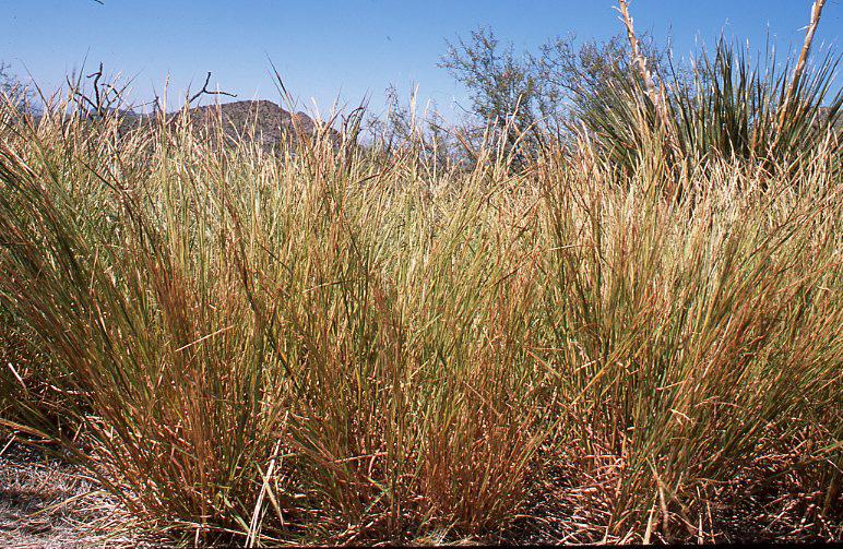
51. Autumn coloration- Pronounced fall blazonry is not limited to woody plants as evidenced by onset (early stage) of the brilliantly blazing autumnal coloration in shoots of tanglehead (Heteropogon contortus), one of the dominant climax (decreaser) grasses in the Trans-Pecos portion of the Basin and Range physiographic province. Tanglehead can be a major grass species--and as a decreaser--in the Chihuhu;an Desert, semidesert grassland, sotol grassland and up to lower elevational ends of the pinyon-juniper-grass woodland range types in this region. Powell (1988, ps. 336-337) explained that in autumn in Trans-Pecos Texas "dense stands of tanglehead can be recognized on hillsides from far away because of the clumps of rusty herbage". In reference to Powell's "fall coloration", Hatch and Pluhar (1993, p. 44-45) described the herbage of tanglehead as "a reddish-brown color at maturity".
This member of the bluestem tribe (Andropogoneae) is not only notable for the beauty but also the nutritive value and palatability of its herbage. Hatch and Pluhar (1993, p. 44-45) regarded forage value of tanglehead as being good for livestock and poor for wildlife. Of course, wildlife covers a multitude of species that, just within vertebrates, includes amphibians to ungulates. It is hard to imagine tangelhead as being good for livestock (eg. cattle, goats, sheep, horses) and poor for such wildlife species as bison, elk, desert bighorn sheep, mule deer, and pronghorn. Yes, that is an apt comparison. While bison were not frequent in the Trans-Pecos, tangelhead is not limited to the Trans-Pecos. Tanglehead is also abundant in the Gulf Coastal marshes and prairies, the Rio Grande Plains, and parts of the Edwards Plateau (Hatch and Pluhar (1993, p. 45), and that is just in Texas.
Tanglehead is one of the most widely distributed grasses on Earth with a species (biological) range that "has a world-wide distribution" (Hitchcock and Chase, 1950, p. 779) encompassing parts of South America, Africa, southern Asia, Australia, and Oceania. Across this vast biological range tanglehead can be mechanically injurious, especially to thinner skinneda animals like sheep, when the spikelets become ripe. This situation was discussed below in captions accompanying slides of these unique spikelets.
Tanglehead is one of the 200 plant species included in the International Range Plant Identification Contest conducted and sponsored by the Society for Range Management (Stubbendieck et al. 1992, p. 38-39).
Big Bend National Park, Brewster County, Texas. Early October; peak standing crop, anthesis.

52. Even inflorescences show fall color- Flower clusters (raemes) with ripening spikelets of tanglehead in the Chihuhuan Desert in the Big Bend area of Trans-Pecos Texas. The reddish-brown to burnt-orange autumn coloration of tanglehead herbage was beginning to show in these racemes.
Big Bend National Park, Brewster County, Texas. Early October, anthesis.
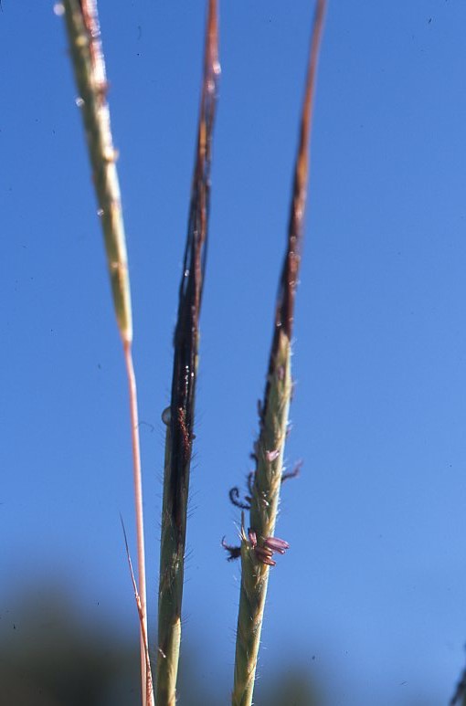
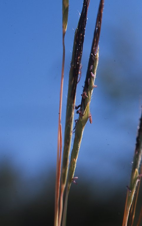
53. Yes, it is in the bluestem tribe- Racemes of tanglehead at anthesis in the upper Chihuhuan Desert in the Big Bend area of Trans-pecos Texas. Although initial and superficial examination can be misleading, tanglehead is a member of tribe, Andropogoneae. Tanglehead has paired spikelets, the fertile being sessile and the staminate or neuter (sterile) spikelet being pedicellate (Chase, 1959, 1964). Chase (1964, ps. 86-87) interpreted the inflorescence of tanglehead as a raceme and described it as "a more complicated arrangement" in which the sessile fertile spikelet and the pediceled sterile spikelet (paired spikelets) form a "joint of the raceme"; however, "a further modification" is that the "lower two or three pairs of spikelets are all sterile". This entire graminaceous contraption is confusing even to veteran rangemen. (It took Agnes Chase to sort it out.). After all this, the fertile lemma developes "into a strong, bent and twisted brown awn" ( Hitchcock and Chase, 1951. p. 779), "a stout geniculate and twisted awn" (Shaw, 2012, p. 559).
In addition to these sources, Gould (1951, p. 302), Gould (1975, ps. 614, 618), Powell (1988, ps. 336-337), Reilly and Maher (2005), and Everitt et al. (2011, ps. 158-159) were suggested.
Big Bend National Park, Brewster County, Texas. Early October, anthesis.
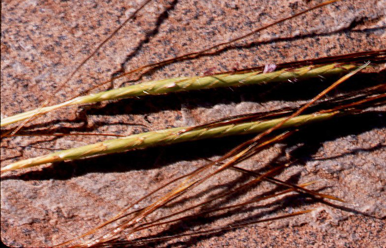
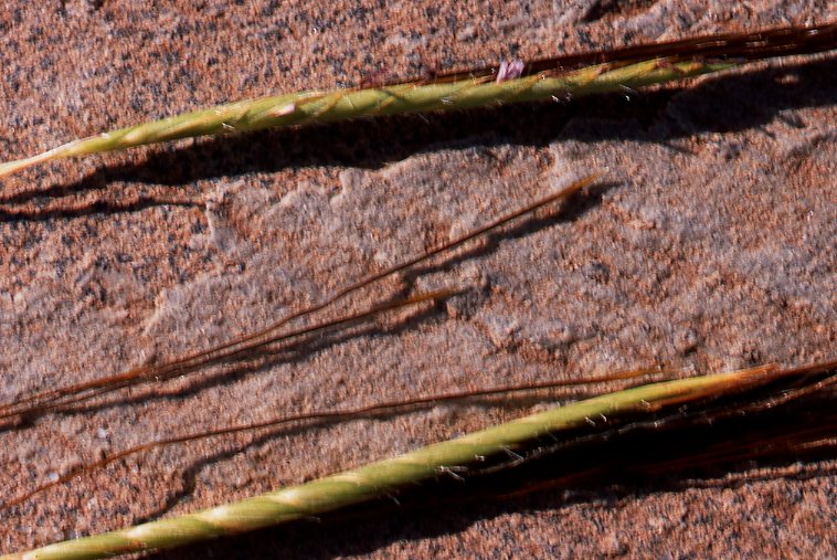
54. Hard, sharp, and sometimes troublesome- Spikelets (fertile ones were the ones in evidence) of tanglehead (first slide) and spikelets along with racemes of tanglehead (second and third slides) that had been produced on an upper part of the Chihuhuan Desert in the Big Bend area of Trans-Pecos Texas. The floral arrrangement or pattern of the inflorescence of tanglehead is "complicated" (Chase, 1964, ps. 86-87) with some details of this confusing inflorescence arrangement elaborated in the immediately preceding caption. Most standard treatments of the Heteropogon inflorescence did not elaborate to the detail provided by Chase (1964, ps. 86-87). Description, diagrams, and photographs given by Shaw (2012, p. 558-560) made up the closest (though still a "fur piece" away from that the immortal Agnes Chase). Shaw (2912, p. 558) did provide this bit of "comfort" for those of us initially bamboozled by the tanglehead "spear": "Mature fertile spikelet superficially similar to the floret of stipoid grasses in appearance". Similarity ends there.
The most distinctive features of tanglehead (other common names include black speargrass, steekgras, and pili, this latter being Hawaiian) are the long, bent, twisted awn combined with the sharp callus at the other end of the lemma of the fertile spikelet. As in the case of florets of the Stipa species, this structure or organ can be mechanically injurious to thin-skinned animals including sheep. Hitchcock and Chase (1951. p. 779) stated that "mature fruits are injurious to sheep", but if tanglehead is "grazed constantly the troublesome awns do not develop". Of course, some grain production is usually advantageous even in perennial grasses where most reproduction is asexual (vegetative). Shaw (2012, p. 559) stated: "Sharp callus can be damaging to livestock". Injury is not limited to puncture wounds by the callus. In instances where the callus-initiated puncture wound permits entry of the entire (or more of) the spikelet, the cable-like awn compounds the damage. The spikelet, including awn, will sometimes work its way beyond skin into muscle or even into internal animal organs.
Notwithstanding possible mechanical injury, herbage of tanglehead has good forage value for ungulates. From an ecological (successional) standpoint tanglehead is a climax decreaser grass that is often a local dominant. Tanglehead is a damn fine range plant. Axiomatically, tanglehead has less value for bird species, but even here the cespitose (bunchgrass) habit would likely be of similar value as other cespitose species, such as little bluestem (Andropogon scoparius), to, say, nesting bobwhite quail. This condition was noted by Everitt et al. (2011, p. 159) who specified that tanglehead "provides good nesting cover" for bobwhite quail and wild turkey "and fawning cover for white-tailed deer".
By the way, these grass organs were laid on granite which is one of the major soil parent materials in the Big Bend area of the Chihuhuan Desert and adjoining range cover types.
Big Bend National Park, Brewster County, Texas. Early October; grain-ripe (first slide), anthesis (second and third slides).
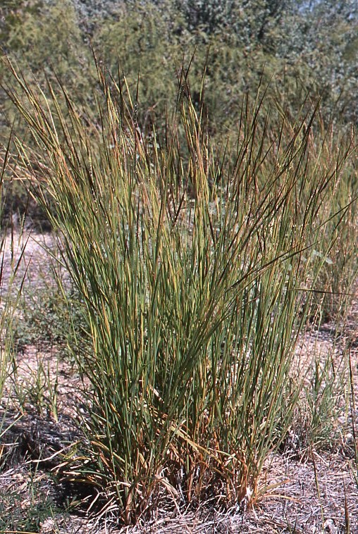
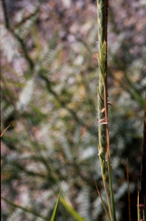
55. Parting summary shots- These two views made a synopsis of tanglehead. The first slide showed five cespitose plants (genetic individuals; genotypes) showing both 1) the bunchgrass habit of this panicoid (tribe, Andropogoneae) grass and 2) the frequent occurrence of several plants growing in very close proximity to each other. The second slide showed the inflorescence-- interpreted as a raceme by Chase (1964, ps. 86-87)--of tanglehead at anthesis.
These plants were growing in an ecotone of Chihuhuan Desert scrub and sotol grasslands, the latter of which was itself an ecotonal or transitional grassland elevationally situated between basin hot desert shrubland and montane pinyon pine-juniper woodland.
Tanglehead grows in both the northern and southern hemispheres and is an important range grass in the Sonoran Desert as well as the Chihuhuan Desert (Kearney and Peebles, 1960, p. 144; Shreve and Wiggins, 1964, p. 300-301).
Recommended summary treatments of tanglehead included Gould (1951, p. 302), Gould (1975, ps. 614, 618), Powell (1988, ps. 336-337), Hatch and Pluhar (1993, p. 44-45), Shaw (2912, p. 558-560).
Tanglehead is one of the 200 plant species on the International Range Plant Identification Contest sponsored by the Society for Range Management (Stubbendieck et al. 1992, p. 38-39).
Big Bend National Park, Brewster County, Texas. Early October; peak standing crop, anthesis.


56. Speaking of complexes; it gave me one- Wright's threeawn (Aristida wrightii; A. purpurea var. wrightii) in a hot basin of the Chihuhuan Desert scrub in the Big Bend area of Trans-pecos Texas. Record rainfall during throught the warm growing season made for the comparatively large plant seen here.
A. wrightii is (was) a species long-recognized by the agrostological authorities (Coulter, 1891-1894, p. 514; Silveus, 1933, p.33; Hitchcock and Chase (1951, p. 474; Gould, 1951, p. 241; Gould, 1975, ps. 401-402; Correll and Johnston, 1979, ps. 258-260 passim) based on morphological features. During the 1980s, studies coming out of the New Mexico Agricultural Experiment Station (Allred, 1984) revealed (strongly suggested) that a number of closely related Aristida species were, in taxonomic reality (by standards of Plant Systematics), a complex of closely related taxa that were better interpreted as varieties within the species, A. purpurea. This group of closely related varieties (which had heretofore been recognized as traditional species based on slight morphological differences) came to be known as the Aristida purpurea complex. This varietial reinterpretation was adopted by more recent authorities such as Powell (1988, ps. 250-254), for Aristida species in Trans-Pecos Texas. The Aristida purpurea complex was eventually established as "official", "authorized" "definitive" (whatever) in the Flora of North America (Allred in Barkworth et al., 2003, ps. 330-341). Definitive treatment of the A.purpurea complex members found in the eastern parts of the Basin and Range physiographic province (including almost all of the Chihuhuan Desert) is Allred and Ivey (2012, ps. 633-634).
Usually changes (usually unnecessary) in scientific names cause confusion (understandably) when students are confronted with more recent names contrasting with those in the older (and, especially, the classic) literature. Fortunately this was not the case with the A. purpurea complex as readers simply find, for instance, A. purpurea var. wrightii in recent literature versus W. wrightii in older treatments.
"What goes 'round comes 'round: interestingly (and, not a little, ironically) this splitting of A. purpurea (and the closely related A. longiseta) into taxonomic varieties was done by (Silveus, 1933, ps. 336-338) fifty years before Allred (1984) reached similar--very similar--conclusions and arrangements!
Anyway, Wright's threeawn is one of the important taxa (how's that?) in the Chihuhuan Desert and adjoining vegetational units including the Sonoran Desert with flowering restricted to more favorable conditions (Kearney and Peeples, 1960, p. 121). Wright's threeawn was distinguished morphologically from A. purpurea by having a erect or, "sometimes somewhat flexuous" panicle rather rather than a "nodding panicle slender and flexuous" and from other closely related species by having a longer panicle with branches of several flowers versus Aristida species with "few-flowered" branches (Hitchcock and Chase, 1951, p. 463).
Big Bend National Park, Brewster County, Texas. Early October; peak standing crop, ripening grain stage.

57. Passel of tillers (and not in a complex)- Local dense stand (first slide) and a large cespitose (bunchgrass) plant (second slide) of Havard's threeawn (Aristia havardii= A. barbata). Havard's threeawn was one of the principal species in the herbaceous understorey of the Chihuhuan Desert scrub as presented here. Plants of this species--as of all grasses--were extremely large and robust at time of potographs due to record rainfallfrom spring up through early autumn. Made for "impressive examples" and demonstrated the amazing production potential of Chihuhuan Desert ranges when they are managed properly. The rainfall, man has no control over; management is his responsibility, delegated from God.
This species (by one or the other of these names) was recognized by Hitchcock and Chase (1951, p. 470), ), Gould (1951, p. 236-237), Gould (1975, 392-395), Powell (1988, ps. 247-249), Allred and Ivey (2012, p. 633) all of whom also recognized A. divaricata and remarked on the closeness of these two species. This situation was perhaps critical to the listing of A. divaricata (along with A. purpurea) as a dominant grass of the semidesert grassland and understorey of the Chihuhuan Desert (Clements, 1920, ps; 144-148 and, somewhat, Weaver and Clements, 1938, p. 573). Some of the plants seen and identified as A. divaricata were likely to have been those of A. havardii (= A. barbata), or intergradations between them. (See Successional and Plant Indicator Note shortly below.)
Havard's threeawn is a climax dominant, at least locally. In the Chihuhuan and Sonoran Deserts as well as adjacent semidesert grasslands this species is a decreaser. As is the case for all the perennial threeawns, it is most valuable for forage when immature which is usually earlier in the spring grazing season.
Big Bend National Park, Brewster County, Texas. Early October; peak standing crop, ripening grain stage.

58. Looking down at A. havardii (or was it divaricata)- A top-down view of Havard's threeawn in the Chihuhuan desert in the Big Bend area of Trans-pecos Basin and Range vegetational area. A side-view presentation of panicles of Havard's threeawn was presented immediately below to offer a more nearly complete picture of the infloresecence of this decreaser (and seasonally valuable) forage species.
Hitchcock and Chase (1951, p. 470) described Havard's threeawn as "forming hemispherical tufts" with "the culms rather stiffly radiating in all directions". Matches these photographs pretty well, hugh?
Aristida species are defining grass species of the Chihuhuan and Sonoran Deserts and adjoining semidesert grasslands (see successional note immediately below the next caption).
Morphological note: A. havardii and A. divaricata are closely related and, while these two species have morphological differences (Gould, 1975, ps. 392-395), there is intergradation between the two leading Powell (1988, ps. 247-249), after he described A. havardii and A. divaricata, to suggest that these two species might be meged into one species. Incidentally, Gould (1975, p. 392) gave B. barbata as the scientific name for Havard's threeawn as did (Silveus, 1933, p. 334), both of whom gave A. havardii as a synonym. Coulter (1891-1894, p. 515) used A. havardii but also gave other species names (apparently assumed to be obsolete) along with descriptions and keys including A. humboldtiana which Hitchcock and Chase (1951, p. 820) showed as a synomym for A. divaricata. Thus, Colter (1891-1894, p. 515), the first systematic flora for this region, also distinguished between A. havardii and A. divaricata.
Brewster County, Texas. Early October; peak standing crop, ripening grain stage.


59. For once, a readily identified one- Sideview of panicles (first slide) and more detailed view of branches of panicle (second slide) of Havard's threeawn growing in the Chihuhuan Desert basin shrubland in Trans-Pecos Texas. Hitchcock and Chase (1951, p. 470) described the panicle branches of Havard's threeawn as being "divaricately spreading or whmewhat reflexed" with "divaricate" defined as "widely and stifly divergent" (Hitchcock and Chase, 1951, p. 991).
The similarity of this species to A. divaricata and confusion regarding scientific names between the two species was discussed in detail directly above.
By the way, the granite rock these panicle branches were laid on was the parent material of much of the soil in this part of the Texas Big Bend. Other parts of the Trans-Pecos area have igneous rock as parent material for soils.
Brewster County, Texas. Early October; peak standing crop, ripening grain stage.
Successional and Plant Indicator Note: Aristida species, especially A. purpurea and A. divaricata, are some of the defining climax dominants of the semidesert grassland and, as to be expected, as major climax herbaceous species in the adjoining and intermingled Chihuhuan and Sonoran Deserts. Clements (1920, ps. 144-148) defined and described semidesert grassland as desert plains grassland, the Aristida-Bouteloua Association. In describing the Chihuhuan Desert, or as he entitled it, Larrea-Prosopis Formation, (Clements, 1920, ps. 162-170) did not specifically list (name) major grass species of the herbaceous understorey. In fact, Clementsian interpretation of this formation was altered drastically by Weaver an Clements (1938, p. 537) when this association was regarded as "subclimax" and "... proven to be a desert-plains savanna" in which shrubs "... have largely replaced the grasses in consequence of overgrazing and of fire, also, to some extent". Relict climax plant communities protected from such disturbances "... usually exhibit Bouteloua, Aristida, and their associates as dominants ...".
Specific Aristida species listed by Weaver and Clements (1938, p. 525) for the desert plains grassland were A. divaricata, A. purpurea, A. californica, and A. arizonica.
Explanation for examples of a species: the following examples of chino grama, chinograss, or chino (Bouteloua ramosa) were all in Big Bend Natioanl Park in what could most aptly be described as a transition zone or ecotone between the lower elevation and basin Chihuhuan Desert and higher elevation semidesert grassland spatially adjacent to lower montane sotol grassland. These examples were taken ("collected alive on film") over two days in early October.
Given that chino grama is a major or important species in both the Trans-Pecos portion of the southwestern semidesert grassland cover type (SRM 505, more-or-less) and the Chihuuan Desert range type (SRM 508, more-or-less) as shown in Shiflet (1994), the same examples were included in both of these chapters. The author was richly blessed to obtain these examples where he did (midway between two major range cover types) and did not see fit to squabble over arbitrary distinctions as to which rangeland dominance type they best fit.


60. The defining grass- View of one massive (by desert grass standards) plant of chino grama or, sometimes, chinograss or, even just, chino (Bouteloua ramosa), the distinctive, defining grass species of the Big Bend (and other parts of Trans Pecos Texas) portion of both Chihuhuan Desert and numerous locations of semidesert grassland. The second slide was a closer-in view of the featured (foreground) plant in the first slide. In the first slide a second chino grama plant was to left rear of the featured specimen.
This large plant (measured as basal diameter which is a rough approximation to size of rootcrown) with its many shoots (all were tillers or intravaginated shoots) was most likely an older plant given that it was less likely to have been growing in an unusually favorable microsite. This specimen was growing in association with creosotebush, cane bluestem, green sprangletop (Leptochloa dubia), Arizona cottontop (Trichachne californica), smooth sotol or desert candle (Dasylirion leiophyllum), tarbush, honey mesquite, skeleton-leaf goldeneye (Viguiera stenoloba), and mariola (Parthenium incanum).
There has been some confusion as to the appropriate name for chino grama. Powell (2000, ps. 216-219) explained that Gould (1975, p. 351), for decades the final voice for the Texas Gramineae, regarded B. ramosa and B. breviseta as conspecifics whereas Correll and Johnston (1979, p. 246-247), the definitive authority for Texas vascular flora, treated these as two distinct species. Previous to Gould (1975, p. 351) Silveus (1933, p. 428) presented B. breviseta as the principal scientific name with B. ramosa being a synonym while showing the two common names of "gyp grass" and "chino" yet shortly before this he had detailed distinct differences between "chino" and "gyp grass" (Silveus, 1933, p. 425). Hitchcock and Chase (1951, p. 541-542) showed B. breviseta for "gypsum sands and calcareous rocks" and gave B. ramosa as one synonym for B. breviseta (Hicthcock and Chase, 1951, p. 827). Before all these "late-comers", Coulter (1891-1894, p. 530) gave B. breviseta and B. ramosa (both with the common name of "grama") for west Texas while Wooton and Standley (1915, p. 87) gave only B. breviseta for Trans-Pecos Texas and southern New Mexico.
Powell (2000, ps. 216-219) sided with Coulter (1891-1894, p. 530) and Correll and Johnsoton (1979, p. 246-247) in distinguishing B. ramosa from B. breviseta, this latter species commonly known as gyp grama because it is as an obligate gypsophile restricted to gypsum or gypseous soils. A quarter century after Powell (2000, ps. 216-219) and one and a quarter centuries after Coulter (1891-1894, p. 530) established that these are two separate species, Shaw (2012, ps. 337, 342), Gould's protege and eventual replacement, also distinguished between B. ramosa and B. breviseta with the latter being confined to gypsum soils. Unfortunately (in this rangeman's opinion), Shaw (2102, ps. 268-275, 334-344) also split Bouteloua into two genera by simply elevating one of the two sections of Bouteloua in Hitchcock and Chase (1951, ps. 532-533) to its own genus. As if there was not enough confusion already! Yes, this section-elevated genus had been applied as a genus name previously to some of the Bouteloua species--as had numerous other genus names ncluding Atheropogon, Chloris, Dinebra, Actinochloa, Melica, Eutriana, Aristida, Cynosurus, and you get the idea (Wooton and Standley, 1915, p. 87; Hitchcock and Chase, 1951, ps. 826-830).
The current author was fortunate to find large areas of gyp range sites in eastern New Mexico that were in pristine condition and dominated by gyp grama. From perspective of field biology and range environment, gyp grama and chino grama are clearly distinct species confined to even more distinctive rangeland habitats. Both of these species, however, do define and delineate their range sites. Chino grama is "more versatile" as it is not limited to edaphic factors as specific as gypseous soils. The more adaptable, less site-specific chino grama is important in both the Chihuhuan Desert and semidesert grasslands in the Trans-Pecos landcape.
Chino grama is the dominant range plant over various xeric range sites of semidesert grassland, especially those with rock-strewn, steep, south slopes in Trans-Pecos Texas. On Chihuhuan Desert scrub ranges, chino grama is more apt to be found on moisture-favorable habitats and, especially, at ecotones between Chihuhuan Desert and semidesert grassland dominated by less xeric species (eg. Arizona cottontop). Chino grama often dominates these range environments as a single species, a Clementsian consociation. Such single-species stands often cover large area. Correll and Johnston (1979, p. 247) provided this concluding statement in regard to ecological and economic importance of chino grama in its rather restricted species range: "This is perhaps the best forage grass in the true desert areas".
Big Bend National Park, Brewster County, Texas. Early October; peak standing crop, anthesis.

61. Dual representation of a defining species- Two seemingly young (as shown by a smaller number of tillers) plants of chino grama or chino growing in an ecotone between semidesert grassland and Chihuhuan Desert basin scrub in the Big Bend area of Trans-Pecos Texas near the end of a record-rainfall year. Chino grama is the defining grass species of pristine, relict, range vegetation on the more xeric habitats (eg. shallow soils on rocky, south slopes) of this eastern portion of the Basin and Range physiographic province.
Chino grama is strictly cespitose (tufted. clumped,or bunched; bunchgrass habit) with all shoots being either a) tillers (vertical or upright intravaginated shoots) or b) lateral shoots off of established tillers (tiller branches). Although these tillers are perennial organs, most of which die at end of the current warm-growing season, the plant's poraxisis or rootcrown enlarges some each year (growing season) such that older plants become increasingly bigger in cover (both basal or foliar) over time. Cover, number of tillers, and basal (as in rootcrown) diameter of these two plants (genotypes) can be compared to the much larger (and, likely, older) specimen presented immediately above.
A phenomenon in some chloroid (tribe, Chlorideae) grasses is that shoots produced in the previous (preceding) year(s) become active (are reactivated after dormancy) in the subsequent growing season ("green up" a second or ? year). Leithead et al. (1976, p. 56) stated it this way for B. breviseta: "When growth starts in late spring or early summer, most of old growth greens up because this grass stores nutrients in stems as well as in roots". In other words, not all herbaceous growth in some perennial grass species is strictly annual (ie. some of the chloroid grasses have aboveground perennial or perenniating parts).
Big Bend National Park, Brewster County, Texas. Early October; peak standing crop, anthesis.

62. Another big 'un- A large specimen of chino grama (known also by the common name, chinograss or, just plain, chino) growing in an ecotone between lower elevation (basin) Chihuhuan Desert scrubland and, at slightly higher elevation, semidesert grassland in the Big Bend area at eastern margin of the Basin and Range physiographic province. Chino grama is commonly the defining species of semidesert (Clements' "desert plains") grassland in this local area or subregion. Chino grama is not nearly as widely distributed as is black grama, the dominant over an immense region hroughout both the Chihuhuan Desert and Sonoran Desert Regions, but chinograss is the dominant plant species of semidesert grassland that develops on xeric habitats such as shallow, rocky soils on steep, south slopes in the Trans-Pecos Region and extending far to the south so as to include four states in the Republic of Mexico.
Shaw (2012, p. 342) described chino grama as "densely cespitose". That description clearly fit the example seen here. This specimen was growing beside smooth sotol or desert candle. This plant was growing in close proximity to cane bluestem, green sprangletop, sideoats grama, tanglehead, Arizona cottontop, tarbush, honey mesquite, mariola, and skeleton-leaf goldeneye.
Big Bend National Park, Brewster County, Texas. Early October; peak standing crop, anthesis.


63. Mature plants seen from above and alongside- Five or six smaller plants of chino grama or chino being looked at from a top-down view (first slide) and one or, possibly, two plants (genetic individuals) as seen from the side (second slide) growing on a shallow, stoney soil on a southwest-facing slope in the Big Bend area of the eastern Basin and Range physiographic province. These plants had already completed (or nearly so) their annual growth for this year and were going into cool-season dormancy. Their racemes (flower cluseters) were loaded with spikelets, the seed viability of which was unknown (but if it was ever to amount to anything this record-rainfall year was the time for it).
These specimen plants clearly showed the cespitose (bunched, tufted, clumped) habit of this species. Production of shoots is, however, not just a simple matter of tiller (vertical, intravaginal shoot) production. Gould (1975, p. 351), who used B. breviseta and B. ramosa as synonymous, described development of lateral shoots (asexual branches) arising from existing tillers which have numerous prophylls (node/internode/leaf units) as well as formation of new tillers arising from a "firm or hard, knotty or subrhizomatous base". Silveus (1933, p. 428) described "branching from short scaly rootstocks" (ie. tillers coming off of short rhizomes). This asexual reproduction clearly prevails over sexual reproduction, this latter of which was discussed immediately below. Leithead et al. (1976, p. 56), who lumped chino grama with gyp grama as Bouteloua breviseta, summarized: "Reproduces largely from axillary buds at basal nodes".
Other description of growth/axexual reproduction in chno grama was provided in preceding captions. These two views simply gave other views of this arid lands bunchgrass.
Big Bend National Park, Brewster County, Texas. Early October; peak standing crop, grain-ripe phenological stage.


64. Flags of a defining unit- Sexual shoots with racemes of chino grama growing on an ecotone between Chihuhuan Desert scrub and semidesert grassland in the Big Bend area of Trans Pecos Texas, the more eastern edge of the Basin and Range physiographic province.
An extended portion of the rachis without spikelets (or with aborted/undeveloped spikelets) is a frequent state of development in this species. Silveus (1933, p. 428) explained (indirectly) this phenomenon by describing a rudiment of a spikelet with three awns on a short pedicel and a second rudiment consisting of two or, sometimes, one glume at apex of the rachis. Silveus (1933, p. 436) even presented a detailed diagram of this rudiment! No other author has yet to describe this organ although Shaw (2012, ps. 337, 342) noted a terminal "reduced spikelet" for both gyp grama and chino grama (after moving these species to section-elevated genus, Chondrosum; do not look in Bouteloua, readers). Silveus (1933) is truly a timeless classic (and Silveus was a lawyer not an agrostologist). This rangeman would not take for his mint copy. "Gold is where you find it" (expression of California Forty-Niners).
The flower clusters (racemes) seen here had been produced in a warm-growing season (spring through autumn) of record rainfall. These racemes were obviously at peak snthesis. Grain production and seed viability in chino grama was unknown. Leithead et al. (1976, p. 57) stated that "[s]ome new plants are established from seed" in Bouteloua breviseta, which has explained above is gyp grama and not chino grama (B. ramosa). These two species are similar enough that it could be inferred that at least a few new genetic plants (novel genotypes) are produced sexually in chino grama.
Most reproduction in chino grama would be asexual from either a) lateral shoots off of existing tillers or b) short, scaly rhizomes or, perhaps more correctly, rhizome-like rootcrowns as described immediately above.
The inflorescence of chino grama (like that of all Bouteloua species, especially those in section, Chondrosium) has been subject to various interpretations. The traditional view has regarded flower clusters as racemes, but Silveus (1933, p.426-427) called them "spikes" as did Hitchcock and Chase (1951, p. 532) describing them as "with 2 to several or many spikes racemose on a common axis..." while Gould (1975, p. 335) said the inflorescence consisted " 1-numerous short, spicate branches, these closely or distantly spaced along the main axis", Powell (2000, p. 206) regarded the inflorescence as a "panicle of 1-numerous branches from a main axis", and Shaw (2012, p. 334) described the inflorescence as consisting of one to several "short, spicte branches" but he called them "panicles with 1-4 branches" for chino grama (Shaw, 2012, p. 342). This discussion will end with Agnes Chase (1937, 1964, ps. 57-58; having the final description of the Bouteloua inflorescence: "sessile spikelets in one-sided spikes". Anyway this is what they, it, whatever look like (and at closer camera distance immediately below).
Big Bend National Park, Brewster County, Texas. Early October; peak standing crop, anthesis.


65. Flower clusters of a defining species- Racemes of chino grama in the hot basin habitat of the Chihuhuan Desert in the Trans-Pecos Basin and Range vegetational area of far-west Texas. Chino grama is the definitive grass species on more xeric sites of semidesert grassland in the Big Bend area of Trans-Pecos Texas. Chino grama has a much smaller biological (species) range than black grama (Bouteloua eriopoda) which dominates even more xeric sites of semidesert grassland farther to the west of the Big Bend area. North of the Rio Grande chino grama is limited to the Trans-Pecos area of Texas and apparently has not dared to cross the state line into New Mexico. Chino grama does call four Mexican states home (Powell, 1988, p. 217).
The racemes shown here was typical of tens of thousands that had been produced in the current record-rainfall year. These at-anthesis raceme specimens--as was typical for its cohort racemes--were not mature enough to have the more characteristic curved form that developes upon maturity and senescence.
Big Bend National Park, Brewster County, Texas. Early October; peak standing crop, anthesis.


66. All spruced up and not much of a place to grow- A little plant of sprucetop or woolyspiked grama (Bouteloua chondrosiodes) growing in a gravel bed in basin topography of the Chihuhuan Desert in the Big Bend area Trans Pecos Texas. Powell, 2000, ps 211-212) concluded: "Sprucetop grama is highly palatable and is an excellent forage speacies where abundant enough". Such abundance is apparently quite local in occurrence in Trans-Pecos Texas (Silveus (1933, ps. 426, 431). Sprucetop grama also grows in semidesert grassland in southern Arizona and Mexico, a region for which Gould (1951, p. 145) remarked of sprucetop grama: "One of the better range grasses in Arizona and highly palatable to all classes of livestock". The habitat of wollyspiked grama was commonly described as "gravelly" (Coulter, 1891-1894, p. 532; Silveus, 1933, p. 431) or "rocky" (Hitchcock and Chase, 1951, p. 536; Shaw, 2012, p. 270). The ground surface shown in the first slide was "right on target".
Shoots of sprucetop grama range from roughly 30 to 60 centimeters in height which is about the same size as major forage gramas such as black grama (B. eriopoda), blue grama (B. gracilis), and the, locally more common, chino grama (Gould, 1975, ps. 341, 349, 351). The little specimen shown here at a long way to go to reach such a size, it being only about 24 centimeters tall and dimunitive at its base (it was growing in a "rock pile" of soil). This was more consistent with the height range of 20 to 60 centimeters given by Hitchcock and Chase (1951, p. 536) or, slightly smaller, as reported by Silveus (1933, ps. 426, 431).
The total sexual shoot with spikelets on "spikes", "racemes", "spicate branches", or whatever name used by the various agrostological authorities (see above discussion for Bouteloua species in section, Chondrosium) as seen here in the second slide was typical with line drawings in the standard references (again, sources cited above). Also typical was the habit or general plant form or outline in which leaf blades were confined primarily to the plant's low base as described by Coulter (1891-1894, p. 532) and Silveus (1933, p. 426) and, even more revealing, as shown photographically (Silveus, 1933, p. 441).
Sprucetop grama is Bouteloua section, Atheropogon (Hitchcock and Chase, 1951, p. 532), the species of which have spikes or racemes in which spikelets are "not pectinately arranged". In older literature, such as Coulter (1891-1894, p. 532), woolytop or sprucetop grama was shown under the scientific name of Bouteloua havardii.
Big Bend National Park, Brewster County, Texas. Early October; peak standing crop, anthesis.

67. Succulent form of Chihuhuan Desert- Even though the Chihuhuan Desert supposedly has more cactus species than the Sonoran Desert it is the latter that is regarded as the "succulent desert". This is due to dominance of what is generally interpreted as the succulent life or growth form (eg. species of giant arborescent cactus, abundance of various barrel cactus, numerous Agave species, etc.) in the Sonoran Desert. The general situation is that the Chihuhuan Desert is not a succulent desert, but there are infrequent exceptions to this overall pehnomenon. This photograph presented such a local exceptional range plant community. The dominant species was the succulent, lechuguilla (Agave lechuguilla). Smooth sotol (Dasylirion leiophyllum) was also present (eg. the plant with tall flower stalk) as were cactus species, especially Englemann pricklypear. Likewise ocotillo, a frequent local associate (to creosotebush) was "alive and well". Non-succulent shrubs also common in this range vegetation included creosotebush, the regional dominant of the Chihuhuan and Sonroan Deserts, and the woody composite mariola (Parthenium incanum). The most common of the uncommon grasses were chino grama, black grama, and red threeawn (in that order). Forbs were essentially absent with the Compositae being represented by mariola. Woody legumes were absent from this local community. Hurray, no mesquite!
This was an example of "the Mixed Desert Scrub Phase" consisting of creosotebush, cactus, ocotillo, and lechuguilla identified by MacMahon (in Barbour and Billings, 1988, ps. 249-250).
Big Bend National Park, Brewster, County, Texas. June, early estival aspect. FRES No. 33 (Southwestern Shrubsteppe Shrubland Ecosystem). K-53 (Trans-Pecos Shrub Savanna). No SRM applied; succulent vriant of SRM 508 (Creosotebush-Tarbush) was a real "stretch" (too much so, but it might help some viewers). One form or expression of Mixed Scrub-Succulent Series, 153.25, Chihuhuan Desertscrub, 153.2 (Brown et al., 1998, p. 41). Chihuhuan Deserts- Low Mountains and Bajadas Ecoregion 24 c (Griffith et al., 2004).

68. Photogenic transition zone- The so-called sotol-grasslands are an ecotone between the Chihuhuan Desert scrub dominated by creoeotebush-tarbush scrub (the the Larrea-Flourensia association or the Larrea-Flourensia associes as either climax or subclimax vegetation according to Clements [1920] or Weaver and Clements [1938, p. 537], respectively) that occupies hotter desert basins and the semidesert grassland dominated by the Bouteloua species, especially chino grama (B. ramosa), at a slightly cooler, higher elevational zone in foothills of mountain ranges. This landscape-scale view and those of adjacent range vegetation shown in the immediately succeeding two-slide/caption set presented representative examples of that ecotonal grass-shrub savanna below the Chisos Mountains in the Big Bend Country of Trans-Pecos, Texas.
In addition to the tall, conspicuous namesake smooth sotol or desert candle (Dasylirion leiophyllum) and the ever-present creototebush, other shrub species present in this view included skeleton-leaf goldeneye (Viguiera stenoloba), Chihuhuan Desert pricklypear (Opuntia phaecantha), Torrey yucca or Spanish dagger (Yucca torreyi= Y. treculeana) and a rich herbaceous layer dominated by numerous grass species including cane bluestem, sideoats grama, tanglehead, chino grama (Bouteloua ramosa), plains birstlegrass, and green sprangletop (Leptochloa dubia).
Big Bend National Park, Brewster, County, Texas. Early October; early autumnal aspect in a very wet year. No appropriate vegetational unit in Kuchler (1964, in Garrison, 1977), Society for Range Management (Shiflet, 1994), or Brown et al., (1998). Chihuhuan Deserts- Low Mountains and Bajadas Ecoregion, 24c.


69. A distinct and characteristic ecotone- Sotol grassland (as it is known in Trans-Pecos Texas) is typically a rather narrow transition zone between some of the semidesert grassland forms and those of the Chihuhuan Desert shrubland. The landscape-scale representation seen here included such range plant species as smooth sotol or desert candle, guayacan, the dark shrub in lower left corner; desert sumac (Rhus microphylla), shrubs in the distant background, and a plethera of native, warm-season, perennial grasses including cane bluestem, plains bristlegrass, tanglehead, sideoats grama, chino grama, and green sprangletop.
Details of the herbaceous layer of this climax range vegetation were presented in the immediately following slide/caption set.
Big Bend National Park, Brewster, County, Texas. Early October; early autumnal aspect in a very wet year. No appropriate vegetational unit in Kuchler (1964, in Garrison, 1977), Society for Range Management (Shiflet, 1994), or Brown et al., (1998). Chihuhuan Deserts- Low Mountains and Bajadas Ecoregion, 24c.


70. Happy and thriving in the sotol grasslands- In the first or upper slide cane bluestem and green sprangletop (foreground) along with chino grama, sideoats grama and skeletonleaf goldeneye (background) comprised the understorey of a sotol grassland with smooth sotol or desert candle as the obvious dominant species of the shrub component. The second or lower slide presented the inflorescence of green sprangletop (left) and cane bluestem (right) against a backdrop of the leaves and lower sexual shoot of smooth sotol or desert candle.
The "close-up and personal snapshots" were on sotol grassland that formed an ecotone between creosotebush-dominated Chihuhuan Desert shrubland in lower basins and semidesert grasslands in the foothills or lower slopes of desert mountain ranges such as the Chisos Mountains in the examples seen here.
Big Bend National Park, Brewster, County, Texas. Early October; early autumnal aspect in a very wet year. No appropriate vegetational unit in Kuchler (1964, in Garrison, 1977), Society for Range Management (Shiflet, 1994), or Brown et al., (1998). Chihuhuan Deserts- Low Mountains and Bajadas Ecoregion, 24c.


71. Happy and thriving at closer distance- Even closer and more personal views of the inflorescence (numerous closely spaced rames) of cane bluestem (Andropogon barbinodis) with a few shoots of green sprangletop (Leptochloa dubia) for a sidekick as a follow-up to the immediately preceding slides. In the first of these three slides this panicoid species (cane bluestem) and its accompanying eragrostoid species (green sprangletop) had a succulent "curtain" of smooth sotol or desert candle (Dasylirion leiophyllum), the liliaceous shrub after which this sotol grassland was named. The transitional sotol grassland is an ecotone between some of the semidesert grassland forms (range sites) and those of the Chihuhuan Desert scrubland on which cane bluestem is a climax dominant along with tanglehead (often a co-dominant decreaser grass) and green sprangletop, chino grama, plains bristlegrass, and various threeawn species.
The second and third of these slides featured the inflorescences of cane bluestem. The inflorescence (flower cluster) of cane bluestem has more recently been described as a panicle of racemose primary and, sometimes, secondary branches (Powell, 1988, p. 324). This arrangement has, in the perspective of some agrostologists, qualified bluestem species having this floral arrangement to be in the genus Bothriochloa rather than the traditional Andropogon.
Brief summary treatments for cane bluestem included Gould (1951, p. 306-307), Gould (1975, p.), Powell (1988, ps. 328-329), Hatch and Pluhar (1994, ps. 38-39), Magee (2005), Everitt et al. (2011, p. 52), and Shaw (2012, p. 257).
Big Bend National Park, Brewster, County, Texas. Early October; early autumnal aspect in a very wet year.

72. It's sprangled all right- Large specimen of green sprangletop (Leptochloa dubia) growing in the shrubland of the Chihuhuan Desert. This climax (decreaser) eragrostoid grass is widely distributed on numerous range sites in not only the Chihuhuan Desert, but also adjoining semidesert grasslands, sotol grasslands, understorey of pinyon pine-juniper woodlands and, especially, transition grasslands that are ecotonal between semidesert grasslands and mixed prairie grasslands of the Staked Plains or Llano Estacado.
This plant grew to extremely large size (over three and a half feet tall) due to a record quantity (and fortituous temporal distribution) of rainfall during the warm-growing season. Green sprangletop can be quite palatable and, when abundant with such immense plants, a major forage species to livestock and, even, wildlife Hatch and Pluhar (1993, ps. 98-99).
The "sprangled"- or "sprankling"- or "crystaline"-appearing texture of this image was compliments of scanning by an Epson Perfection (which it is not) 700 scanner.
Big Bend National Park, Brewster, County, Texas. Early October; early autumnal aspect.

73. A sprangled top- Extraordinarily large panicle of green sprangletop (with a visiting grasshopper) with "overflowing" spikelets of ripening grain. This nice, bountiful inflorescence had been produced in the Big Bend area of Trans-pecos Texas on an ecotonal grassland that was a transition between mixed prairie of the Southern Great plains and semidesert grasslands
Brewster County, Texas. Early October; grain-ripening phenological stage.


74. Desert and plains- Two plants (first slide) and sexual shoots with panicles (second slide) of plains bristlegrass (Setaria leucopila= S. macrostachya, either in part or due to earlier nomenclature) growing in the hot basin form of the Chihuhuan Desert in the Big Bend area of Trans-Pecos Texas. Good summary treatments of plains bristlegrass were provided by Gould, (1975, ps 557-558), Powell (1988, ps. 305-306), and Hatch and Pluuhar (1993, ps. 156-157).
These plants were growing as neighbors of such shrubs as creosotebush, mariola, ocotillo, guyacan, range ratany, and plumed crinklemat and with cane bluestem, tanglehead, sideoats grama, green sprangletop, and chino grama as major grasses. This range plant community was shown above.
There has been considerable confusion regarding proper name of plains bristlegrass. The species now recognized as S. leucopila was formerly included in with or synonymous with S. macrostachya as for example by Silveus (1933, p, 674-675, 681), Hitchcock and Chase (1951, ps. 721-722), Gould (1951, ps. 270-271) . Readers of the classical botanical and successional literature should make note of this because S. leucopila will not be found frequently in such works, S. macrostachya being the species name most encountered. S. leucopila and S. macrostachya are very similar morphologically and taxonomically (Gould, 1975, ps.; Correll and Johnston, 1979, ps. 185-186; Shaw, 2012, ps. 880, 886-887). Plains bristlegrass was probably the species Coulter (1891-1894, ps. 510) described as S. setosa.
Plains bristlegrass is widely distributed throughout the Basin and Range and western Great Plains physiographic provinces being locally abundant from portions of the Southern High Plains (Staked Plains or Llano Estacado) from southeastern Colorado southward and in both the Chihuhuan and Sonoran Deserts far down into the states of Mexico. Where plentiful, plains bristlegrass is a valuable forage species. For Texas, Shaw (2012, p. 886) described plains bristlegrass as the "[m]ost economically important of all the perennial species of Setaria".
Plains bristlegrass (as S. leucopila) is on the list of 200 North American plant species for the International Range Plant Identification Contest sponsored by the Society for Range Management (Stubbendieck et al., 1992, ps. 156-157).
Big Bend National Park, Brewster, County, Texas. Early October; early autumnal aspect.


75. Bristley and condensed- Several contracted panicles (first slide) and portion of a contracted panicle (second slide) of plains bristlegrass produced in the basin form of Chihuhuan Desert scrubland in the eastern (the Trans-Pecos) part of the Basin and Range physiographic province. These organs were on plants shown in the immediately preceding slide. Creosotebush, ocotillo, mariola, guyacan, range ratany, Englemann pricklypear, sotol, and plumed crinklemat were shrubs and cane bluestem, sideoats grama, tanglehead, chino grama, and green sprangletop as major grasses.
Big Bend National Park, Brewster, County, Texas. Early October; early autumnal aspect.


76. Not the showest of forbs- Large specimen of Gulf or coarse vervain (Verbena xutha) growing on desert pavement in a lower basin form of Chihuhuan Desert scrub in the Big Bend area of the Basin and Range physiographic province. Gulf vervain is a species of "weedy" (meaning, in this context, rank-growing) as indicated by the common name of "coarse". Coarse vervain is also "weedy" in that it is most commonly a species best adapted to and growing in disturbed areas or, at least, harsh microsites.
Coarse vervain has no particular significance to the Chihuhuan Desert beyond general harshness of the desert environment. Significantly enough the specimen presented here was growing beside a well-worn trail (ie. local disturbed microsite). This specimen also attested to the general adaptability of its species which has a biological range throughout the North American mid-South growing from Alabama across to the Trans-Pecos portion of the Basin and Range physiographic province.
Thyere are 24 Verbena species and/or taxonomic varieties recognized as species by some authors in the Trans-Pecos Basin and Range vegetational of Texas (Gould, 1962, ps. 75-76). Very few of these taxa are limited to the Trans-Pecos land resource area including V. xutha which also grows in five of the other nine vegetational areas (Gould, 1962, ps. 75-76).
Big Bend National Park, Brewster, County, Texas. Early October; full-bloom phenological stage.

77. "I am, too, showy"- Flowers of Gulf or coarse vervain. These flowers were on one sexual shoot of the big specimen shown in the two immediately preeding slides. This large plant had produced a number of sexual shoots that were flowering profusely such that there did not seem to be any question that this native, perennial forb (Diggs et al., 1999, p. 1058) was most likely a fitness survivor (natural selection permitted successful continuation of its kind and the option for genetic change or modification; its genes--selfish, alturistic, or otherwise--had been perpetuated). Meanwhile, coarse vervain had added this much color to the always colorful (in its own way) Chihuhuan Desert. Carry on ole weed.
Big Bend National Park, Brewster, County, Texas. Early October; full-bloom phenological stage.


78. Little and loaded in the desert- A fruit bearing leader (first slide) and details of leaves and cluster of fruit (secon slide) of littleleaf or desert sumac (Rhus microphylla) in a basin of the Chihuhuan Desert in the Big Bend area of Trans Pecos Texas. These "photo-samples" were on a plant growing with creosotebush, guayacan, desert hackberry (Celtis pallida), mariola,, and a number of grass species including tanglehead, plains bristlegrass, cane bluestem, sideoats grama, chino grama, and green sprangletop.
Desert sumac is widely distributed throughout the deserts of southwestern North America occurring in both the Chihuhuan and Sonoran Deserts. This specimen of desert or littleleaf sumac was bearing an especially heavy fruit crop in a rainfall-record setting year. The fruit type in the Rhus species is a drupe. Good reference for the Rhus species of the Trans Pecos Region remains Powell (1988, ps. 255-258).
Big Bend National Park, Brewster County, Texas. Early October; ripe fruit stage of phenology.


79. Where there's a dad more water- Two large plants (first or upper slide) and details of foliage, flowers, and fruit (second or lower slide) of trumpet-flower (Tecoma stans) on a slightly lower, more mesic microhabitat in the eastern Chihuhuan Desert in Trans Pecos Texas. This woody (shrub) species is in the Bignoniaceae (bigonia family) and "sports" large, showy flowers characteristic of this range plant family.
There is apparently next-to-no browse value in trumpet-flower as far as ungulate species are concerned, but this relatively small shrub certainly adds to the charm of the desert environment. Trumpet-flower has a biological (species) range that also includes the Sonoran Desert. In the Lone Star State trumpet-flower is supposedly restricted to the Trans Pecos Region.
Big Bend National Park, Brewster County, Texas. October; full-bloom/immature fruit phenological stage.


80 A. Chihuhuan yellow- The telltale flower of the bignonia family makes trumpet-flower one of the most strikingly colorful shrubs in the Desert Southwest, including both Chihunuan and Sonoran Deserts. Powell (1988, p. 391) reported that Indians used extracts of this species for various medicinal purposes. Appparently the only current commercial use of trumpet-flower is for landscaping where it is of obvious value, especially where native plant species are preferred.
Big Bend National Park, Brewster County, Texas. October; full-bloom/immature fruit phenological stage.


80 B. Some ore views- Huge cluster of flowers (first slide) and a composite view of leaves, flower, and capsular fruit (second slide) of trumpet-flower in a basin of the Chihuhuan Desert. The ornamental (landscaping) attributes of this species have become well-recognized by nurserymen in recent years.
Big Bend National Park, Brewster County, Texas. Mid-September; peak-bloom/immature fruit phenological stage.

81. Another version of a "family fruit"- Capsules of trumpet-flower produced on the large plant introduced in two slide/caption sets above. The elongated fruit of the Bignoniaceae is very characteristic and consistent across the various member species of the bigonia family. Although these capsules are not showy, like the brightly colored, trumpet-shaped flowers, they are distinctive and contribute to the uniqueness of this desert shrub.
Big Bend National Park, Brewster County, Texas. October; immature fruit phenological stage.
Location note: more examples of the sotol grasslands were included in the grassland chapter entitled, Semidesert Grasslands. That is the appropriate location for the sotol grassland range type given that such climax range vegetation is true grassland (including climax grasslands with conspicuous shrub cover). It is also a given, however, that sotol grasslands--at least some of the ssotol range communities adjoining Chihuhuan Desert creosotebush-dominated scrubland--are ecotones, transition zones, that do not fit "neatly" into either grassland or shrubland groups. Furthermore, such climax ecotonal range vegetation often comprised the bulk of range plant communities that "linked" or formed "ecological connection" between basin desert scrub of the creosotebush-tarbush cover type (SRM 508; Shiflet, 1994) and the semidesert grassland cover type (SRM 505; Shiflet, 1994). In the concept of Landscape Ecology these sotol grassland ecotones were corridors (landscape "conduits") between desert shrubland and semidesert grasslands. It was appropriate that examples of these ecotonal corridors were included at this point in the chapter, Chihuhuan Desert.
All of these various range types formed a vegetational mosaic that was a marvel to behold. For the betterment of mankind a marvelous sample of this ecological patchwork of plant communities was preserved in Big Bend National Park where most of these examples had developed and from which the author was blessed to find and share them with others who share a love of range vegetation.


82. Creosotebush-Ocotillo-Grama Savana range cover type- These three photographs were examples of a rangeland cover type that has not been published, at least not per se as for example by the Society for Range Management (Shiflet, 1994) or as a specific biotic community in Brown et al. (19198). There are large acreages in the Trans-Pecos Basin and Range where ocotillo rather than tarbush is the associate or even co-dominant with creosotebush (ie. a creosotebush-ocotillo rather than the more common creosotebush-tarbush cover type, association, series, or whatever unit designation was used by the publishing authority). In the observation and interpretation of this author there should be a creosotebush-ocotillo savanna range type, and this presented photographic evidence of the existence of such a rang plant community.
There was a well-defined and prominent herbaceous layer among the two major shrub species. This layer was comprised primarily by chino grama (dominant) and black grama (associate or second co-dominant). These were the major range plant species on foothill grama semidesert grassland that developed as zones of range vegetation at higher elevations on hill and mountain slopes above the more common "creosote-bush plains" or "creosotebush flats" form (range type) on basins and bajadas. Red threeawn and bush muly were other grass species that were present, but neither species approached general abundance of either of the two Bouteloua speceies. The semidesert grassland cover types were dealt with in that chapter under the Grasslands biome herein.
The range vegetation displayed and described here was clearly a creosotebush-ocotillo shrub steppe or creosotebush-ocotillo-gramagrass savanna. Additional woody plant species included pricklypear cactus, especially Englemann pricklypear (Opuntia englemannii var. englemannii), lechuguilla, smooth sotol, Faxon yucca or Spanish bayonet, whitethorn acacia (Acacia constricta), and honey mesquite. This was an example what MacMahon (in Barbour and Billings, 1988, ps. 249-250) labeled "the Mixed Desert Scrub phase" of the Chihuhuan Desert.
According to local authorities of the National Park Service livestock had been effectively removed from this rangeland for a period of about 55 years (at time photographs were taken) and the grass understorey (especially chino grama) had made tremendous recovery. At least this is the official conclusion of the National Park Service (1983, p. 81). "That's my story and I'm sticking to it."
Big Bend National Park, Brewster County, Texas. June, early estival aspect (before beginning of summer rainy period). FRES No 33 (Southwestern Shrubsteppe Shrubland Ecosystem). K-53 (Trans-Pecos Shurb Savanna). Ocotillo variant of SRM 508 (Creosotebush-Tarbush). One form of Creosotebush-Tarbush Series, 153.21, of Chihuhuan Desertscrub, 153.2 (Brown et al., 1998, p. 41). Chihuhuan Deserts- Low Mountains and Bajadas Ecoregion 24c (Griffith et al., 2004).

83. Landscape of Creosotebush-Ocotillo-Grama Savanna range cover type- View at landscape-scale of one variant, form, or expression of creosotebush-dominated Chihuhuan Desertscrub. This proposed rangeland cover type was displayed at more restricted spatial scale and described immediately above. This slide was presented to convey physiography of the Trans-Pecos Basin and Range and the physiogonomy of this Chihuhuan Desertscrub savanna or creosotebush-ocotillo-grama shrubsteppe. Dominant grass was chino grama with black grama the associate species. Red threeawn and bush muhly were sparse, but other perennial native grasses. In addition to creosotebush and associate species, ocotillo, there were such succulent shrubs as pricklypear species, lechuguilla, and smooth sotol. Other shrub species included the woody legumes honey mesquite and whitethorn acacia.
Big Bend National Park, Brewster County, Texas. June, early estival aspect. FRES No. 33 (Southwestern Shrubsteppe Shrubland Ecosystem). K-53 (Trans-Pecos Shrub Savanna). Ocotillo variant of SRM 508 (Creosotebush-Tarbush). A form of Creosotebush-Tarbush Series, 153.21, of Chihuhuan Desertscrub, 153.2 (Brown et al., 1998, p. 41). Chihuhuan Deserts- Low Mountains and Bajadas Ecoregion 24c (Griffith et al., 2004).

84. Species make-up of creosotebush-ocotillo-grama savanna- Detail of range vegetation shown in the immediately preceding three photographs. Creosotebush, ocotillo, various species of cacti, and widely; scattered mesquite made up the shrub component. Grasses present in this "photo-quadrant" were were a large specimen of chino grama and a small individual of bush muhly. Dead forb stalks were of the native annual cool-season brassica, tansy mustard (Descurainia pinnata).
Big Bend National Park, Brewster County, Texas June, early estival aspect (prior to onset of summer rains).

85. Chihuhuan Desertscrub on a dissected plain- Along this upland drainage a range plant community had developed that was more mesic than the vegetation of adjoining plains. This was an example of how a small difference of available soil water and other abiotic factors (eg. cooler soil temperature and less evaporation on microsites having slightly more shade) can result in a pronuonced difference in range vegetation. Even though creosotebush was still the dominant and ocotillo was present, honey mesquite and Texas or Lindheimer pricklypear (Opuntia englemannii var. lindheimeri) were more common and, clearly, more robust. Speaking of robust and vigerous, "how 'bout them" chino grama plants!
Big Bend National Park, Brewster County, Texas. June, early estival aspect. FRES No. 33 (Southwestern Shrubsteppe Shrubland Ecosystem). K-53 (Trans-Pecos Shrub Savanna). Variant of SRM 508 (Creosotebush-Tarbush). A form of Creosotebush-Tarbush Series, 153.21, of Chihuhuan Desertscrub, 153.2 (Brown et al., 1998, p. 41). Chihuhuan Deeserts- Low Mountains and Bajadas Ecoregion 24c (Griffithe et al., 2004).
A high proportion of the water drainages in deserts and similar vegetation (in arid landscapes generally) are periodically or occasionally flowing streams that "run water" infrequently during the "wet season" or following short-term precipitation events. These "infrequent" streams or drainages are known as washes. Washes were defined by the American Geological Institute (Wilson and Moore, 1998) as: "a term applied in the western U.S. (especially in the arid and semiarid regions of the SW) to the broad, gravelly, normally dry bed of an intermittent stream, often situated at the botton of a canyon; it is occasionally filled by a torrent of water. Syn. dry wash; washout". These same authors defined intermittent stream as: "a stream or reach of a stream that flows only at certain times of the year, as when it receives water from springs or from some surface source".
The following section presented and described examples of washes in the Chihuhuan Desert from the standpoint of wash vegetation. Wash vegetation--scanty and sparse though it might be--is riparian vegetation.
Location note: examples of washes in the Sonoran Desert wre covered in Range Types of North America in the chapter of that title.


86. Wash vegetation in Chihuhuan Desert basin- A narrow "ribbon" of unique range vegetation developed along an arroyo or dry wash in a basin supporting Chihuuhuan Desertscrub. Wilson and Moore (1998) defined arroyo: "A term applied in the arid and semi-arid regions of SW U.S. to the small, deep, flat-floored channel or gully of an ephemeral stream or of an intermittent stream, usually with vertical or steeply cut banks of unconsolidated materal at least 60 cm high; it is usually dry, but may be transformed into a temporary watercourse or short-lived torrent after heavy rainfall. Cf: dry wash; hondo".Dry wash was defined: "A wash that carries water only at infrequent intervals and for short periods, as after a heavy rainfall" (Wilson and Moore, 1998). Ephemeral refered to a stream or part of stream that flows for brief periods and only in dierect response to precipitation of the immediate area and that is always above the water table whereas intermittent applied to streams that flow only at certain periods or seasons of the year and such streams may receive water from springs or surface sources as well as from precipitation (Wilson an Moore, 1998).
This arroyo had formed on the graben fill of a large basin (Macleod, 2002, p. 26). MacLeod (2002, p. 238) defined graben as: "A through or basin bounded on both sides by normal faults dipping into the graben and which has moved down relative to the adojining fault blocks". Much of the Big Bend portion of the Trans-Pecos Basin and Range was subjected to considerable seismic and volcanic activity in formation of this physiographidc province.
Dry washes and arroyos (the more generic term) are environments drastically different from adjoining and surrounding habitats and as such support dramatically different range plant communities. Such range vegetation provides habitat for animal species and animal communities that reflect these differences. Wash ecosystems are unique biotic communities and ecosysstems. These ecosystems are much more important than would appear from their relative small area. In context of Landscape Ecology a wash ecosystem constitutes a corridor, "a narrow strip of land that differs from the matrix on either side" (Forman and Godron, 1986, p. 591). Along with matrix and patch (discussed above) corridor are the three basic types of landscape elements (Forman and Godron, 1986, ps. 23, 27, 31). Corridors can attach or provide connections between patch and matrix, one matrix to another matrix, or one patch to another patch. Corridors such as arroyos thereby provide invaluable habitat, including transportation, for organisms (even man).
Range vegetation along this wash was composed primarily of woody plant species. Major shrubs included desertwillow (or desert-willow) or desert-catalpa (Chilopsis linearis= C. saligna= C. glutinosa), evergreen or tobacco sumac (Rhus virens), honey mesquite, seepwillow (Baccharis salicifolia= B. glutinosa= B. viminea), and Apache plume (Fallugia paradoxa). Grasses included fluffgrass, sand dropseed (Sporobolus cryptandrus), vine mesquite (Panicum obtusum), bush muhly, and some threeawn in the Aristida purpurea complex.
Apache plume was blooming and conspicuous in center foreground of the first photograph.Desertwillow was very prominent in right foreground to midground in the second photograph. Tallest shrubs of dark green color were tobacco or evergreen sumac.
Big Bend National Park, Brewster County, Texas. June, estival aspect with several species (desertwillow, Apache plume) in full-bloom stage. None of the vegetation authorities mapped or discussed units of range vegetation at this small a scale.

87. Wash vegetation along a larger stream in Chihuhuan Desert- This was a larger ephemeral stream than the arroyo featured in the two immediately preceding photographs. Plant species comprising this arroyo vegetation were also larger. In addition to major shrub species-- including desertwillow, Apache plume, seepwillow, honey mesquite, and tobacco or evergreen sumac-- found along the arroyo in the preceding photographs this range plant community included cottonwood trees (the two tallest plants along left bank of stream. Nomenclature and identifiction of cottonwood species is another example of confused and confusing taxonomy. These trees were either Fremont (= Arizona) cottonwood (Populus fremontii subsp. mestae= P. arizonica= P. mexicana) or RioGrande cottonwood (P. deltoides ssp. wislizenii= P. wislizenii). Positive identifiction between these two species requires examination of floral discs (Powell, 1988p. 85) which were not available at time of photograph. Given that this was smack-dab in the middle of the desert, cottonwood tree was likely adequate.
Big Bend National Park, Brewster County, Texas. June, estival aspect.


88. Needlesome- Needle grama (Bouteloua aristidoides) growing on the upper (more like, outer) bank of an arroyo in the Chihuhuan Desert in the Big Bend area of Trans-Pecos Texas. Powell (1988, p. 240) reported that needle grama was found "often along dry watercourses, and in disturbed areas". Needle grama is a native, annual, eragrostoid grass adapted to disturbance (in this instance, both flooding and wildlife traffic).
Superficially, arrangement and general appearance of spikelets resemble that of Aristida species, hence the specific epithet, aristoides.
Big Bend National Park, Brewster County, Texas. Early October; peak standing crop, "half-ripe" fruit (dough stage).


89. Needled some more- Examples of a few plants (first slide) and details of shoots (second slide) of needle grama growing on the outer bank of an arroyo in Chihuhuan Desert scrub in the more eastern portion (Big Bend area of Trans-Pecos) of the Basin and Range physiographic province. There is not a lot of basic information (yet alone ecological/physiological knowledge) about any of the native, perennial Bouteloua species of the Chihuhuan Desert so "it only stands to reason" that there is almost nothing in this regard with respect to the native, annual grama grasses.
Standard references for taxonomic and morphological features of needle grama included Gould (1951, ps. 141-143), Gould (1975, ps. 341), Powell (1988, ps. 240-241), and Everitt et al. (2011, p. 59) all of whom specified that needle grama was of little, if any, forage value other than for a short period in its early growth. Any plant cover functions to some degree as protection against soil erosion and provides some organic matter to facilitate plant succession. Furthermore, as a native grass species, needle grama serves some beneficial, ecological roles(s) and so deserves 'billing" in Range Types of North America. Needle grama is a natural occurring member of the producer group of range ecosystems in both the Chihuhuan Desert and Sonoran Desert (Kearney and Peebles, 1960, p.128).
Needle grama has a species range that extends into arid regions of South America (Hitchcock and Chase, 1951, p.533; Kearney and Peebles, 1960, p.128 Gould, 1975, ps. 341; Powell, 1988, ps. 240-241). Silveus (1933, p. 432) provided a good summary statement regarding needle grama: "This species is as variable as the seasons and conditions of the capricious climate of its range". Needle grama has to be an opportunistic species. It could serve as the "poster child" example of ephemeral grass species, "six-weeks grasses" that complete their life cycle in remarkably short time frames whenever growing conditions permit this.
Hitchcock and Chase (1951, p. 532) separatedthe Bouteloua genus into two sections with Section 1 Atheropogon being those species whose spikelets are not pectinately arranged on a rachis and which are shed entire rather thas as florets (ie. disarticulation is below the glumes). Needle grama is in Atheropogon along with sideoats grama.
Big Bend National Park, Brewster County, Texas. Early October; peak standing crop, "half-ripe" fruit (dough stage).


90. It runs water, sometimes- Three upstream views of Chihuhuan Desert wash vegetation consisting of two shrub species: 1) seep willow or willowleaf baccharis (Baccharis salicinia= B. salicifolia) and 2) desert willow or desert catalpa (Chilopsia linearis= C. saligna). These were dominant and associate species, respectively. This range plant community is riparian (stream-side) vegetation that was about as simple (and sparse) as any vegetation could be, especially riparian vegetation. Honey mesquite (Prosopis glandulosa) grew in nearly single-species stands (populations) to the far outskirts of the seep willow-desert willow community. (See location note below for coverage of mesquite bosque vegetation in Range Types of North America.)
This range plant community had to be interpreted as the climax vegetation (= potential natural vegetation) for this range site. This is especially the case in the polyclimax theory where this riparian (stream-side) vegetation would be best regarded as an edaphic climax or topographic climax. In monoclimax theory such stream vegetation would be defined most precisely as a serclimax (Weaver and Clements, 1938, ps. 79, 81).
The three landscape-scale views seen here were from the east side (east bank) and moving progressively westward. This desert intermittent stream provided an example of a braided stream. A braided stream was defined by the American Geological Institute (Wilson and Moore, 1998) as: "a stream that divides into or follows an interlacing or tangled network of several small branching and renuiting shallow channels separated from each other by ephemeral branch islands or channel bars, resembling in part the strands of a complex braid". Several channel bars can be seen in these and the three slides in the immediately following slide/caption set. Intermittent stream was defined above in the introduction to Chihuhuan Desert Wash Vegetation.
Tornillo Creek, Big Bend National Park, Brewster County, Texas. Early October, early autumnal aspect. FRES No. 33 (Southwestern Shrubsteppe Shrubland Ecosystem). K-53 (Trans-Pecos Shrub Savanna). Desert catalpa-willowleaf baccharis variant of SRM 508 (Creosotebush-Tarbush). Seepwillow Series, 233.21, of Southwestern Interior Swamp and Riparian Scrub 233.2 (Brown et al., 1998, p. 44). Chihuhuan Deserts- Low Mountains and Bajadas Ecoregion 24c (Griffith et al., 2004).


91. About as dry as a wash can be- Three more views at landscape-scale of the riparian range vegetation of a wash in the Chihuhuan Desert that was composed simply of two shrub species: 1) seep willow or willowleaf baccharis and 2) desert willow or desert catalpa. Seep willow baccharis was the dominant while desert willow was the associate species of this remarkably simple (and scanty cover) climax range vegetation. Designation of climax applied to this riparian range vegetation was discussed in the immediately preceding caption.
The first of these three images was an upstream view at the west bank of this desert intermittent stream (defined in the introduction to the Desert Wash Vegetation). The second and third "photo-transect" views of this braided stream were looking downstream and progressively moving eastward or closer to the east bank. Braided stream was defined in the immediately preceding caption. Several channel bars of this intermittent, braided stream were visible in these slides.
Tornillo Creek, Big Bend National Park, Brewster County, Texas. Early October, early autumnal aspect. FRES No. 33 (Southwestern Shrubsteppe Shrubland Ecosystem). K-53 (Trans-Pecos Shrub Savanna). Desert catalpa-willowleaf baccharis variant of SRM 508 (Creosotebush-Tarbush). Seepwillow Series, 233.21, of Southwestern Interior Swamp and Riparian Scrub 233.2 (Brown et al., 1998, p. 44). Chihuhuan Deserts- Low Mountains and Bajadas Ecoregion 24c (Griffith et al., 2004).


92. Another wash; same range plant community- Three upstream views at progressively closer (shorter camera) distance of a Chihuhuan Desert wash with riparian vegetation dominated by willowleaf bacccharis or seep willow and with desert willow or desert catalpa as the associate species of this extremely "simple" range plant community. There was only this single layer in this climax range vegetation, but immediately adjacent to the seep willow-desert willow range type there was the outer edge of a honey mesquite bosque community. In fact, it was somewhat arbitrary as to where one edaphic/topographic climax community began and the other soil/relief climax community began. Given that typically honey mesquite joins the willowleaf baccharis-desert catalpa type only at it's perimeter (see again the preceding riparian community composecd exclusively of the two latter shrub species) while at the same time honey mesquite forms single-species stands (some quite extensive in size) as bosques, it was apparent--if not obvious--that the seep willow-desert willow vegetation and honey mesquite-comprised vegetation were two distinct range plant communities of stream and flood plain habitats.
Plants of the shrub form of honey mesquite were visible at outer edges of the seep willow-dominated riparian community in all three of the slides in this set.
In the three slides presented here most of the willowleaf baccharis or seep willow plants of this dioecious species were female, and they were conspicuously at peak-bloom stage of phenology.
Alamo Creek, along which this seep willow- desert willow vegetation developed, was a braided stream as was the case for for Tornillo Creek in the above example of the seep willow-desert catalpa range cover type.
Alamo Creek, Big Bend National Park, Brewster, County, Texas. Early October, early autumnal aspect. FRES No. 33 (Southwestern Shrubsteppe Shrubland Ecosystem). K-53 (Trans-Pecos Shrub Savanna). Desert catalpa-willowleaf baccharis variant of SRM 508 (Creosotebush-Tarbush). Seepwillow Series, 233.21, of Southwestern Interior Swamp and Riparian Scrub 233.2 (Brown et al., 1998, p. 44). Chihuhuan Deserts- Low Mountains and Bajadas Ecoregion 24c (Griffith et al., 2004).

93. Looking at it from the opposite direction- A downstream view of the same seep willow-desert willow (desert catalpa) riparian vegetation that developed along Alamo Creek and which was introduced in the immediately preceding three slides and caption. The "photo-sample" seen here of this riparian range cover type was a nearly exclusive stand of seep willow (seep willow baccharis) with comparatively few plants of desert willow (desert catalpa).
Most of these plants of willowleaf baccharis were also female as in the above population of this species.
The "line" of shrubby vegetation at the outer edge of this wash (intermittent stream in the desert) that appears as taller, darker-green foliage was the perimeter of an adjoining scrub bosque made up almost entirely of the shrub form of honey mesquite.
Alamo Creek, Big Bend National Park, Brewster, County, Texas. Early October, early autumnal aspect. FRES No. 33 (Southwestern Shrubsteppe Shrubland Ecosystem). K-53 (Trans-Pecos Shrub Savanna). Desert catalpa-willowleaf baccharis variant of SRM 508 (Creosotebush-Tarbush). Seepwillow Series, 233.21, of Southwestern Interior Swamp and Riparia

94. Bowed down with gals- Leaders or boughs of female willow (= willowleaf) baccharis, seepwillow, jara, or waterwally (Baccharis salifolia= B. salicina) growing at edge of the channel of Alamo Creek following several rushes of high water due to recent heavy rains. A combination of flash floods and an extremely heavy crop of flowers were responsible for the limbs of willow baccharis or seepwillow lying on (and next to on) the ground surface of this stream channel.
There are nine shrub species of Baccharis in Trans Pecos Texas of which B. salicinia and B. salifolia are two (that are probably one and the same) and the one that is the most widespread and abundant (Powell, 1988, ps.429-434, passim). In this section, Powell (1988, ps. 429-434) provided a dichotomous key and specific, distinguising differences between B. salicinia and B. salifolia, but other prominent authorities such as Correll and Johnston (1979, p. 1561) gave only B. salicina. Likewise, Diggs et al. (1999, p. 324) gave only B. salicina and did not give older (presumedly now obsolete) specific epithets. All authors agreeded that B.salicina (or B. salifolia) was closely related to B. neglecta. Vines (1963, ps. 971-972, 974) recognized willow baccharis as B. salicina and seepwillow baccharis as B. glutinosa, the species name that Powell (1988, p.434) showed as an older synonym for B. salicifolia. Both of these latter authors also discussed B. angustifolia as a sometimes misapplied species name for B. neglecta.
The author of this caption became so confused that he relied on the two synonyms as used and cautioned readers to watch carefully how various other authors applied (or misapplied; but who is the appropriate judge?) specific epithets. For instance, in the classic Botany of Western Texas, Coulter (1891-1894) showed B. glutinosa, B. salicina, and B. angustifolia as all growing along streams. One thing that all taxonomists agreeded on was this (these) species was (were) dioecious. Unquestionably, the plants featured herein were female.
Big Bend National Park, Brewster County, Texas. Early October; peak-bloom stage of phenology.


95. More maidens than imaginable- A "gazillion" pistillate flowers on some leaders of a female willow (willowleaf) baccharis growing in the channel (at edge of channel) of Alamo Creek in early autumn after a record-setting spring through early autumn rainfall. Both slides showed a single bough with the bough in the second (lower) slide bearing even more flowers than the did the leader in the first slide. Bowed boughs were the combined result of 1) recent flash floods down this desert wash or ephemeral stream (whichever term was more fitting) and 2) a heavy biomass load of flowers.
The nearly unbelievable load of female blooms illustrated the feast-and-famile abundance of resources (life-supporting factors) followed by the consequent boom-and-bust-cycle of sexual reproduction in harsh habitats such as here in the Chihuhuan Desert. An almost assuredly heavy fruit (achenes, in this species) yield will insure a soil seed bank of willow baccharis or seepwillow for decades (centuries?) to come. Some old "desert rats" could go a lifetime without seeing such a flower ("seed") crop as the one seen here. Such is life in the desert.
Big Bend National Park, Brewster County, Texas. Early October; peak-bloom stage of phenology.


96. More girls than ya can shake a stick at- Countless pistillate flower heads in seepwillow or willow baccharis produced on one female plant growing on the edge of the channel of Alamo Creek in the Chihuhuan Desert during a phenomenally wet growing season. These flowers (capitula or heads) were growing among the "gazillion" on the leader or bough seen in the immediately preceding slide. And this was only on one plant!
Big Bend National Park, Brewster County, Texas. Early October; peak-bloom stage of phenology.
Geology note: in addition to the above-mentioned geologic phenomenon of braided streams it should be remarked that the physical form of the geologic substrate of the two streams--Tornillo and Alamo Creeks--treated immediately above was sand and gravel. The next stream to be treated in the immediately following two-slide/caption set--Rough Run Creek--had a stream channel substrate of rock ranging in size from small bolders to large stones with some larger gravel.


97. Another wash, another substrate; same range vegetation- A desert wash in which bolders and large stones rather than sand and gravel formed the substrate or geologic form of material in the stream channel. Different stream (wash) channel material notwithstanding, the riparian vegetation in this "rock-ribbed"wash was the same range plant community as that in which sand and gravel comprised the stream channel materials.
The wash vegetation presented here was a consociation of willowleaf or seep willow baccharis with miniscule cover of desert willow or desert catalpa. Likewise, there was a narrow bosque of honey mesquite (another consociation) at the contiguous edge of the seep willow-dominated riparian zone (visible as taller, darker-green crown cover at extreme outward edges of vegetation). Both mesquite bosque and seep willow streamside communities were on the floodplain of the desert wash and both were interpreted as edaphic/topographic climaxes as viewed from the polyclimax perspective. From the monoclimax interpretation both of these shrubland communities were serclimaxes.
Same climax scrub vegetation in different desert washes with different geologic materials in these intermittent streams.
Rough Run Creek, Big Bend National Park, Brewster, County, Texas. Early October, early autumnal aspect. FRES No. 33 (Southwestern Shrubsteppe Shrubland Ecosystem). K-53 (Trans-Pecos Shrub Savanna). Desert catalpa-willowleaf baccharis variant of SRM 508 (Creosotebush-Tarbush). Seepwillow Series, 233.21, of Southwestern Interior Swamp and Riparian Scrub 233.2 (Brown et al., 1998, p. 44). Chihuhuan Deserts- Low Mountains and Bajadas Ecoregion 24c (Griffith et al., 2004).


98. Another wash; a different (somewhat) range plant community- Another Chihuhuan desert wash dominated by desert-willow or desert-catalpa, but with honey mesquite as the associate and netleaf hackberry (Celtis reticulata= C. laevigata var. reticulata), Chihuhuan brickell-bush or brickellbush (Brickellia florabunda), and rubber rabbitbrush (Chrysothamnus nauseosus) as other important shrubs. There was no herbaceous cover in this wash vegetation. it was not known whether absence of grasses, grasslike plants, and forbs was natural or due to past overgrazing (this range was currently being grazed by beef cattle though not to degree of overuse, at least not at time of photographs).
Hildago County, New Mexico. Late June-early estival aspect. FRES No. 33 (Southwestern Shrubsteppe Shrubland Ecosystem). K-53 (Trans-Pecos Shrub Savanna). Desert catalpa-willowleaf baccharis variant of SRM 508 (Creosotebush-Tarbush). Seepwillow Series, 233.21, of Southwestern Interior Swamp and Riparian Scrub 233.2 (Brown et al., 1998, p. 44). Madrean Archipelago- Apachian Valleys and Low Hills Ecoregion 79a (Griffith etal. 2006).

98. Washed dry- Dry channel of a Chihuhuan Desert wash with desert-willow or desert-catalpa as the dominant and honey mesquite as the associate species of the riparian zone. There was not an herbaceous layer in this desert stream scrub community. In fact, there were no plants of any herbaceous species present. It was not known whether this absence of herbaceous plants/species was the natural state (native range plant community) or whethera former herbaceous component had been "grazed out" on this long-grazed cattle range (and, long before that, deer range). Cattle hoof prints were clearly seen in the substrte of the dry stream channel bottom.
Honey mesquite and desert willow were the only plant species visible in this photograph.
Hildago County, New Mexico. Late June-early estival aspect. FRES No. 33 (Southwestern Shrubsteppe Shrubland Ecosystem). K-53 (Trans-Pecos Shrub Savanna). Desert catalpa-willowleaf baccharis variant of SRM 508 (Creosotebush-Tarbush). Seepwillow Series, 233.21, of Southwestern Interior Swamp and Riparian Scrub 233.2 (Brown et al., 1998, p. 44). Madrean Archipelago- Apachian Valleys and Low Hills Ecoregion 79a (Griffith etal. 2006).


99. Higher but no drier- Range vegetation that developed on upper bank/streamside of first stream terrace (first slide) and upper bank of first terrace (second slide) along a wash (seasonal-ephemeral stream) in the Chihuhuan Desert in extreme southwestern New Mexico. Range vegetation in the first or upper slide included desert-willow or desert-catalpa, the dominant species; honey mesquite, the associate species; netleaf hackberry; Chihuhuan brickell-bush; and rubber rabbitbrush (right to left). Range plant species in the second or lower slide included rubber rabbitbrush (grey-colored shrubs far-left to far-right in midground), Chihuhuan brickell-bush (four smaller yellowish-green plants in center foreground to right midground), and a combination of desert willow, honey mesquite, and netleaf hackberry (across background which was closer to channel of wash).
No herbaceous range plants were present in this wash vegetation. It was not know if absence of herbaceous plants was the natural state or a deteriorated state induced by overgrazing (both beef cattle and mule deer were present on this range).
The rocky substrate of this usually dry wash was desert pavement, but stones were also stream-deposited (large alluvial deposites) in contrast to the sandy soil of the adjoining landscape mosaic of Chihuhuan Desert and semidesert grassland.
Hildago County, New Mexico. Late June-early estival aspect. FRES No. 33 (Southwestern Shrubsteppe Shrubland Ecosystem). K-53 (Trans-Pecos Shrub Savanna). Desert catalpa-willowleaf baccharis variant of SRM 508 (Creosotebush-Tarbush). Seepwillow Series, 233.21, of Southwestern Interior Swamp and Riparian Scrub 233.2 (Brown et al., 1998, p. 44). Madrean Archipelago- Apachian Valleys and Low Hills Ecoregion 79a (Griffith etal. 2006).

100. Dominant of a desert wash- Specimen of desert-willow or desert-catalpa (Chilopsis linearis) that was the dominant of the riparian zone of a dry wash in the Chihuhuan Desert of southwestern New Mexico. Honey mesquite was the associate species of this range wash vegetation.
Hildago County, New Mexico. Late June; peak-bloom phenological stage.


101. What? Doesn't look like a willow?- Profusely blooming leaders or branches (first slide) and two flowers (second slide) of desert-willow. No, this is not an actual willow, but a member of the Bignoniaceae, the bignolia family. Other common--and equally misleading common names--include willow-leaved catalpa, bow willow, and flowering willow.
Flowers certainly do look like those of Catalpa species.
Widespread plantings of this species in the greater southwest by both homeowners and highway departments attests to the ornamental value and adaptation of this species to xeric edaphic conditions.
A good standard reference for Chilopsis linearis is Vines (1960, p. 928-929) and also surperb is the newer photographic-line drawing guide for New Mexico woody plants (complete with keys) by Carter (2012, p. 381).
Hildago County, New Mexico. Late June; peak-bloom phenological stage.


102. Blooming where it belongs- Honey mesquite (Prosopis glandulosa) at full-bloom stage seen as several inflorescences (first slide) and at the detail of a single unit or group of several flower clusters or inflorescences (second slide). These specimens were growing along a desert wash in the Chihuhuan Desert of southwestern New Mexico.
Although honey mesquite has become one of the worst brush species in the greater southwestern portion of North America this native, woody legume is a natural dominant of certain range sites, especially those along stream channels such as river bosques and, as seen here, desert washes. In these more mesic and free-water areas mesquite is a major component, often the dominant, of the potential natural shrubland vegetation. In such climax range plant communities mesquite is not an ecological invader (ie. not brush or a noxious woody plant).
Hildago County, New Mexico. Late June; peak-bloom phenological stage.

103. The short of it- "About spent" flower clusters (inflorescences) and immature fruits (legumes) on short shoots of honey mesquite along a desert wash in the Chihuhuan Desert in southwestern New Mexico. Typically, short shoots (those without elongated internodes) are the fruit-bearing (sexual) leaders whereas long shoots (leaders with elongated internodes) are asexual (Sosebee, ps. 272-275).
Hildago County, New Mexico. Late June; late-bloom and immature fruit phenological stages on the same short shoot.

104. Bricks along the wash- Upper shoots of Chihuhuan brickell-bush or brickellbush (Brickellia florabunda) growing on the upper bank of a desert wash in extreme southwestern New Mexico.
For excellent treatment of the brickellbushes (Brickellia species) of New Mexico see Carter (2012, ps. 292-299).
Hildago County, New Mexico. Late June; shoot elongation stage of phenology.
Management message for wash vegetation- "Looks can be deceiving" when it comes to range plant communities. At "first flush" range vegetation that develops along (and in) intermittent streams in arid and semiarid zones, especially desert washes, appears relatively unimportant. Such riparian vegetation frequently does not appear to be vegetation at all; just a few widely scattered plants. This plant life is aptly described as "sparse", "scant", and "nearly bare" with plants being "few and far between" (low cover, density, and biomass in the parlance of Range Analysis).
All true, and this is why whatever riparaian vegetation there is along desert washes is that much more important. Value is always largely a function of scarcity. With extremely limited riparian vegetation along washes it is all the more important to properly use and protect these range plant communities. This is self-evident from perspectives of range, watershed, and wildlife management practices.
Range vegetation that develops in the riparian zone of intermittent streams is priceless for the "goods and services" it provides. These valuable functions include furnishing shade and other habitat features for animals, reducing accelerated soil erosion and maintaining stream channel integrity, furnishing some regulation of stream flow, enhancing water quality, and offering aesthetically pleasing views to weary desert travelers.
Range vegetation of desert washes should be cherished and protected.
Location note: honey mesquite (Prosopis glandulosa) bosques as climax shrublands developed along the floodplain of the Rio Grande into which both Tornillo and Alamo Creeks drained. Coverage of mesquite bosques and related riparian vegetation in Range Types of North America was treated in the shrubland chapter entitled, Miscellaneous Shrublands.


105. Creosotebush-cenizo-grama savanna- Another distinctive range plant community within the overall or regional creosotebush-dominated Chihuhuan Desertscrub was the one shown here in which ocotillo was replaced by cenizo (Leucophyllum spp.; ceniza is also used as a common name for a single Leucophyllum sp. as given below) and guyacan (Porlieria angustifolia= Guaiacum angustifolium). This author wondered if based on productivity measures (eg. Gross Pirmary Productivity, Net Primary Productivity, annual biomass production, etc.) chino grama was likely the dominant range plant in this community. The herbaceous understorey was nearly a consociation of chinograss, but black grama was also abundant locally. Threeawns (Aristida purpurea complex species) and bush muhly were also present, but acators with minor roles.
It was presence of guyacan, Big Bend silverleaf or lesser Texas silverleaf (Leucophyllum minus), Boquillas silverleaf (L. candidum= L violaceum), and ceniza or, less commonly, purple sage or Texas silverleaf (L. frutescens) that distinguished this Chihuhuan Desert range cover type from those in which tarbush, ocotillo, or mesquite were associate species to the dominant creosotebush. The dominant understorey grasses (Bouteloua spp. the most widespread of these dominants) were the same and nearly consistent with B. ramosa and B. eriopoda as understorey to all shrub species combinations. Again, creosotebush was almost always the dominant shrub; the regional dominant of both Chihuhuan and Sonoran Deserts. Also usually present, though not dominant, were pricklypear species and honey mesquite.
Range vegetation in the first of these two photographs had substantially less cover by ceniza and guyacan (shrubs in general) than that of vegetation in the second slide. These distinguishing range shrubs were, however, present throughout this range cover type. In the second photograph guyacan, cerniza species, and Englemann pricklypear were more plentiful, Two guyacan plants were to right of center creosotebush. One plant of Big Bend silverleaf was beside (right side of) guyacan and another silverleaf was visible in lower right corner of photgraph.
It was felt that the Big Bend silverleaf, Boquillas silverleaf, and/or ceniza or purple sage were more diagnostic-- more of indicator species-- than was guyacan. This concluision was based on recognition of the Ceniza Shrub (Leucophyllum- Larrea-Prosopis) unit of Kuchler (1964, in Garrison et al., 1977). All three of these species occur in the general vicinity of the Chisos Mountains. The species do not necessarily occur together, and identification of specific plants as to species was impossible in numerous instances due to shed leaves (ie. bare shrubs). Kuchler (1964, p. 45) listed only L. frutescens for his Ceniza Shrub potential natural vegetation, but similarity of species as to habitats and presence of all three species in the locality of photographed vegetation rendered the species of Leucophyllum largely irrelevant while widespread abundance was diagnostic and, indeed, determinative as to range cover type in the judgment of this author.
This range vegetation was similar to the Ceniza Shrub (K-38) form of the Texas savanna Shrubland Ecosystem (FRES No. 32) and could be interpreted as a transition to that range type or, perhaps, even as an "island" of the Ceniza Shrub type. Therefore actual FRES was uncertain although the general area was FRES No. 33 (Southwestern Shrubsteppe Shrubland Ecosystem), K-53 (Trans-Pecos Shrub Savanna). There were no SRM rangeland cover types or Brown Series that were explicit for this range type. Chihuhuan Deserts- Low Mountains and Bajadas Ecoregion 24 c (Griffith et al., 2004). Big Bend National Park, Brewster County, Texas. June, early estival aspect (before start of summer rainy period).

106. Composite of Creosotebush-Ceniza-Grama Savanna range cover type- A detailed view of species composition and internal structure of a Chihuhuan Desertscrub range dominance type in which ceniza and guyacan were associate shrub species to creosotebush and chino and black grama shared dominance with creosotebush. Guyacan was represented by center shrub in immediate foreground. A large specimen of Big Bend silverleaf was at extreme right margin while two creosotebush plants and pricklypear were in left foreground. Honey mesquite was in background. Chino grama, the dominant herbaceous species, was everywhere.
Big Bend National Park, Brewster County, Texas. June, early estival aspect. This range vegetation was "ambiguous". It could be seen as an "island" or "outlier" of K-38 (Ceniza Shrub) which was placed under FRES No. 32 (Texas Savanna), but the general area was of FRES 33 (Trans-Pecos Shrub Savanna). There was not a truly descriptive SRM rangeland cover type so a variant (say, Ceniza) of the generic SRM 508 (Creosotebush-Tarbush) had to suffice (or else just be ignored). Likewise there was no appropriate biotic community unit in Brown et al. (1998). Chihuhuan DEseerts- Low Mountains and Bajadas Ecoregion 24c (Griffith et al., 2004).

107. Community composition and structure of Creosotebush-Ceniza-Grama Savanna- Range vegetation within the regional or overall creosotebush-dominated Chihuhuan Desertscrub in which various shrub species and chino grama (along with some black grama) "shared the billing". The shrubs included ceniza, Big Bend silverleaf, guyacan, honey mesquite, and tarbush. In this species-rich local community tarbush came back to team-up with the dominant creosotebush, but unlike the general Creosotebush-Tarbush rangeland cover type (SRM 508) the other shrub species were equally plentiful and produced as much foliar (= aerial) cover as tarbush. Ceniza, Boquillas silverleaf, and Big Bend silverleaf were indicator species. Their importance and ecological significance went beyond the community feature of aerial cover or dominance. Honey mesquite was more common and had a greater proportion of cover and apparent biomass than in other range plant communities in this general area.
The most accurate designation of this range type based on species composition and persistent presence of spceies was the Kuchler unit K-38 (Ceniza Shrub; Leucophyllum-Larrea-Prosopois) in Garrison et al. (1977, including map). This was described in Kuchler (1964, p. 45). Plants present included two visible grass species, chino grama and red threeawn. The largest shrub in left background was honey mesquite. Cresotebush was to immediate right of mesquite.The two pale-green shrubs to right of creosotebush were tarbush. Big Bend silverleaf was in extreme lower left corner. Ceniza were indistinguishable in background as was sotol and Englemann pricklypear. Shrubs in foreground without leaves could not be idenitified positively but judging from bark characteristics they appeared to be mariola (Parthenium incanum) or guayule (P. argentatum).
Big Bend National Park, Brewster County, Texas. June, early estival aspect. From standpoint of species composition this range vegetation was FRES No. 32 (Texas Savanna Shrubland Ecosystem). K-38 (Ceniza Shrub). Based on geographic location and vegetation mapped at large spatial scale for that location this was FRES No. 33 (Southwestern Shrubsteppe Shrubland Ecosystem). K-53 (Trans-Pecos Shrub Savanna). Could be described as a ceniza (Leucophyllum spp.) variant of SRM 508 (Creosotebush-Tarbush). A variant of Creosotebush-Tarbush Series, 153.21, of Chihuhuan Desertscrub, 153.2 (Brown et al., 1998, p. 41). Chihuhuan Deserts- Low Mountains and Bajadas Ecoregion 24c (Griffith et al., 2004).


108. A most unique expression- One of the most spatially restricted and, when flowering, distinctive variants of the Chihuhuan Desert is the Ceniza Scrub or Ceniza Shrubland. These three slides amounted to a series of "nested photo-plots" of progressively smaller size as readily seen. In the first or upper "photo-plot" the large, dark-green shrub in the center midground was guayacan. This large guayacan was surrounded by the bright pink-flowered cenizo on the left and bronze-colored creosotebush in front and to the right.
The second and third slides were the sub-plot and the sub-plot of the sub-plot, respectively, of the range vegetation in the first slide, the "photo-plot". The second and thrid slide presented a plant of creosotebush in front center of cenizo plants at peak bloom.
Cenizo was blooming in a cooler early autumn following one of the wettest summers on record. Under these growing conditions the Ceniza Scrub community of the Chihuhuan Desert was extremely conspicuous and as picturesque as it was small in spatial-scale.
Another conspicuous--at least to rangemen--feature of the desert scrub community was absence of herbaceous plants. It was not known if this was natural or due to human influence, notably overgrazing with livestock. In a brief description of the Ceniza Shrub unit (Kuchler, 1964, p. 45) mentioned "a synusia [a vegetational layer] of grass" including Bouteloua species, tobosagrass (Hilaria mutica), and burrograss (Scleropogon brevifolius).
Big Bend National Park, Brewster County, Texas. Early October; early autumnal aspect (peak-bloom phenological stage of cenizo). From standpoint of species composition this range vegetation was FRES No. 32 (Texas Savanna Shrubland Ecosystem). K-38 (Ceniza Shrub). No SRM for this range type. Based on geographic location and vegetation mapped at large spatial scale for that location this was FRES No. 33 (Southwestern Shrubsteppe Shrubland Ecosystem). K-53 (Trans-Pecos Shrub Savanna). Could be described as a ceniza (Leucophyllum spp.) variant of SRM 508 (Creosotebush-Tarbush). A variant of Creosotebush-Tarbush Series, 153.21, of Chihuhuan Desertscrub, 153.2 (Brown et al., 1998, p. 41). Chihuhuan Deserts- Low Mountains and Bajadas Ecoregion 24c (Griffith et al., 2004).

109. Dominant and defining sub-dominant of a unique type- The brilliant pink-blossomed crown of cenizo or so-called purple sage at peak bloom surrounded by plants of creosotebush, the dominant and generally the defining species of Chihuhuan Desert scrub. Cenizo is more than an associate species, but at best a distant-second co-dominant such that this unique climax vegetation was regarded as the sub-dominant of this variant or sub-type of the Chihuhuan Desert (SRM 505; Shiflet, 1994). By the vegetation classification scheme of Kuchler (1964) this climax range plant community was Ceniza Shrub (Kuchler unit 38).
There was no herbaceous layer in this desert scrub, the absence of which could have been the natural state or, alternatively, the result (at least partially) of overgrazing by livestock.
Big Bend National Park, Brewster County, Texas. Early October; early autumnal aspect (peak-bloom phenological stage of cenizo). From standpoint of species composition this range vegetation was FRES No. 32 (Texas Savanna Shrubland Ecosystem). K-38 (Ceniza Shrub). No SRM for this range type. Based on geographic location and vegetation mapped at large spatial scale for that location this was FRES No. 33 (Southwestern Shrubsteppe Shrubland Ecosystem). K-53 (Trans-Pecos Shrub Savanna). Could be described as a ceniza (Leucophyllum spp.) variant of SRM 508 (Creosotebush-Tarbush). A variant of Creosotebush-Tarbush Series, 153.21, of Chihuhuan Desertscrub, 153.2 (Brown et al., 1998, p. 41). Chihuhuan Deserts- Low Mountains and Bajadas Ecoregion 24c (Griffith et al., 2004).
Location note: the Ceniza Scrub developed as a narrow band of potential natural vegetation along the formerly impressive river known as the Rio Grande (Rio Bravo in Mexico). Today, this international border between the United States of America and the Republic of Mexico has been nearly dried up by man's misuse of it. The climax vegetation that bears the name Ceniza is still largely intact (minus a grazed out herbaceous, largely grassy, understorey in many areas) along the Rio Grande (inland from riparian vegetation zones). Part of this narrow strip of climax range vegetation is in the Rio Grande (= Tamaulipan= South Texas) Plains while other sections of this range plant community (at scale of a range cover type) are in the Chihuhuan Desert.
The Chihuhuan Desert Scrub form of Ceniza Shrubland was treated in this chapter, but most coverage of Ceniza Scrub in Range Types of North America was included in the chapter entitled, Rio Grande Plains (Tamaulipan Brushlands).

110. Species richness of Chihuhuan Desertscrub- This photographic sample of range vegetation was in close proximity to the range plant community sample in the preceding slide. The regional co-dominants were paraded in the foreground: creosotebush (L.) and tarbush (R.). Big Bend silverleaf was well-distributed throughout as was the herbaceous dominant, chino grama which was joined by black grama and red threeawn in local abundance. Ocotillo was also present (barely visible in backgroud) as were Englemann pricklypear, honey mesquite, and guyacan as major shrub species. Mariola and, in lesser proportions, guayule were present as minor woody species.
Chisos Mountains on far horizon. Big Bend National Park, Brewster County, Texas. June, early estival aspect (before start of summer rains). This range plant community could be accurately described as ceniza variant of SRM 508 (Creosotebush-Tarbush). It could be seen as a local variant of FRES No. 33 (Southwestern Shrubsteppe Shrubland Ecosystem) and K-53 (Trans-Pecos Shrub Savanna) or as an outlying part (an "island") of FRES No. 32 (Texas Savanna Shrubland Ecosystem) and K-38 (Ceniza Shrub). Ceniza variant of SRM 508 (Creosotebush-Tarbush). Closest biotic community in Brown et al.(1998) was variant of Creosotebush-Tarbush Series, 153.21, Chinuhunan Desertscrub, 153.2. Chihuhuan Deserts- Low Mountains and Bajadas Ecoregion 24c (Griffith et al., 2004).

111. Chihuhuan cast of characters- "Zoom-in" shot of the Chihuhuan Desertscrub range community presented in the two immediately preceding photographs. Tallest shrub (right center) was creosotebush while the shrub on either side of this large creosotebush was a plant of tarbush. The three plants in left to center foreground were (left to right) Big Bend silverleaf, guyacan, and red threeawn. Creosotebush was in upper left corner; honey mesquite in center background. Several plants of Big Bend silverleaf in midground (in front of mesquite and behind tall creosotebush and the two tarbush plants).
Big Bend National Park, Brewster County, Texas. June, early estivl aspect. Most logical interpretation of this range vegetation was as a ceniza variant of the general creosotebush-tarbush asociation of Chihuhuan Desert. This would be a local variant (not the generic or sterotypic form) of FRES No. 33 (Southwestern Shrubsteppe Shrubland Ecosystem) and K-53 (Trans-Pecos Shrub Savanna). Alternatively this could be seen as an patch or "island" of FRES No. 32 (Texas Savanna Shrubland Ecosystem) and K-38 (Ceniza Shrub). Logically this was transition vegetation between the Creosotebush-Tarbush Association of Chihuhuan Desert and the Ceniza Shrub unit of Kuchler (1964, p. 45). Ceniza variant of SRM 508 (Creosotebush-Tarbush). Ceniza variant of Creosotebush-Tarbush Series, 153.21, Chihuhuan Desertscrub, 153.2 (Brown et al., 1998, p. 41). Chihuhuan Deserts- Low Mountain and Bajadas Ecoregion 24c (Griffith et al., 2004).

112. Co-dominants of the Chihuhuan Desert- Creosotebush (center) flanked by two tarbush plants (one plant left and one plant right of center creosotebush) and all three accompanied by bush muhly (growing under creosotebush) on an ecotonal semidesert grassland between extreme eastern margin of Chihuhuan Desert and most semiarid perimeter of mixed prairie along easternmost border of Trans Pecos Basin and Range province.
Range vegetation shown in this photograph was described in greater detail in the chapter, Semidesert Grassland, under (in) the Grasslands portions of this publication. Here emphasis was laid on the co-dominant shrubs of the Chihuhuan Desert.
Railway Ranch, Upton County, Texas. Mid-October; peak bloom stage of tarbush and immediate post peak bloom of creosotebush. FRES No.40 (Desert Grasslands Ecosystem). K-48 (Grama-Tobosa Prairie). SRM 505 (Grama-Tobosa Shrub). Mixed Grass-Scrub Series 143.124 of Chihuhuan (Semidesert) Grassland biotic community 143.1 of Brown et al. (1998, p.40). Gyp range site. High Plains- Arid Llano Estacado, 25k (Griffith et al., 2004).

113. Another set of co-dominants of the Chihuhuan Desert- Tarbush, left, and creosotebush, right, on a disturbance climax co-dominated by these two typical regional co-dominants of the Chihuhuan Desert. There was essentially zero herbaceous understorey in this (former) livestock range on what should have been a desert shrub-grass savanna (the potential climax vegetation).
This was clearly a case of desertification: nothing but desert scrub where once there had been an herbaceous (grass-dominated) layer beneath the climax shrubs. It was likely that shrub density and foliar cover had increased in absence of competing grass and forb species or herbage to furnish fuel for fire.
Pecos County, Texas. Mid-October.


114. Creosotebush leader and flowers- Flowering branch of creosotebush in first photograph. Details of creosotebush inflorescences in second photograph. Big Bend Ranch State Park, Presidio County, Texas. June.

115. Tarbush (Flourensia cernua)- This woody composite (Heliantheae tribe) is the regional co-dominant with creosotebush of the Chihuhuan Desert. This co-dominant plant community was the Larrea-Flourensia Association of the Eastern Desert Scrub (Chihuhuan Desert) that together with the Western Desert Scrub (Sonoran Desert) made up the Larrea-Prosopis Formation of Clements (1920, ps. 162-171 passim). The Clementsian Larrea-Flourensia Association is still around in the SRM 508 (Creosotebush-Tarbush) rangeland cover type (Shiflet, 1994) and the Creosotebush-Tarbush Series, 153.21, of Chihuhuan Desertscrub, 153.2, of Brown et al., 1998).
The major authorities on vegetation of the Chihuhuan Desert have consistently recognized tarbush as the co-dominant to creosotebush (eg. MacMahon in Barbour and Billings, 1988, p. 249 and 2000, p 304). this latter of which is the dominant of the Chihuhuan and Sonoran Deserts super-region.Tarbush is, however, a weak co-dominant (more like the most common associate species on some range types and range sites within the Chihuhuan Desert). It was discussed above that some Chihuhuan Desert range types were distinguished by presence of ocotillo, tasajillo, honey mesquite, and ceniza as a co-dominant or strong associate species with creosotebush. Tarbush appears with nothing of the consistency of creosotebush in the Chinuhuan Desertscrub, but it is a "stauch help-mate".
It has been a common observation (and sometimes documented vegetational change) that on Chihuhuan Desert Disclimax (= man-made expansion of Chihuhuan Desertscrub into semidesert grasslands) increases in creosotebush and mesquite were made at expense of tarbush (see Gibbens et al., 2005). Generally speaking tarbush is regarded as more mesophytic than creosotebush (Herbel in Shiflet, 1994). This could explain the wider distribution of creosotebush on both natural and anthropogenic deserts.
Note: other shrubs of the Compositae were presented shortly below. Tarbush was included here because it is co-dominant with creosotebush as defining shrubs of the Chihuhuan Desert.
Big Bend National Park, Brewster County, Texas. June.

116. Another tarry specimen- A comparatively large tarbush plant (with two smaller neighbors of the same species to its rear) in the Big Bend area of Trans Pecos Texas. This specimen was growing on a Gravelly range site of semidesert grassland, but it was part of a desert plains grassland and Chihuhuan Desert scrub so it warrented inclusion here. This big individual was shown in a rainfall record-setting year so it was in full-leaf, but not in any physiological state of mind for sexual reproduction. (Compare leaf foliage of this plant to the sparser leaf coverage of the plant in the preceding slide. Desert plants have to be versatile; "flexible" would have sounded too much like a pun. )
Big Bend National Park, Brewster County, Texas. Early October; non-blooming stage.

117. Leaders of tarbush- Branches of tarbush showing leaves and last year's flower stalks. Big Bend National Park, Brewster County, Texas. June.


118. Tarry twigs- Leaders (= shoots or stems) of tarbush with typical leaves and unopened inflorescences.
Railway Ranch, Upton County, Texas. Early October, immediate pre-bloom to early bloom phenological stage.


119. Tarry bloomers- Young heads of tarbush; immature, just-starting-to-open capitula (plural of capitulum, type of inflorescence in which a few to many sessile flowers are inserted on a common disk or receptacle) of tarbush. This compositous shrub is a co-dominant with creosotebush of the Chihuhuan Desert scrub type. These were closer-in views of unopened and just-opening flowers (first and second slides, respectively) of tarbush. Tarbush is in Heliantheae, one of the largest tribes of the Compositae, which includes sunflowers (Helianthus spp.), ragweeeds (Ambrosia spp.), coneflowers (Ratibida and Rudbeckia spp.), cockleburs (Xanthium spp.), and Zinnia sp.
Railway Ranch, Upton County, Texas. Early October, pre- to early bloom phenological stage.peak bloom stage of tarbush.


120. Where range site dictates range type- On a rocky shallow-soil, south slope--a Limestone Hills or Limestone Hill & Mountain range site (Natural Resource Conservation Service on-line ecological site descriptions)--a scrubland range plant community dominated by viscid or whitethorn acacia ( Acacia neovernicosa= A. constricta var. vernicosa) had developed within the surrounding, almost-all-encompassing semidesert grassland-Staked Plains mixed prairie transition grassland.
Not only had this island of Chihuhuan Desert developed within a transition grassland, but it was--by its location--itself a transition range plant community. This range vegetation was unusual in both 1) biological diversity of range plant species and 2) plant species composition.
Besides the dominant viscid acacia, other range plant species (in approximate order of importance/cover) were littleleaf sumac (Rhus microphylla), Wheeler's sotol (Dasylirion wheeleri), plains bristlegrass (Setaria leucopila), mariola (Parthenium incanum), javelina-bush (Condalia eriocoides), sand sagebrush (Artemisia filifolia), black grama (Bouteloua eriopoda), sideoats grama (B. curtipendula) and, even a few plants of alkali sacaton (Sporobolus airoides).
Lincoln County, New Mexico. Late June, early estival aspect. FRES No. 33 (Southwestern Shrubsteppe Shrubland Ecosystem) and K-52 (Grama-Tobosa Shrubsteppe). SRM 505 (Grama-Tobosa Shrub). Mixed Grass-Scrub Series 143.124 of Chihuhuan (Semidesert) Grassland biotic community 143.1 of Brown et al. (1998, p.40). Southwestern Tablelands- Southern New Mexico Dissected Plains Ecoregion 26q (Griffith et al. 2006).

121. An island of desert- General landscape view of a whitethorn or viscid acacia-dominated grass-shrub range community that developed as a "vegetational "island" on a Limestone Hills range site within an otherwise "sea" of transition grassland which was a transition between semidesert grassland to the west and mixed prairie of the Llano Estacado (Staked Plains) to the east.
Other shrubs besides viscid or whitethorn acacia included (in approximate order based on cover and general abundance) littleleaf or desert sumac, Wheeler's sotol, mariola, javelina-bush, and sand sagebrush. There was a well-developed and productive herbaceous understorey dominated by climax grass species with plains bristlegrass being the dominant of these followed by black grama, sideoats grama, and alkali sacaton (general order based on cover).
Lincoln County, New Mexico. Late June; early estival aspect. FRES No. 33 (Southwestern Shrubsteppe Shrubland Ecosystem) and K-52 (Grama-Tobosa Shrubsteppe). SRM 505 (Grama-Tobosa Shrub). Mixed Grass-Scrub Series 143.124 of Chihuhuan (Semidesert) Grassland biotic community 143.1 of Brown et al. (1998, p.40). Southwestern Tablelands- Southern New Mexico Dissected Plains Ecoregion 26q (Griffith et al. 2006).

122. Big boy on this block of desert range- Plains bristlegrass (Setaria leucopila) was the dominant herbaceous species in a well-developed understory of shrub-grass scrubland dominated by viscid or whitethorn acacia and that was regarded as an "island" of Chihuhuan Desert. This potential natural range vegetation had developed on a Limestone Hills range site in the semiarid tablelands just west of the Southern High Plains (Staked Plains).
Srubs in the higher stony hill seen in the background were whitethorn acacia and littleleaf or desert sumac.
Lincoln County, New Mexico. Late June; peak satnding crop and early grain phenological stage of plains bristlegrass.


123. Scrubby legume in desert hills- Whitethorn acacia (Acacia neovernicosa= A. constricta var. vernicosa) in stony, desertic hills at eastern outskirts of the Chihihuan Desert--a transition between desert and semidesert grassland--in southcentral New Mexico.
Gutsy breezes of afternoon valley winds--warm upslope winds that, by convection, blow up mountain slopes during the day--made crisp close-up (macro-lens) images impossible. Viewers will have to make do.
Lincoln County, New Mexico. Late June; early to mid-bloom phenological stage.

124. Little leaves, but a big specimen- Large and robust specimen of littleleaf or desert sumac (Rhus microphylla) growing in an ecotonal area of Chihuhuan Desert and semidesert grassland. Trees in the background of this image were growing along an ephemeral stream while the large desert sumac specimen was prospering on adjoining Chihuhuan Desert.
Hildago County, New Mexico. Late June; ripe-fruit phenological stage.


125. May be little, but a lot- Progressively closer views of leaders "loaded" with fruit (drupe) of littleleaf or desert sumac. Desert sumac has long been recognized as a browse plant though Dayton (1931, p. 97) reported that "its palatability appears to be very low". Drupes would obviously be of considerably grater value as mast, especially for birds, than the browse of leaves, bark, buds, etc.
While working on the semidesert grassland-Chihuhuan Desert vegetational mosaic of the New Mexico State University College Ranch and the Agricultural Research Service Jornada Experimental Range in southcentral New Mexico, the current author frequently observed that widely scattered plants of littleleaf sumac, which were the largest plants on such ranges, were routinely used by cattle for shade . This and the valuable drupes clearly proved that desert sumac is a valuable range plant.
Good standard references for desert or litttleleaf included Vines (1960, p.) and Powell (1988, ps. 257-258).
Hildago County, New Mexico. Late June; ripe-fruit phenological stage.


Neighboring forb- Manyflowered stickleaf (or manyflowered blazing star) or Adonis stickleaf (Mentzelia multiflora) shown as one plant (first slide) and with typical upper shoots (second slide) growing within three shrub-crown's distance of the desert sumac specimen presented immediately above. This was at edge of semidesert grassland and a gallary forest that had developed along an ephemeral stream.
The common names of blazing star and stickleaf have been shown variously as being one word, two separate words, or two hyphenated words. The common name of stickleaf is derived from the condition of leaves clinging ('sticking") to clothing, hair, or wool by means of tiny, hook-like or barbed hairs. Perhaps the serrated leaf margins facilitate this attachment as well. This "sticking leaf" characteristic is especially troublesome in wool.
Mentzelia, a genus in the loasa family (Loasaceae), is well-represented in New Mexico with a total of 25 species (Allred and Ivey, 2012, ps. 384-387).
Hildago County, New Mexico. Late June; peak-bloom and early fruit stage of pehenology.


Blazing stars of a stickery leaf customer- Shoot apices with flowers and leaves of manyflowered blazingstar or manyflowered stickleaf (first or upper slide) growing at edge of a semidesert grassland and a gallary forest in the Chihuhuan Desert Region in southwestern New Mexico. The second or lower slide was of one flower of manyflowered blazingstar. Petals of M. multiflora an be white, cream-colored, or yellow (Allred and Ivey, 2012, p. 384). The off-white color seen here "fits the bill".
Hildago County, New Mexico. Late June; peak-bloom stage of pehenology.

Capsuled above stickery leaves- Shoot apices with leaves and capsules of manyflowered stickleaf or manyflowered blazing star growing on the plant introduced above that was on the perimeter of semidesert grassland and a gallary forest along a stream in the Chihuhuan Desert Region.
Hildago County, New Mexico. Late June; early to ripening fruit stage of pehenology.
[ Home ]